DHULE
Cultural Sites
Last updated on 4 November 2025. Help us improve the information on this page by clicking on suggest edits or writing to us.
Ahilya Barav
Ahilya Barav is a historical five-storey stepwell situated in the village of Ahilyapur in Dhule. It was built during the reign of Ahilyabai Holkar (1767–1795), who governed the expansive Holkar Empire from her capital at Maheshwar. At the time, the Holkars controlled a notably extensive network of strategic territories, including Laling, Thalner, Songir, Sultanpur, and Galna, regions that now form part of present-day Dhule district.
![Ahilyapur Barav in Ahilyapur, Dhule is lit up by locals on the occasion of the birth anniversary of Punyashlok Ahilyabai Holkar[1]](/media/culture/images/maharashtra/dhule/cultural-sites/ahilyapur-barav-in-ahilyapur-dhule-is-li_G2ofjBM.jpg)
It is said that Ahilyapur lay along an important route connecting Maheshwar to Pune and served as a key rest stop for merchants, as well as a logistical post for the movement of goods, personnel, and information between the regions of Malwa and Khandesh. Its location made it a vital link in the broader commercial and administrative system of the Holkar Empire.
In support of this role, Ahilya Barav was constructed to meet both practical and strategic needs. Built from brick and stone, the stepwell spans approximately 1,012 square meters and features 13 arches. It is said to have been designed to accommodate up to 100 bullocks at once, with space for military personnel in the central area. Due to this intriguing design, the Barav is locally referred to as “12 bailancha mothnad” (area with twelve stalls for bullocks). Inside, a reservoir and remnants of a water system, including broken pipes, offer a fascinating glimpse into the infrastructure and engineering of the period.
Bhamer Fort
Bhamer Fort is a historic hill fort located on the Dhule-Surat highway in Sakri taluka of Dhule district. It is considered by many to be the most prominent among the district’s five hill forts, despite much of its structure being in a state of deterioration today. The fort is strategically positioned across three hills surrounding Bhamer village, with natural mountain defenses on three sides and constructed fortifications including a double rampart and gateway on the fourth.
![A ruined stairway at Bhamer Fort, Dhule.[2]](/media/culture/images/maharashtra/dhule/cultural-sites/a-ruined-stairway-at-bhamer-fort-dhule2-a6334dfc.jpg)
Bhamer, the village where the fort lies, as Suresh Nimbalkar in Durgbharari mentions, was originally part of a ‘nagar’ (city) called Bhadravati. Bhadravati, it is said, was ruled by a King named Yuvnashwa who named the nagar after his daughter. Notably, according to legend, King Yuvnashwa fought alongside the Pandavas in the Mahabharat. The name eventually evolved to Bhamer. The village was very prosperous in the past and there are many caves too, that are noted in the district Gazetteer to be “on one level like the ones at Ellora (Verul) in Aurangabad district.” Based on the presence and placement of these caves among other factors, Nimbalkar suggests that the fort was likely built during the Satavahan era. The fort, in the past, he says, was a “major center of trade.” It is said that during the medieval period, trade routes such as the Khandesh-Burhanpur-Surat and Nashik route passed through the region.
The fort changed hands several times throughout history. Notably, it is said that the fort served as the capital of the Ahir kings before it came under the control of the Bahmani Sultanate and then the Marathas. Perhaps the final chapter in the fort’s prominent history came as the British took control in 1818.
Nimbalkar mentions that in 1820 the British lost the fort to a rebel and chief named Kale Khan. The British response to the revolt was too severe. It is said that in their effort to punish Kale Khan, as it is noted in the district Gazetteer (1971), much of “the town was destroyed.” It is likely that after this, neither the fort nor Bhamer, for a long while, as the Gazetteer affirms, regained its old glory.
Chondipada
Chondipada is a small village that lies within the Dhule district. Locals say that the village once housed a small fort within its vicinity. Some allege that the fort probably was formed alongside a collection of forts that were established as they fell along a trade route. This route, it is believed, was significant as it connected to the thriving market town, Thalner, which was notably also the first capital of the Farooqi dynasty who for a long time ruled the Khandesh Sultanate.
It is said that the entrance of the fort was around 50 ft. tall. The size, as many locals feel, probably indicates how grand the fort might have once been. Today, much of the fort lies in ruins with few visible remains. Some lament about the lack of historical knowledge when it comes to the fort and strongly feel that had the fort remained intact, it could have become a notable tourist attraction today.
Dakbangla, Boradi
The Dakbangla, also often referred to as the Koularu bungalow, is a colonial-era home which is located in Boradi village. The bungalow sits along the Sangvi Road and was constructed during the British Raj. It is said that for many years it served as an administrative outpost. According to locals, British officers would often arrive by Tonga (horse-drawn carriage) to stay here.
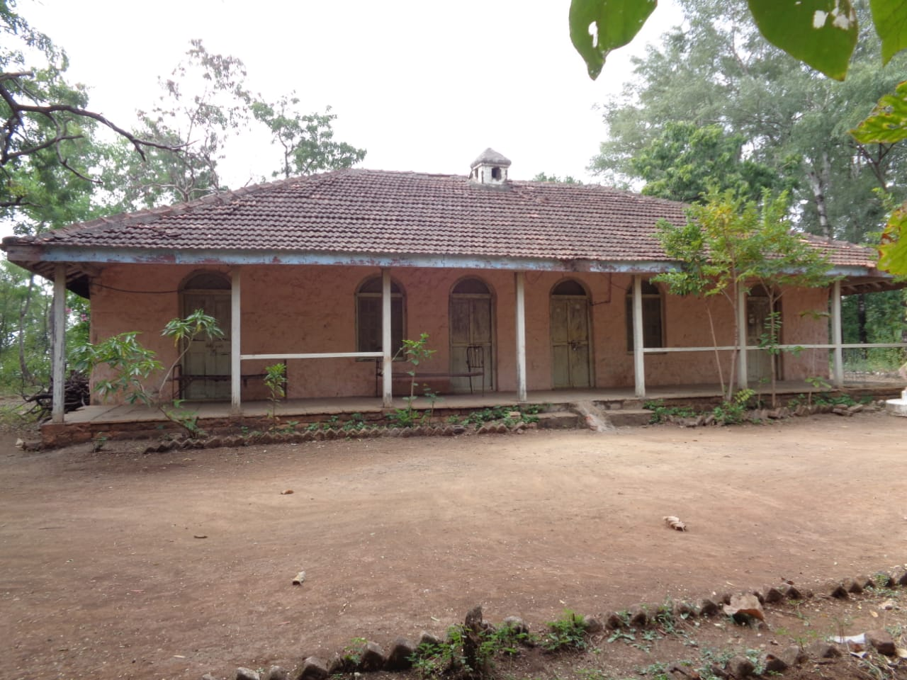
The bungalow originally housed rooms for police and staff. Notably, it is said that few military activities also took place here. There is an old British-era cannon situated nearby which perhaps attests to this. There is an event associated with the Dakbangla which is particularly interesting.
Locals say that around 1942, when the freedom movement was at its peak in colonial India, Karmaveer Annasaheb Venkatarao Randhir, a freedom fighter and social service worker from the Khandesh region, took around ₹5.5 lakhs of treasure from Chimthane village and burned it at the bungalow. It is said that he was subsequently arrested for his actions. While the circumstances around the actions remain unknown, the burning could as well have been an act of rebellion against colonial rule. The Dakbangla, it is said, currently falls under the jurisdiction of the Forest Department. Many structures within it have since fallen into disrepair. One may pass by the structure today, unaware that the bungalow held such an intriguing history.
Gangeshwar Mahadev Mandir
Gangeshwar Mahadev Mandir is a historic religious site which is estimated to be around 500 years old. It is said that the mandir was established by the ancestors of a local named Shamlal Pannalal Marvadi/Agarwal and has been recently renovated by some members of the Zilla Parishad.

The mandir sits at the confluence of two rivers, namely Pan and Burai. For this reason and others, the mandir draws many visitors, particularly couples hoping to conceive. Devotees bathe in the river waters and offer prayers to Bholenath. People also visit the mandir to seek blessings for marriage-related matters.
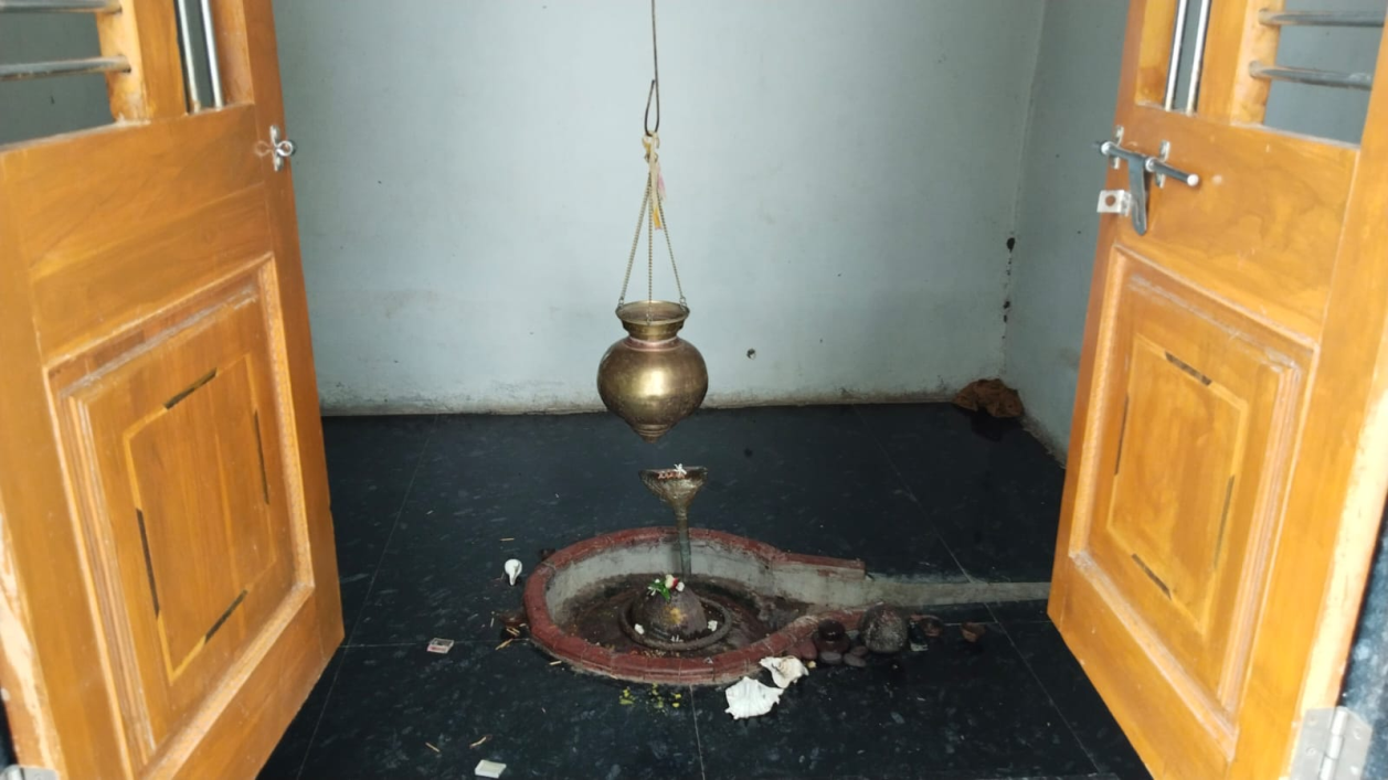
Among the many stories associated with the mandir is one about a man who visited on every Amavasya (new moon) to pray to Bholenath. According to the story, his deep devotion moved Shankar and Devi Parvati to appear before him and grant him a wish. When he asked for children, he was blessed with five sons, each named after the Bhagwan. It is said that one of his grandsons later served as the mandir’s pujari. Notably, a samadhi near the mandir stands in his memory.
Laling Fort
Laling Fort is a historical fortification located on the ridges of the Galna hills. Situated along the Dhule-Nashik road, the fort overlooks the village of Laling at its base. Access to the fort is via a footpath from the village, with an approximate ascent time of one hour.
![Ruins at Laling Fort, Dhule[3]](/media/culture/images/maharashtra/dhule/cultural-sites/ruins-at-laling-fort-dhule3-09b7b74c.jpg)
The origins of Laling Fort are uncertain. While some accounts suggest that the Ahirs originally built or controlled it, the district Gazetteer (1971) states that "the fort is supposed to have been built during the reign of the first of the Faruqi Kings."
The fort held considerable importance. According to the district Gazetteer (1971), the fact that Malik Raja (1370–1399) granted Laling Fort, and not Thalner Fort, to his eldest son strongly indicates that Laling was his chief fort. This decision underscores Laling's significance within the Faruqi dynasty’s power structure.
The fort played a key role in regional conflicts. In 1437, Nasir Khan (the second ruler of the Faruqi dynasty and son of Malik Raja) and his son, Miran Adil Khan (the third ruler of the Faruqi dynasty), were besieged there by a Bahamani general (from the Bahmani Sultanate, a major Deccan power). The siege was part of a broader conflict between the Bahmani Sultanate and the Faruqi dynasty for control over strategic territories in the Deccan. Laling Fort is also mentioned multiple times in early 17th-century records regarding the movements of Mughal troops during their Deccan campaigns.
By 1862, the fort was described as "strongly situated with very few defences left." Despite its current state of ruin, Laling Fort remains a site of historical and architectural significance, with its weathered walls and strategic location, in many ways, reflecting its turbulent past.
Landor Bungalow
Landor Bungalow is a historic building located in the Kuran area of Laling. The bungalow gained historical significance as the temporary residence of Dr B.R. Ambedkar during his three-day visit to Dhule in 1937.
Notably, he came here to handle a legal case for his client, which was filed in the Shirpur court. However, he also made much time during his visit to interact with the local Dalit community and many other prominent figures like Dr Rajwade who lived in Dhule. It is said that he delivered a significant speech at Sandesh Bhoomi (Vijay Anand Chitra Mandir) during a public event.
The bungalow has evolved into a significant historical site over the past three decades. The site is especially significant for the Dalit community from the Khandesh region. Many of his followers usually come to this site to pay their respects. Every year, on 31 July, a Bhima Smriti Yatra is also held to commemorate his visit and celebrate his legacy.
Shri Aai Pedkai Devi Mandir
The Shri Aai Pedkai Devi Mandir is a historic religious site located in the Pedkai forest of Shindkheda taluka. The mandir is dedicated to Aai Pedkai Devi, who is revered as the kul-devi (family deity) of the families who once lived in Pedkai. It is said that the area surrounding the mandir was once home to a village of 21 clans; among them were families named Borse, Mahale, Chinchore, Vedhane, More, Wakade, and Somvanshi. Locals say that the village remained inhabited until around 1950.
![Shri Aai Pedkai Mata Mandir at the hilltop in Dhule.[4]](/media/culture/images/maharashtra/dhule/cultural-sites/shri-aai-pedkai-mata-mandir-at-the-hillt_qbn7UhX.png)
There are several legends associated with the mandir and its location. The mandir currently sits atop Pedkai Hill with no structures above it. However, according to a local legend, this was not always the case. It is said that Pedoba Maharaj, believed to be the brother of Aai Pedkai Devi, once had his shrine positioned higher on the hill than his sister’s mandir. When water and soil from his shrine began falling onto his sister’s mandir below, Pedoba Maharaj is believed to have moved his shrine to lower ground during the night, out of respect for his sister.
The hill where the mandir stands also has many intriguing legends associated with it. According to one such legend, while traveling from Ayodhya into exile, Shri Ram, Lakshman, and Mata Sita passed through this forest. They stopped to drink from the five tanks on Pedkai Hill, leaving behind marks that devotees identify as the footprints of Shri Ram and Lakshman.
Festivals & Events
The two major festivals are celebrated in the Mandir annually. The main festival honoring Aai Pedkai Devi coincides with Navratri, a ten-day celebration that begins on the first day of the bright fortnight in the month of Ashwin (typically falling in September-October) and concludes with Vijaya Dashami. During this period, the mandir becomes a center of devotion. Trust members maintain a constant presence, conducting prayers and rituals, including the ghata-sthapana ceremony (the installation of a sacred pot).
Another significant event is the Yatra festival, which takes place in the month of Chaitra (March-April), starting on Ram Navami (Bhagwan Ram’s birth celebration, typically falling in March-April) and continues until the full moon day (Purnima) of the same month. Devotees gather to receive darshan (sight of the deity) during this auspicious period, often waiting hours for their turn. The festival is marked by special aarti ceremonies.
Traditions and Customs
The mandir maintains several traditional practices. For first-born children, their umbilical cords are ceremonially cut at the mandir grounds. For young girls, their first mundan (first haircut ceremony) is performed in front of the home aarti, and the cut hair is placed in a coconut bowl as an offering to Aai Pedkai Mata at the mandir.
The mandir also maintains strict observances. Non-vegetarian food is prohibited within the mandir premises. The mandir’s devi, Aai Pedkai Mata, is distinguished by ‘anjan’ (kajal) markings on her head and sides, a practice believed to be ancient. Following this tradition, devotees are prohibited from burning Anjana wood, as this is considered a transgression against Aai Pedkai.
Thalner Fort
Thalner Fort is a historical fortification located in Thalner village, situated on the banks of the Tapi River along the Surat-Burhanpur highway. The fort’s distinctive triangular structure features one side rising directly from the Tapi River, while the remaining three sides are surrounded by a hollow way. The fortress walls, according to the district Gazetteer (1971) reach approximately 18.28 meters in height above this hollow.
![Thalner Fort of Dhule standing above the water, showcasing its strategic vantage point and historic presence.[5]](/media/culture/images/maharashtra/dhule/cultural-sites/thalner-fort-of-dhule-standing-above-the_sVyGV1Y.png)
The history of Thalner Fort spans several centuries and dynasties, beginning with its emergence as a strategic stronghold in the late 14th century. In 1370, Firozshah Tughluq (r. 1351-1388) granted Malik Raja Faruqi an estate on the southern border of Gujarat, and Malik established Thalner as his headquarters. In 1371, following his defeat by a king from Gujarat, Malik sought refuge in the fort, demonstrating its early importance as a defensive structure. Upon his death in 1399, he bequeathed Thalner to his second son; however, in 1417 his elder son Nair Khan captured it with assistance from the Sultan of Malwa.
Medieval Period
The fort’s strategic significance continued to grow throughout the 15th and 16th centuries. In 1498, Mahmud Begada, king of Gujarat, besieged the fort and extracted tribute payments. In the following year, he granted Thalner with about one-half of Khandesh to Malik Hissamuddin, a noble of his court.
In 1566, the fort was the scene of the defeat of the Khandesh king Miran Muhammad Khan by Changiz Khan of Gujarat. By 1600, when it passed to Emperor Akbar, Thalner was noted by Abul Fazal in his Ain-i-Akbari (Mughal administrative document) as being of great strength despite being situated on a plain. In 1750, it very notably served as a strong fort and the center of thirty-two little governments.
Shortly after, the fort passed to the Peshwa, who made it over to Holkar. Around 1800, the Nimbalkars, a Maratha clan descending from Nimbraj Parmar of the Jagdeva Parmar lineage, temporarily took possession of the fort, but it was soon reclaimed by the Holkars. The fort remained under Holkar control until 1818, when the Mandasor Treaty, signed during the Third Anglo-Maratha War, forced the Holkars to surrender it to the British.
British Conquest
The British capture of Thalner Fort was described in the district Gazetteer (1971) as "one of the bloodiest incidents in the conquest of Khandesh." The assault on the fort was initiated by General Hislop, who led the British forces. The engagement resulted in the deaths of approximately 250 defenders, while British casualties were reported to be 25.
The British decision to attack was based on intelligence that the fort's western side was poorly defended, lacking artillery. This weakness allowed the British to position their guns for a direct assault on the fort’s gates from the northeast angle.
Native defenders fiercely resisted the British assault despite being outgunned. The initial breach of the gates by the British was successful, but the assault turned into intense close-quarters combat when Colonel Murray and a small party entered through a wicket gate. Lieutenant Colonel Valentine Blacker, in his memoirs on the Maratha War, described the scene: "In a moment, [the enemy] laid them all dead, except Colonel Murray, who, covered with wounds, fell towards the wicket." Despite the fierce resistance, the British regrouped and eventually secured the fort.
Following the capture, the British forces executed the fort’s commandant, hanging him from a tree on the flagstaff tower. According to the Gazetteer (1971), "the commandant was hanged on the same evening to a tree on the flagstaff tower." Very remarkably, this decision is noted to have outraged many locals. A subsequent account "severely blames Sir T. Hislop for hanging the commandant,” perhaps commenting on their brutality.
After the British takeover, it is insinuated in the Gazetteer (1971) that the fort lost much of its strategic significance. However, the history of the fort remains marked by the conflict, with many tombs of those who died in the battle still present within the fort’s grounds.
Vishwanath Kashinath Rajwade Sanshodhan Mandal
The Vishwanath Kashinath Rajwade Sanshodhan Mandal is a library and research centre which is situated in Dhule. It was established on 9 January, 1927, as the Itishacharya Research Board by followers of V.K. Rajwade, who was a prominent historian of Maratha history and a freedom fighter.
Much of the collection which the centre holds are historical documents and resources that V.K. Rajwade started collecting after he moved to Dhule from Pune following a dispute with officials at the Indian History Research Board. He lived in Dhule for almost 26 years, so one can only imagine how rich his collection might have been. Over the years, Rajwade amassed a significant collection of historical materials which, notably, included books and inscriptions in languages such as Farsi, Modi, Sanskrit, Marathi, and Hindi. Many believe that it is through his efforts that these materials remain preserved and accessible to scholars across the world today.
Currently, the mandal serves as a significant research centre which has over 750 library members and more than 20,000 texts. It, in many ways, functions as an important center for historical research, maintaining Rajwade’s legacy of preserving and providing access to important historical materials.
Sources
2023. ‘Songir Fort’. NomadTrekkers. Accessed on Nov. 15, 2024.nomadtrekkers.in/dhule-forts/dhule-forts-son…
Anonymous. 2022. Best Tourist Places in Dhule. Best of Dhule. Accessed November 15, 2024.https://www.bestofdhule.com/best-tourist-pla…
Dhananjay Dixit. 2023. Dhule Ambedkar : धुळ्याचा लांडोर बंगला आणि डॉ. बाबासाहेब आंबेडकर, आजच्या ऐतिहासिक प्रसंगाला 86 वर्ष पूर्ण, काय आहे इतिहास?ABP Majha. Accessed November 15, 2024. https://marathi.abplive.com/news/dhule/mahra…
Durg Bharari. Bhamergad. Durg Bharari. Accessed March 17, 2025. https://durgbharari.in/bhamergad/#google_vig…
Government of Maharashtra. History: V.K. Rajwade Research Board. Dhule District. Accessed March 17, 2025. https://dhule.gov.in/tourist-place/history-v…
Government of Maharashtra. Laling Fort. Dhule District. Accessed November 15, 2024.https://dhule.gov.in/mr/tourist-place/%E0%A4…
Government of Maharashtra. Thalner Fort. Dhule District. Accessed November 15, 2024. https://dhule.gov.in/tourist-place/thalner-f…
Maharashtra State Gazetteers. 1974. Dhulia District. Directorate of Government Printing, Stationery & Publications, Government of Maharashtra, Mumbai.
Last updated on 4 November 2025. Help us improve the information on this page by clicking on suggest edits or writing to us.