Contents
- Chandore Village
- Chavdar Tale
- Chirner Ganpati Mandir
- Chirner Jungle Satyagraha Hutatma Smarak
- Dhakti Pandhari
- Elephanta Caves
- Early Habitation and Maritime Role
- Gharapuri in Inscriptions and Dynastic History
- Construction of the Elephanta Caves
- Architectural Features and Religious Iconography
- Colonial Reinterpretation and Name Change
- Harihareshwar Mandir
- Kadyavarcha Ganpati, Neral
- Khanderi
- Matheran
- Murud Janjira
- Oral Tradition
- Raigad Fort
- Historical Background
- Capital of the Maratha Empire
- Siege of Raigad and Mughal Capture
- British Era and Decline
- Architecture and Layout
- Phadke Wada, Shirdhon
- Shivthar Ghal
- Vadale Lake
- Varadvinayak Mandir, Mahad
- Walan Kund
- Sources
RAIGAD
Cultural Sites
Last updated on 22 July 2025. Help us improve the information on this page by clicking on suggest edits or writing to us.
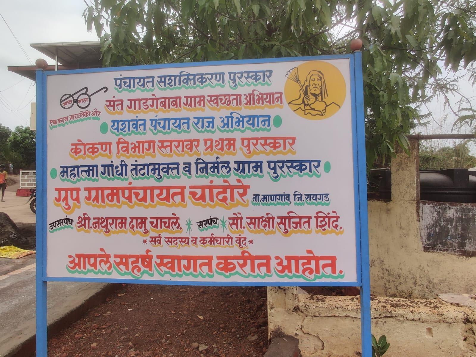
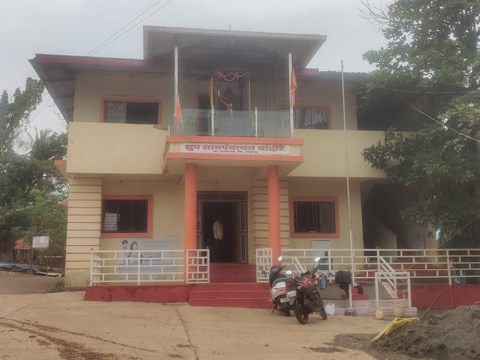
Chandore Village
Chandore is a village located in Mangaon taluka of Raigad district. It is associated with the territorial boundary of Swarajya, the kingdom established by Chhatrapati Shivaji Maharaj (r. 1674–1680 CE). Beyond this point lay the territory of the Siddhis, rulers based in Janjira. As a frontier village, Chandore was frequently exposed to conflict and military pressure.
Over time, this position shaped local attitudes toward governance and community life. Rather than internal rivalries, residents prioritized unity and cooperation in response to external threats. Interestingly, this tradition remains visible today in the village’s political structure: the sarpanch (village head) is still chosen through unanimous agreement, a practice referred to locally as binvirodh rajkaran, or “consensus politics”.
Apart from its socio-historical legacy, Chandore has also drawn attention for its archaeological remains. In 2001, archaeological excavations were undertaken in the village, and over two years, the team unearthed veergals (stone memorials), coins, and fragments of terracotta bangles. The presence of these materials points to an earlier historical phase, suggesting that Chandore may have been both a commemorative site and a link in regional trade routes.
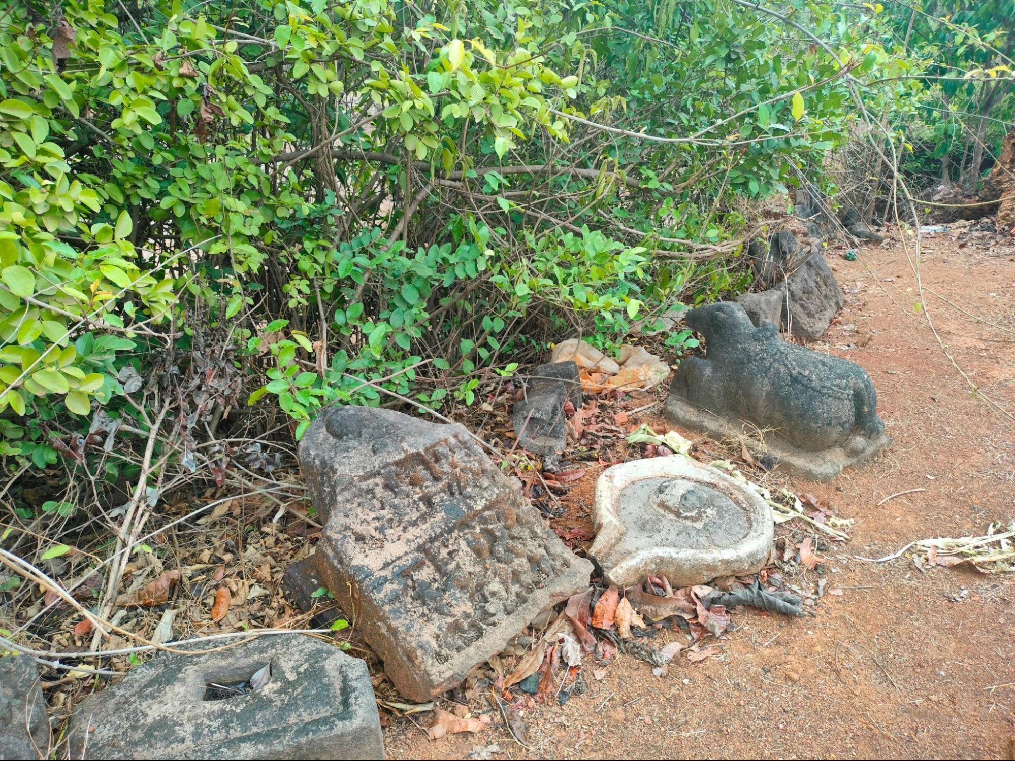
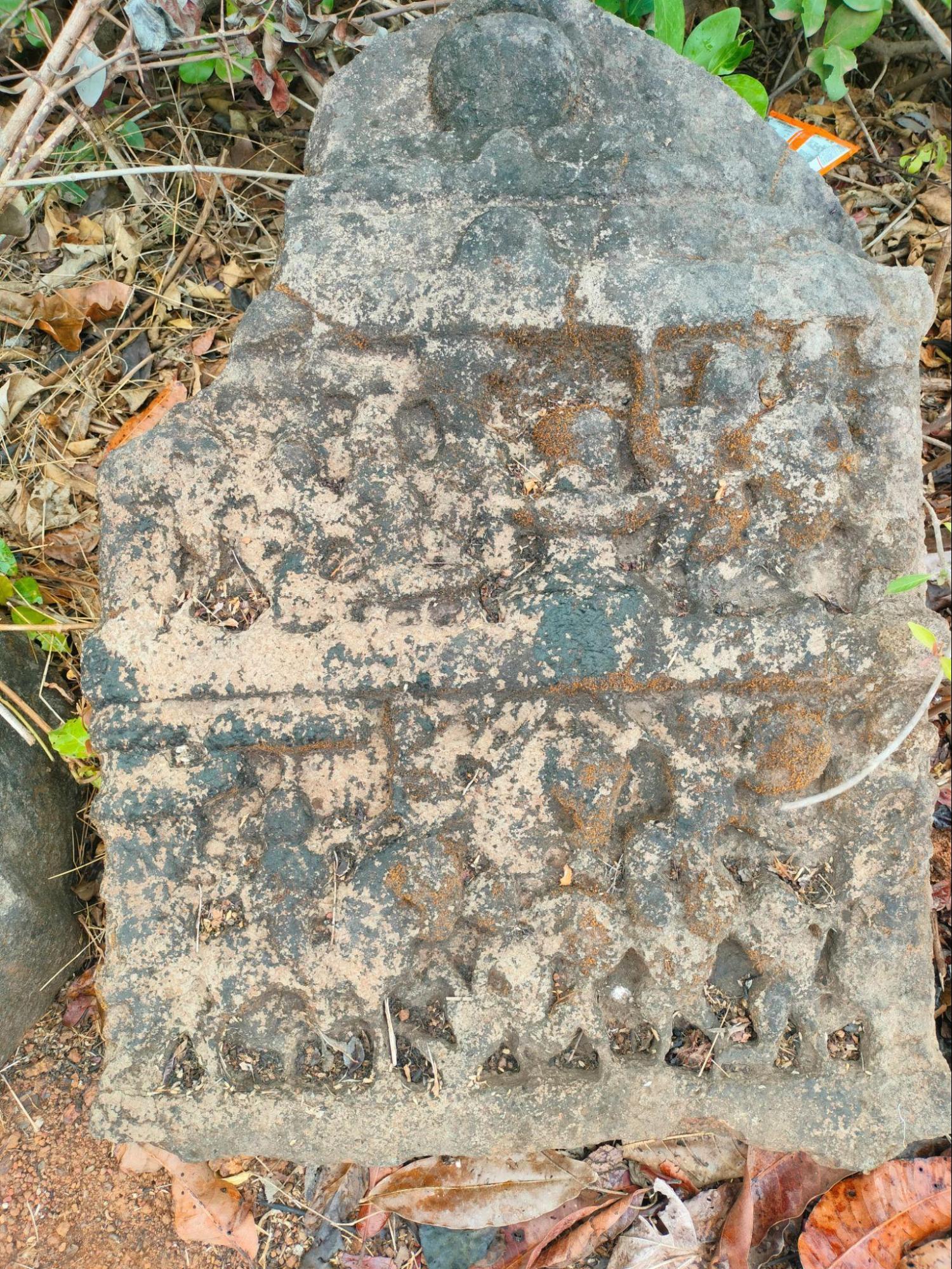
Plans were developed to preserve the excavated objects through the restoration of the village mandir and the beautification of the adjacent lake. However, locals state that its work has since stalled due to a lack of financial support.
Chavdar Tale
Chavdar Tale, located in the town of Mahad, is a public water tank associated with the Mahad Satyagraha of 1927, a significant event in the history of India's social reform movements. Led by Dr. B.R. Ambedkar, the satyagraha sought to assert the right of Dalits to access public water sources, challenging long-standing caste-based restrictions.
![An archival image of the Chavdar Lake at Mahad, Raigad, which was site of the 1927 Satyagraha led by Dr. B.R. Ambedkar to assert the rights of Dalits to access public water sources.[1]](/media/culture/images/maharashtra/raigad/cultural-sites/an-archival-image-of-the-chavdar-lake-a_FYx5CYZ.jpg)
Although the Bombay Legislative Council had passed a resolution in 1923 allowing people of all castes to use public amenities, caste-based restrictions on access continued in practice. Mahad was chosen for the satyagraha with the support of progressive local leaders, including Surendranath Tipnis, president of the Mahad municipality, who had officially declared that public spaces were open to all.
Following a public meeting, Ambedkar led thousands of participants to Chavdar Tale, where he and many others from the Dalit community drank from the water tank as a demonstration of equal rights. Notably, commenting on this moment, in 1927, Ambedkar said, “We are not going to the Chavadar Tank to merely drink its water. We are going to the tank to assert that we, too, are human beings like others.”
Significantly, the Mahad Satyagraha is widely recognized as a landmark moment in the struggle against caste discrimination. It is often referred to by many as the Dalit community’s “Declaration of Independence,” and March 20 is now observed as Social Empowerment Day across India to commemorate this event.
Today, Chavdar Tale remains a site of historical importance. The lake and the nearby Ambedkar Smarak continue to attract visitors, serving as reminders of the ongoing struggle for social equality and dignity that has taken place in Indian history.
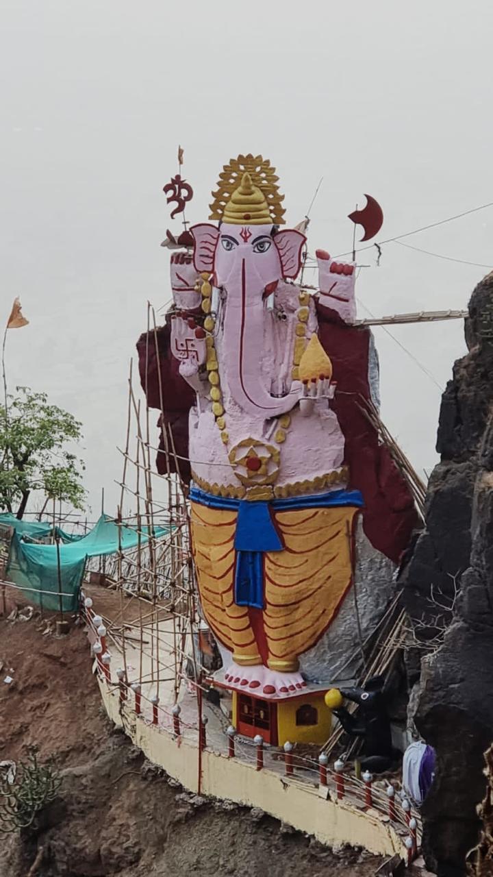
Chirner Ganpati Mandir
The Chirner Ganpati Mandir is a historic site located in Chirner, Uran taluka, Raigad district. Dedicated to Mahaganpati, the gram devta of the village, the Mandir is believed to have been established during the Shilahara period (8th–13th century CE).
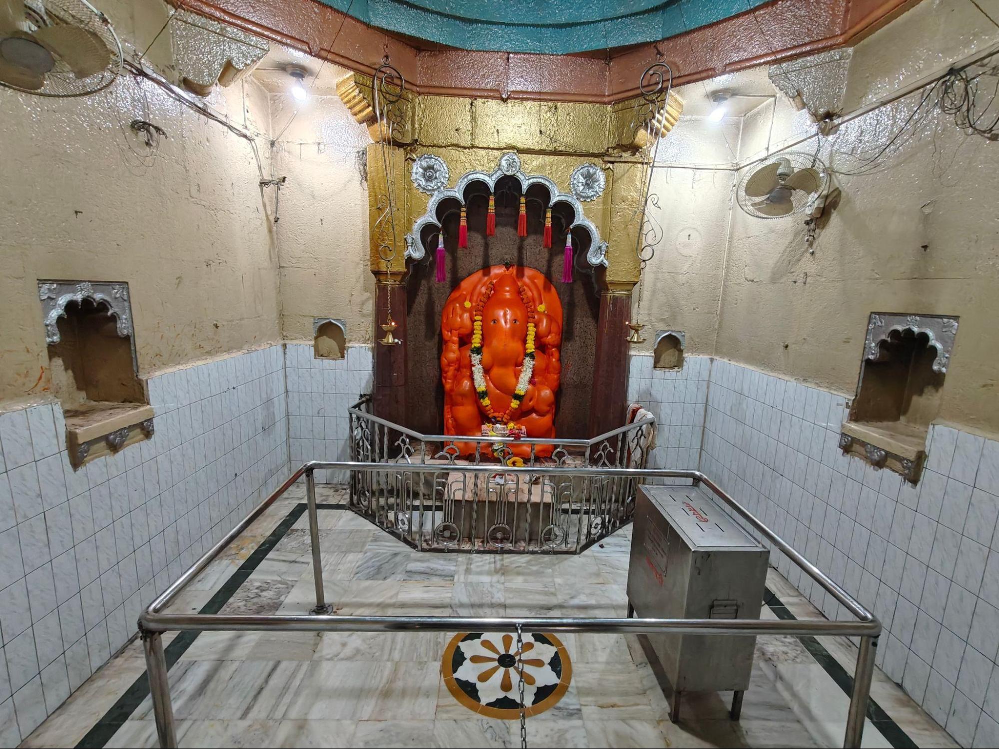
During the British colonial period, it is said that when several local religious facets faced the threat of removal or destruction, villagers are said to have hidden the Ganesh murti in a nearby lake to protect it. After the return of regional stability, the murti was retrieved and reinstalled. The Mandir was reconstructed under the leadership of Sardar Ramji Mahadev Phadke, with a new stone structure built to house the Devta. Today, the Mandir remains a prominent religious site, especially during Ganesh Jayanti, when a large jatra is held in the village.
Chirner Jungle Satyagraha Hutatma Smarak
Chirner, a village in the Uran taluka of Raigad district, holds a notable place in the history of India’s freedom movement. On 25 September 1930, it became the site of the Jungle Satyagraha, a protest against British forest regulations that restricted access to local resources. The Satyagraha was part of a broader wave of nonviolent resistance unfolding across the country during the early 20th century.
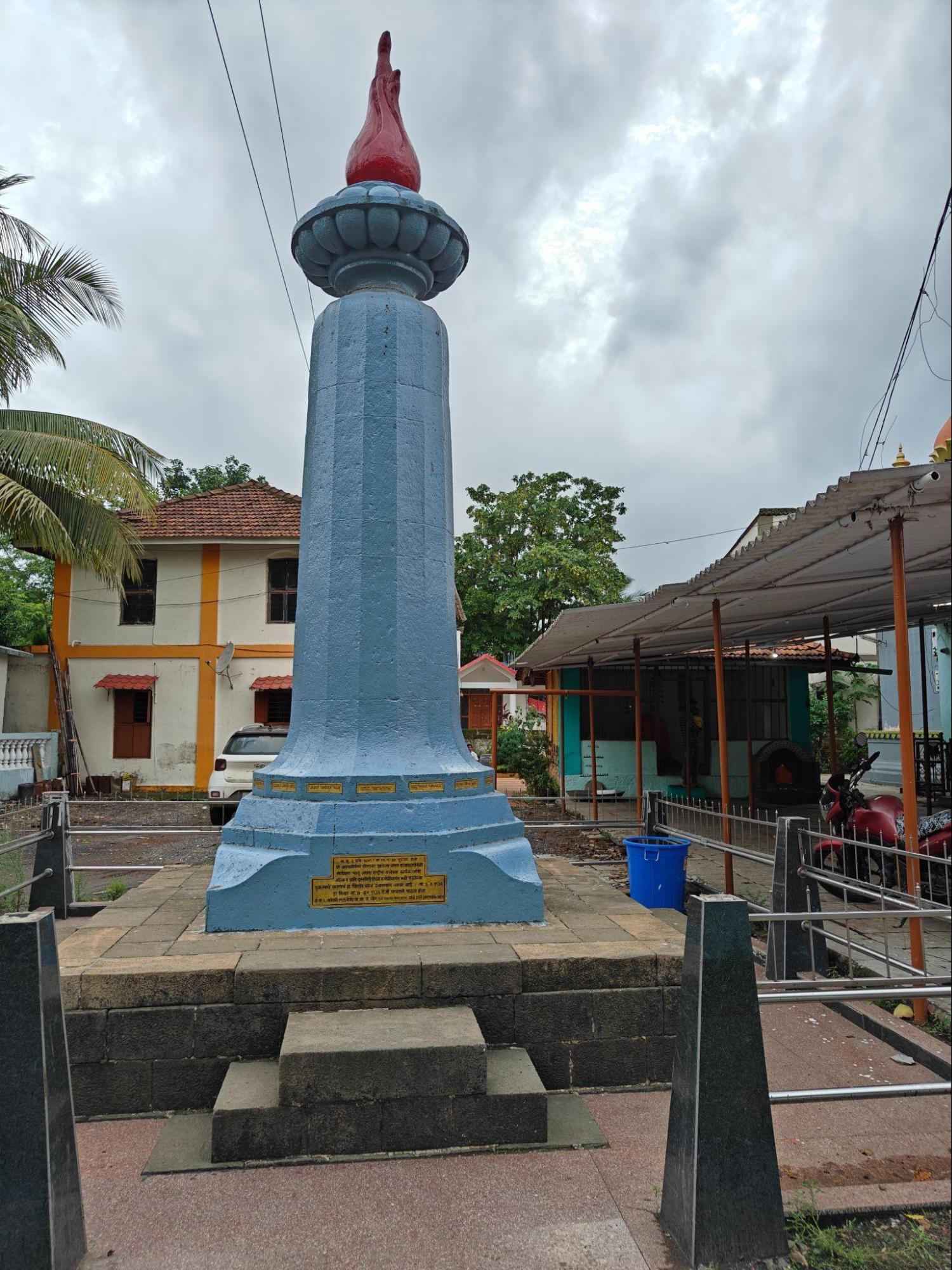
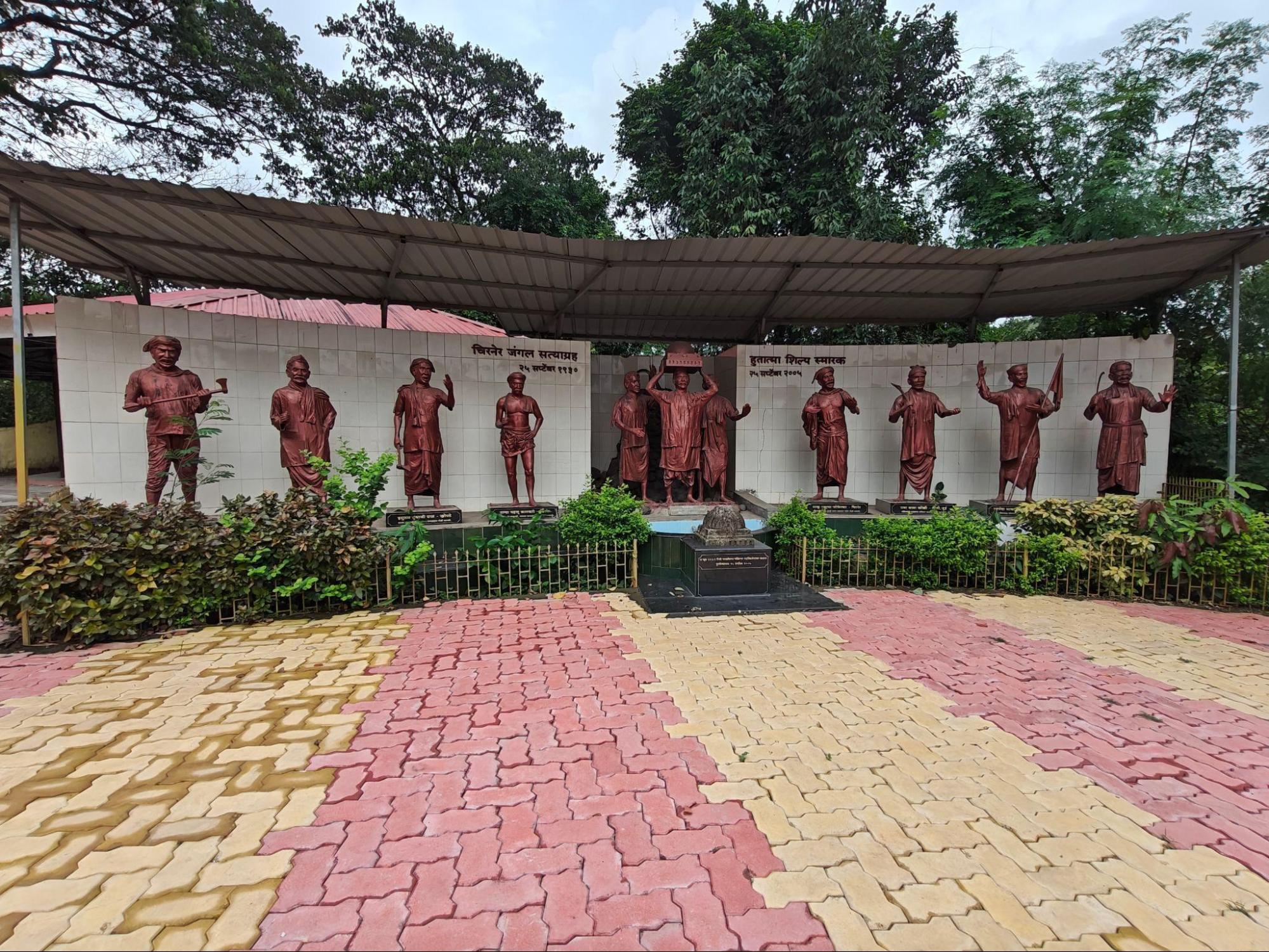
During the protest, nine unarmed participants were shot and killed by British forces. Among those killed was Joshi Mamledar, a local administrative officer. The incident left a lasting mark on the village and became a powerful moment of nonviolent resistance in the region.
To commemorate those who died, a Smruti Stambh (memorial pillar) was erected on 3 January 1932. However, later that same year, the British administration demolished the structure. In 1939, the memorial was rebuilt under the leadership of N.B.G. Khare, then a member of the Mumbai government. In 2005, parts of the original destroyed pillar were recovered and are now preserved at the site.
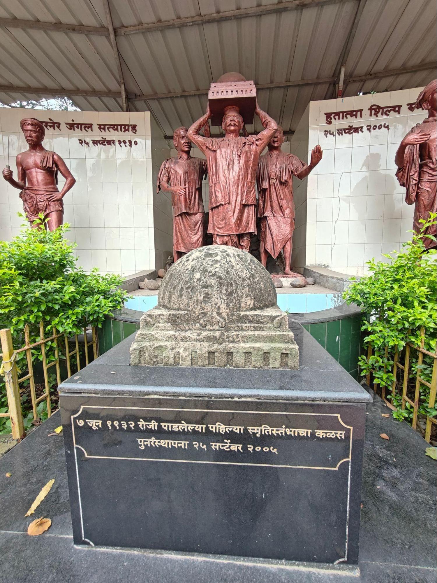
Every year on 25 September, the local community gathers at the Hutatma Smarak to remember the satyagrahis. The event is marked by formal tributes and public gatherings, reflecting the enduring significance of Chirner’s role in the larger movement for India’s independence.
Dhakti Pandhari
Dhakti Pandhari is the local name for Dhanegav, a village in Karjat taluka, Raigad district. It is known for its Mandir dedicated to Vitthal, a form of Vishnu closely associated with the Varkari tradition in Maharashtra. A prominent 50 ft. statue of Vitthal stands near the Mandir, reflecting the significance of the Devta within the local community.
The origins of the site are rooted in a local account involving a woman from the village who regularly undertook the yatra to Pandharpur for Ashadhi Ekadashi. As she grew older, she found the journey increasingly difficult. One night, she dreamt that Vitthal had come to Dhanegav so she would no longer need to travel. Soon after, swayambhu murtis of Vitthal and Rukmini were found in the village, leading to the establishment of the Mandir.
The site was later expanded with community support. The complex includes a gabhara (inner sanctum), sabhamandap (assembly hall), and an open courtyard used for public events. The Mandir holds regular kirtans, particularly during Ashadhi and Kartiki Ekadashi, and draws tirth yatris from Karjat and surrounding regions.
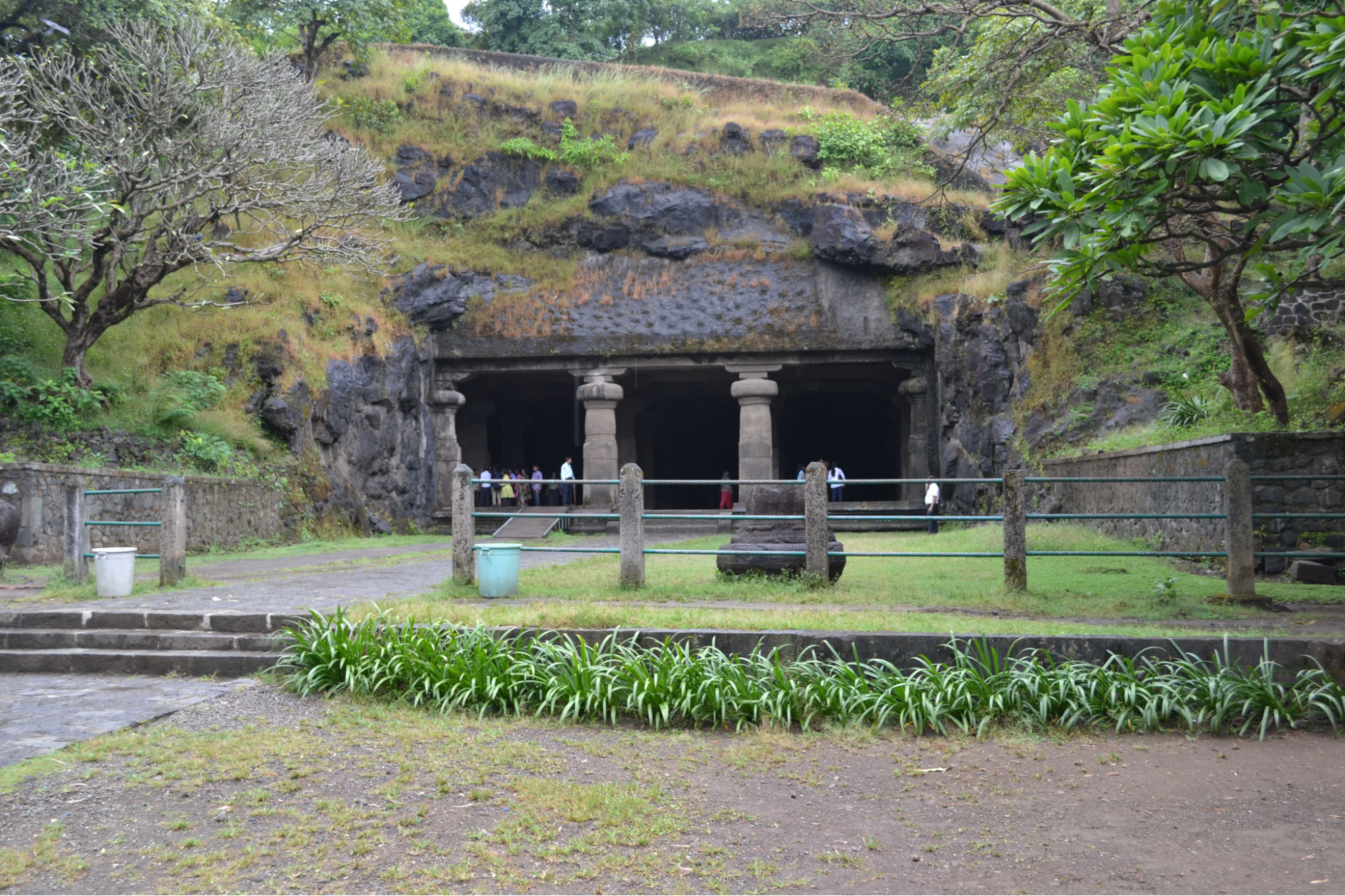
Elephanta Caves
The Elephanta Caves are a group of rock-cut cave mandirs located on Gharapuri Island, approximately 11 km off the coast of Mumbai in Raigad district. Designated a UNESCO World Heritage Site, the caves are renowned for their rock-cut sculptures, particularly the monumental carvings dedicated to Shiv. While the site is popularly known today as Elephanta, its historical names, Shripuri, Puri, and Rajbandar, reveal a layered past tied to ancient trade, political power, and religious life.
Early Habitation and Maritime Role
Long before the caves were carved, Gharapuri Island had been inhabited for over two millennia. Archaeological findings, including Roman amphorae, suggest that it functioned as a port by the 2nd century BCE, providing rest and freshwater for sailors navigating the western coastline of India. It is mentioned in the colonial district Gazetteer (1883), that the island may have served as a regional hub under local rulers, with early remains such as a brick stupa dated to the same period indicating Buddhist activity.
Manish Rai, Assistant Archaeologist at the Archaeological Survey of India, notes that Gharapuri’s location at the mouth of Thane Creek made it a vital port of call for incoming ships: many of which were required to pay docking fees. He adds that this positioning allowed the island to accumulate considerable wealth and visibility, even in the early centuries BCE.
Gharapuri in Inscriptions and Dynastic History
The island’s prominence continued through successive political periods. Inscriptions from the Chalukya dynasty (6th–8th century CE) provide key insight into its strategic role. The Aihole inscription (634 CE), carved at the Meguti Mandir in Karnataka, describes a naval campaign by Pulakesin II (c. 610–642 CE) (a naval strategist, expansionist, and conqueror) against a coastal city named Puri, described as “the goddess of the fortunes of the Western Ocean,” and said to have been besieged by “hundreds of ships.” The metaphorical phrasing underscores the site’s political and cultural value.
Some scholars, including archaeologist Manish Rai (2014), suggest that this Puri may refer to Gharapuri (Elephanta Island). In his analysis published in Heritage and Us, he argues that the island’s strategic maritime location, coupled with inscriptional and archaeological evidence, supports its identification as a fortified port and capital in the early medieval period.
Other historians have linked the reference to Puri more broadly to the region ruled by the Mauryas of Konkan (6th–8th century CE), local rulers and coastal power, whose capital may have included Gharapuri. Later, the Silhara dynasty (c. 765–1215 CE), Konkan rulers and Mandir patrons, is also believed to have controlled the island. Additionally, Dandidurga (c. 735–756 CE), empire-builder and founder of the Rashtrakuta Empire, is known to have claimed territories that included or bordered the region, reinforcing the island’s sustained regional relevance.
By the late 11th century, the island was referred to in inscriptional sources as Shripuri. Though its precise identification remains debated, these references reflect the island’s evolving role as a site of religious significance, maritime activity, and political contestation over many centuries.
Construction of the Elephanta Caves
While the island’s early history stretches back to the 2nd century BCE, the Elephanta Caves were constructed later: between the 5th and 8th centuries CE. Based on stylistic and epigraphic analysis, many scholars attribute their construction to King Krishnaraja (mid-6th century CE), a Shaivite patron and regional ruler of the Kalachuri dynasty (6th–7th century CE). Numerous Kalachuri copper coins have been discovered at the site, further supporting this association.
The Kalachuris, who ruled from Mahishmati (present-day Maheshwar in Madhya Pradesh), were known patrons of Shaivism. They were also associated with the Pashupata cult, one of the earliest Shaivite sects that venerated Bhagwaan Shiv as the supreme Devta. The Elephanta caves were likely part of a broader religious-political project by the Kalachuris to consolidate religious authority in coastal western India.
There are alternate theories as well. Interestingly, some local legends suggest that Pulakesin II commissioned the caves and that it took nearly a century to complete the labor. While these accounts are not supported by archaeological evidence, they reflect the enduring awe inspired by the monument.
Architectural Features and Religious Iconography
The caves are carved from basalt and follow the traditional rock-cut method of excavation, beginning from the top and proceeding downward. The main complex, Cave 1, is organized around a central hall supported by rows of columns, with shrines and sculpted panels along its walls. It contains one of the most iconic images in Indian art: the Trimurti, or three-headed Shiv, representing his aspects as creator, preserver, and destroyer.
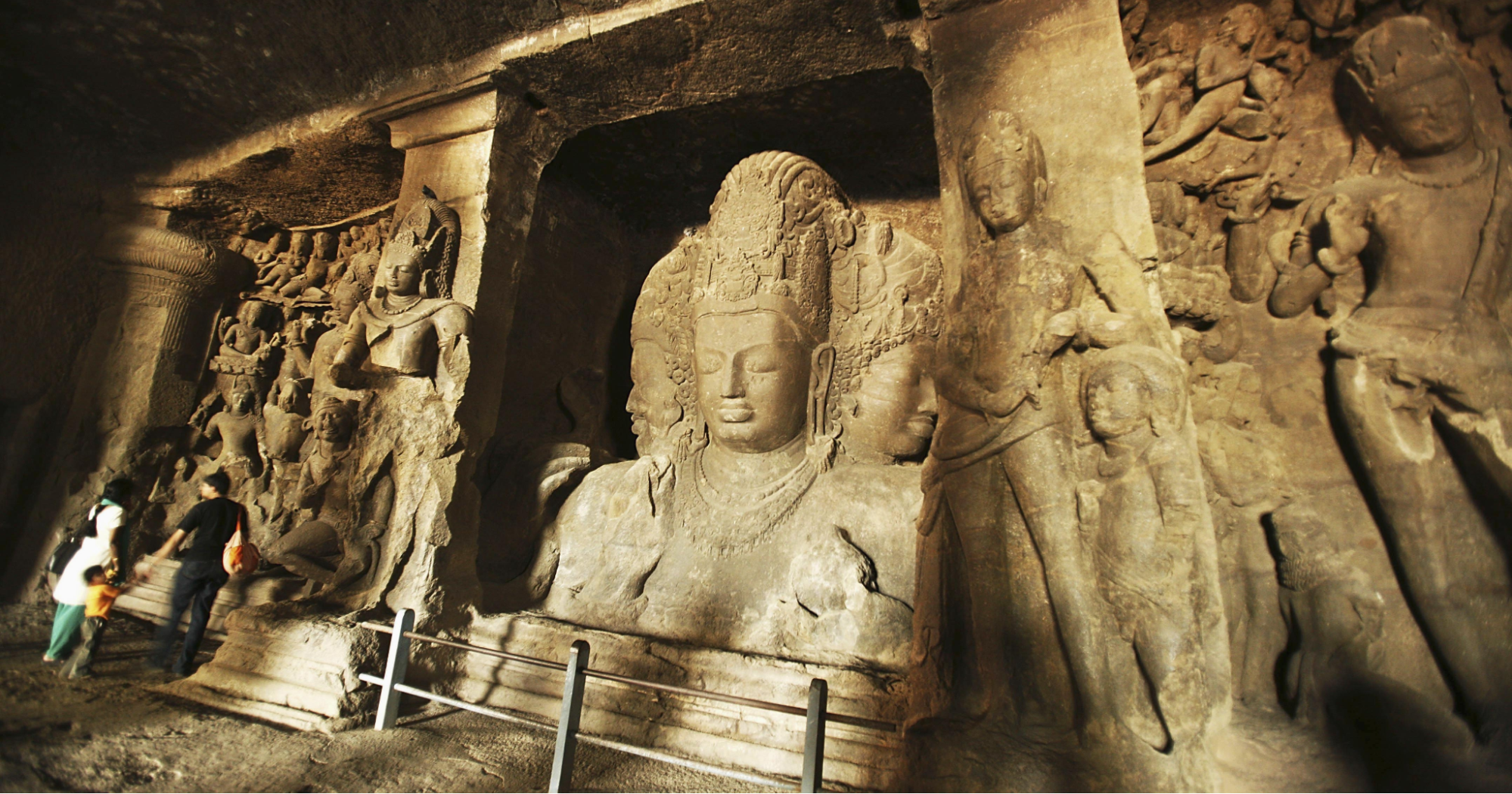
Other panels depict scenes such as Ravan lifting Mount Kailasa, Shiv’s marriage to Parvati, Andhakasura Vadha, and other key episodes from Shaivite literature. Despite later damage, especially during colonial rule, the sculptures retain their expressive strength and technical precision. The layout of the caves, their alignment, and their iconography place them in close relation to other sites in the Deccan, such as Ajanta, Ellora, and the lesser-known Buddhist caves on the island.
Colonial Reinterpretation and Name Change
The name Elephanta originated during the Portuguese colonial period (from 1534 CE). After capturing the site from the Gujarat Sultanate, Portuguese explorers encountered a life-sized stone elephant near the island's entrance. They named the site Ilha Elefante (“Elephant Island”). The statue became a representative marker, though it was later damaged and relocated by British colonial officials (early 19th century CE), museum collectors, and cultural administrators.
![The statue, depicted in “On the Island of Elephanta,” engraved by R. Brandard based on a drawing by W. Daniell was taken by the British colonialists, as was often the case. Unfortunately, it suffered damage during transport and now resides in the Bhau Daji Lad Museum.[2]](/media/culture/images/maharashtra/raigad/cultural-sites/the-statue-depicted-in-on-the-island-of_0KQzPpb.png)
Today, the elephant statue is housed in the Bhau Daji Lad Museum in Mumbai. A 19th-century engraving titled “On the Island of Elephanta” by R. Brandard, after W. Daniell, captures the colonial fascination with the island’s grandeur.
In 1987, the Elephanta Caves were declared a UNESCO World Heritage Site, recognizing their cultural and historical value. Visitors today can access the island via ferry from the Gateway of India or water taxis from Navi Mumbai. Upon arrival, a miniature train carries passengers to the base of the caves, followed by a stairway climb lined with stalls selling local crafts, food, and souvenirs.
![Modern access route to the island, linking Mumbai to the heritage site.[3]](/media/culture/images/maharashtra/raigad/cultural-sites/modern-access-route-to-the-island-linki_0anuJ6P.png)
Harihareshwar Mandir
The Harihareshwar Mandir is a coastal tirtha yatra site located in Harihareshwar, Raigad district. Often referred to as Dakshin Kashi (Kashi of the South), it holds longstanding religious significance and is traditionally believed to have been established by Agastya Rishi, an ancient Vedic scholar known for his role in early South Indian spiritual traditions. Remarkably, it is said that the Mandir is home to the Kuldaivat of the Peshwas, hereditary prime ministers of the Maratha Empire.
A distinct feature of the Mandir is its coastal parikrama route. This circumambulation path extends around the Mandir along the rocky shoreline and is accessible only during low tide (ohoti). During high tide and the monsoon season, the route remains closed due to safety concerns.
The Mandir is also a significant site for funerary rites. Families often visit Harihareshwar to perform final rituals (antyesti) for the deceased, based on the belief that the site’s spiritual energy supports the liberation of the soul (moksha). Bhagwaan Kalbhairav is particularly revered for his protective qualities, believed to ward off negative energies and ghostly forces (pishach).
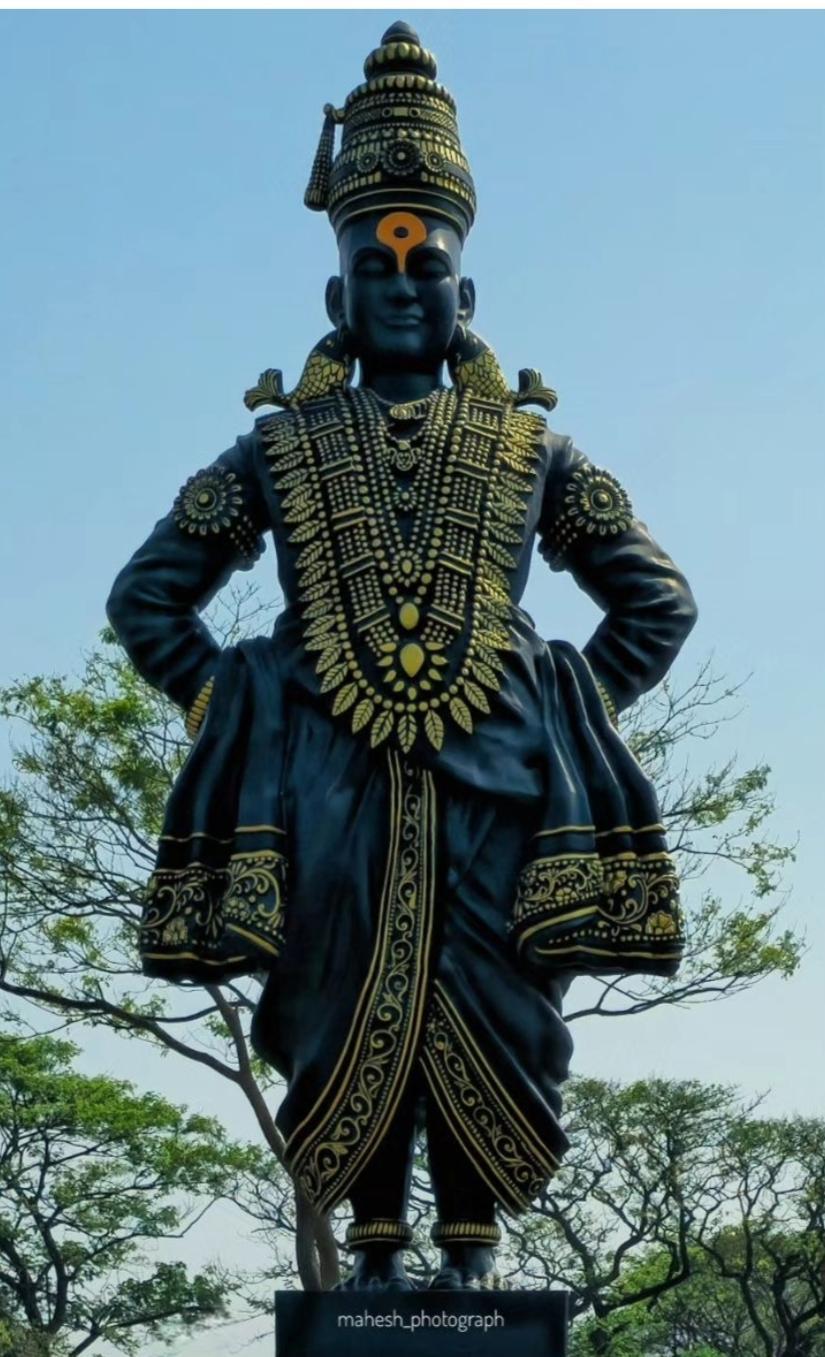
Kadyavarcha Ganpati, Neral
The Kadyavarcha Ganpati is a massive rock-carved Ganesh murti located on a hilltop in Neral, Raigad district. The site, notably, originated from the vision of Rajaram Khade, a local rail motorman who operated the mini train to Matheran. Over years of travel, he developed a deep connection to the location, often sensing the presence of Ganpati while passing by.
In 2004, an unusual encounter with a mouse inside his train engine deepened this feeling. When the mouse jumped out near the same hillside curve, Khade saw it as a divine sign. Inspired, he shared his vision with local villagers and fellow railway workers, who joined him in the effort to carve a Ganesh murti directly into the rock.
The project took nearly 14 years, culminating in 2018 with the completion of a 52-foot-tall Ganesh murti carved directly from the hillside. Positioned on a natural ledge and overlooking the surrounding forest, the murti was later named Nisarg Raja, meaning “King of Nature.” At its base sits a carved mouse, showing Bhagwaan Ganesh’s traditional vahan.
A smaller Mandir was built beside the rock-cut murti to house a secondary murti for daily worship and rituals. Today, the site is maintained by the D3 Group Foundation. It continues to attract visitors during events like Champashashti and Angarki Chaturthi, which are celebrated with the support of the forest and railway departments. Although Rajaram Khade passed away before the project was completed, the site remains closely associated with his legacy.
Khanderi
Khanderi is a fortified island located off the coast of Alibag in Raigad district. It was captured by Maratha forces in 1679 CE, during the reign of Chhatrapati Shivaji Maharaj, who incorporated it into a broader coastal defense strategy. The nearby Underi Fort, taken by the Siddis in 1680, formed part of a strategic pairing that became a site of recurring naval conflict between the two powers. According to local accounts, the twin forts played a critical role in monitoring sea trade routes and resisting foreign influence, particularly from European colonial fleets.
![An old lighthouse at Khanderi Fort, Raigad which was likely added later to the fort site, reflecting its continued use in maritime navigation.[4]](/media/culture/images/maharashtra/raigad/cultural-sites/an-old-lighthouse-at-khanderi-fort-raig_nIgfp5Q.png)
In addition to its military importance, Khanderi Fort is home to a Mandir dedicated to Vetal Dev, the kuldevta of the local Koli community. Locals believe that the murti of Vetal Dev, carved from a single stone, gradually increases in size over time, a detail that lends the site continued religious relevance. Residents also recount hearing the sound of horse hooves at night, believed to signify the Devta’s protective presence.
Matheran
Matheran is a hill station located in the Western Ghats of Raigad district, at an elevation of approximately 800 meters above sea level. It is one of the few towns in India to prohibit motorized vehicles, a restriction that contributes to its low levels of air and noise pollution.
The development of Matheran as a public destination is closely tied to the construction of the Matheran Light Railway in the late 19th century. The project was initiated by Abdul Hussain Adamji, son of Mumbai’s first sheriff, who proposed the railway as a way to improve access to the area. At the time, hill stations were generally accessible only to colonial administrators and elite visitors. The line was conceived as a private effort to open up Matheran to a broader population.
![Entrance of Matheran, a hill station situated in Neral, Raigad district.[5]](/media/culture/images/maharashtra/raigad/cultural-sites/entrance-of-matheran-a-hill-station-sit_7pPZGw3.png)
Construction took approximately seven years. The 20 km route from Neral to Matheran was designed with a narrow gauge of 61 cm, using steam engines imported from Germany and teak sleepers sourced from Burma. The alignment includes over 220 curves, accommodating the steep terrain of the Ghats. The railway was later transferred to Central Indian Railways, which continues to operate it.
The railway marked a shift in Matheran’s function, turning it into a more accessible destination for regional travelers and visitors from nearby urban areas. The toy train continues to operate seasonally, though services are suspended during the monsoon months due to frequent landslides. In recent years, suspensions have occasionally extended beyond seasonal conditions, raising concerns among residents.
Murud Janjira
Murud Janjira is a coastal island fort situated near the town of Murud in Raigad district. From the late 15th century until India’s integration in 1947, the fort remained under the control of the Siddis, an Abyssinian-descended Muslim dynasty. Surrounded by the Arabian Sea and accessible only by boat, Murud Janjira was widely regarded as one of the most impregnable sea forts on the western coast of India.
![Murud Janjira in Alibag, Radigad, an island fort surrounded by water on all sides, known for its impenetrable design and resistance to conquest.[6]](/media/culture/images/maharashtra/raigad/cultural-sites/murud-janjira-in-alibag-radigad-an-isla_hxGxPiq.png)
The name of the fort is peculiar and very interestingly reflects its layered cultural history. “Murud” is derived from the Konkani term “morod”, meaning plateau, while “Janjira” comes from the Arabic word “jazeera”, meaning island. This linguistic combination illustrates the site’s connection to both regional and maritime traditions.
Oral Tradition
Despite repeated military campaigns by several regional powers, the fort was never captured. It remained one of the few major coastal fortifications that resisted Maratha control, despite sustained efforts. Still, while it remained unconquered, local memory preserves accounts of attempted Maratha infiltrations. One such story centers on Maynak Bhandari, a fisherman from Alibag who is said to have assisted Chhatrapati Shivaji Maharaj in a covert plan to access the fort.
According to local legend, Bhandari constructed temporary stairs along the fort’s outer wall under cover of night. When the Maratha forces failed to arrive as planned, he dismantled the structure before dawn. On the day of Shivaji Maharaj’s coronation at Raigad, Bhandari was unexpectedly summoned. Fearing reprisal, he instead found himself honored with a palkhi (ceremonial palanquin) and attendants in recognition of his efforts. When he declined the honor, Shivaji is said to have gifted him a boat named Palkhi instead. The story continues to be shared by the Bhandari community in Alibag as part of their family and regional history.
Raigad Fort
Raigad Fort is a hill fortress which is situated in the Sahyadri mountain range. The fort is of considerable historical importance, for it served as the capital of the Maratha Empire under Chhatrapati Shivaji Maharaj and is often referred to as Durgaraj, or the “king of forts.” It stands at an elevation of 4,449 ft. above sea level and 2,700 ft. above its base, overlooking the town of Mahad in Raigad district. A sheer drop on one side adds to its formidable defenses, making it nearly impossible to ascend or descend the steep hillside without caution.
![An overview of the Raigad fort complex perched atop the Sahyadri range, highlighting its elevated position and natural defenses.[7]](/media/culture/images/maharashtra/raigad/cultural-sites/an-overview-of-the-raigad-fort-complex-_6MAmkrf.png)
Historical Background
Before becoming the Maratha capital, the site of Raigad (then called Rairi) was held by local chieftains and changed hands over successive regional powers. According to the colonial district Gazetteer (1883), it was constructed and controlled by Chandraraoji More, a local chief who possibly belonged to a Maratha community. Positioned within the Western Ghats, the fort served as a strategic outpost before being captured by Shivaji Maharaj in 1656. He renamed it Raigad, meaning “royal fort,” and began developing it into a central administrative base.
By the early 1660s, Shivaji had secured key victories in the Deccan, weakening adversaries such as the Bijapur Sultanate. With his control consolidated in the region, Shivaji began focusing on the Konkan coast, recognizing its strategic significance for trade, naval expansion, and resource control.
In January 1664, Shivaji launched one of his most famous and strategic military operations: the raid on Surat. At that time, Surat was one of the wealthiest trading ports in the Mughal Empire, serving as a crucial commercial hub where merchants from Europe, Persia, and the Middle East conducted business. The city was home to vast Mughal treasures, warehouses filled with riches, and important foreign trading posts, including the British and Dutch East India Companies.
Following his dramatic escape from Mughal captivity in Agra in 1666, Shivaji returned to Raigad and began reorganizing the Maratha administration. Anticipating further conflict with Aurangzeb, he focused on strengthening the military, expanding the fort network, and enhancing intelligence systems. These efforts culminated in Raigad being selected as the Maratha capital.
Capital of the Maratha Empire
In June 1674, Shivaji Maharaj was formally crowned as Chhatrapati at Raigad Fort. The coronation, known as Rajyabhishek, was officiated by the scholar Gaga Bhatt of Kashi and attended by nobles, diplomats, and envoys from across India. The ceremony marked the assertion of a sovereign Maratha rule (Hindavi Swarajya) outside the influence of both the Mughal Empire and Deccan Sultanates.
![Sculpture of Shivaji Maharaj seated on his throne, commemorating his coronation at Raigad Fort. The installation represents a pivotal moment in Maratha history.[8]](/media/culture/images/maharashtra/raigad/cultural-sites/sculpture-of-shivaji-maharaj-seated-on-_nczGWk6.png)
Raigad became the administrative and military center of the Empire. Architect Hiroji Indulkar led the expansion and fortification of the complex. It is said that during this time, over 300 structures were developed, including palaces, military barracks, a vast marketplace, and specialized courtly and residential areas. The fort’s layout included large reservoirs, escape routes, and multi-gated entrances. From this capital, Shivaji managed state affairs, led military campaigns, implemented reforms, and issued coinage in his name.
The scale and planning of Raigad’s construction, remarkably, reflected not only its main role as the Maratha capital but also its practical function as a secure, self-sustaining seat of power.
Siege of Raigad and Mughal Capture
After Shivaji’s death on 3 April 1680, his son Sambhaji Maharaj succeeded him. However, Sambhaji’s reign faced both internal dissent and intensified Mughal pressure. In 1688, Mughal emperor Aurangzeb ordered a renewed assault on Raigad, entrusting the mission to general Zulfiqar Khan. The siege that followed cut off supplies and surrounded the fort from all directions.
With Sambhaji’s capture and execution in 1689, leadership passed to his half-brother Rajaram Maharaj, who was covertly evacuated from Raigad before its fall. The fort was eventually captured by the Mughal forces later that year. It is noted in the district colonial Gazetteer (1883), that in 1689, Mughal general Zulfiqar Khan captured Raigad, renaming it Islamgarh. However, the Marathas reclaimed the fort, years later, in 1735.
British Era and Decline
In the early 19th century, as the British East India Company expanded its reach in western India, Raigad once again became a military target. The fort’s formidable design earned it the nickname “Gibraltar of the East” among British officers.
In 1818, British forces under Colonel Prother launched a sustained artillery campaign against Raigad. During the assault, Varanshibai, the wife of Peshwa Bajirao II, refused to surrender and remained at the fort with a contingent of Arab soldiers. After several days of bombardment, the fort was surrendered, and key structures were destroyed.
Architecture and Layout
Despite later destruction, the architectural layout of Raigad offers insight into how the fort functioned during its time as a capital. As it was built atop a high plateau, the fort utilized its natural surroundings to enhance defense. Major entrances such as the Maha Darwaja and Chitta Darwaja restricted access, while the Nagarkhana Darwaja opened onto the royal court, reinforcing spatial order and ceremonial hierarchy.
![A British-era depiction of Raigad’s grand layout, likely created for military and administrative purposes.[9]](/media/culture/images/maharashtra/raigad/cultural-sites/a-british-era-depiction-of-raigads-gran_f4YmvVI.png)
The Raj Bhavan (royal palace), Rani Vasa (residences of royal women), and other internal structures such as storerooms, granaries, and water reservoirs supported governance and sustainability. Takmak Tok, a cliff used historically for executions, stands at the fort’s edge, while the Samadhi of Shivaji Maharaj near the Jagadishwar Mandir marks the site of his cremation. Together, these elements reflect the dual role of the fort as both a political center and a fortified settlement.
The preserved structures and archaeological remains continue to attract visitors interested in the history of the Maratha Empire and the architectural legacy of the period. Visitors today can reach the site by climbing approximately 1,737 stone steps or via the Raigad Ropeway, a modern tramway that ascends to the summit in about ten minutes.
![The modern aerial tramway that transports visitors to the top of the fort in approximately ten minutes.[10]](/media/culture/images/maharashtra/raigad/cultural-sites/the-modern-aerial-tramway-that-transpor_sa5kVoR.png)
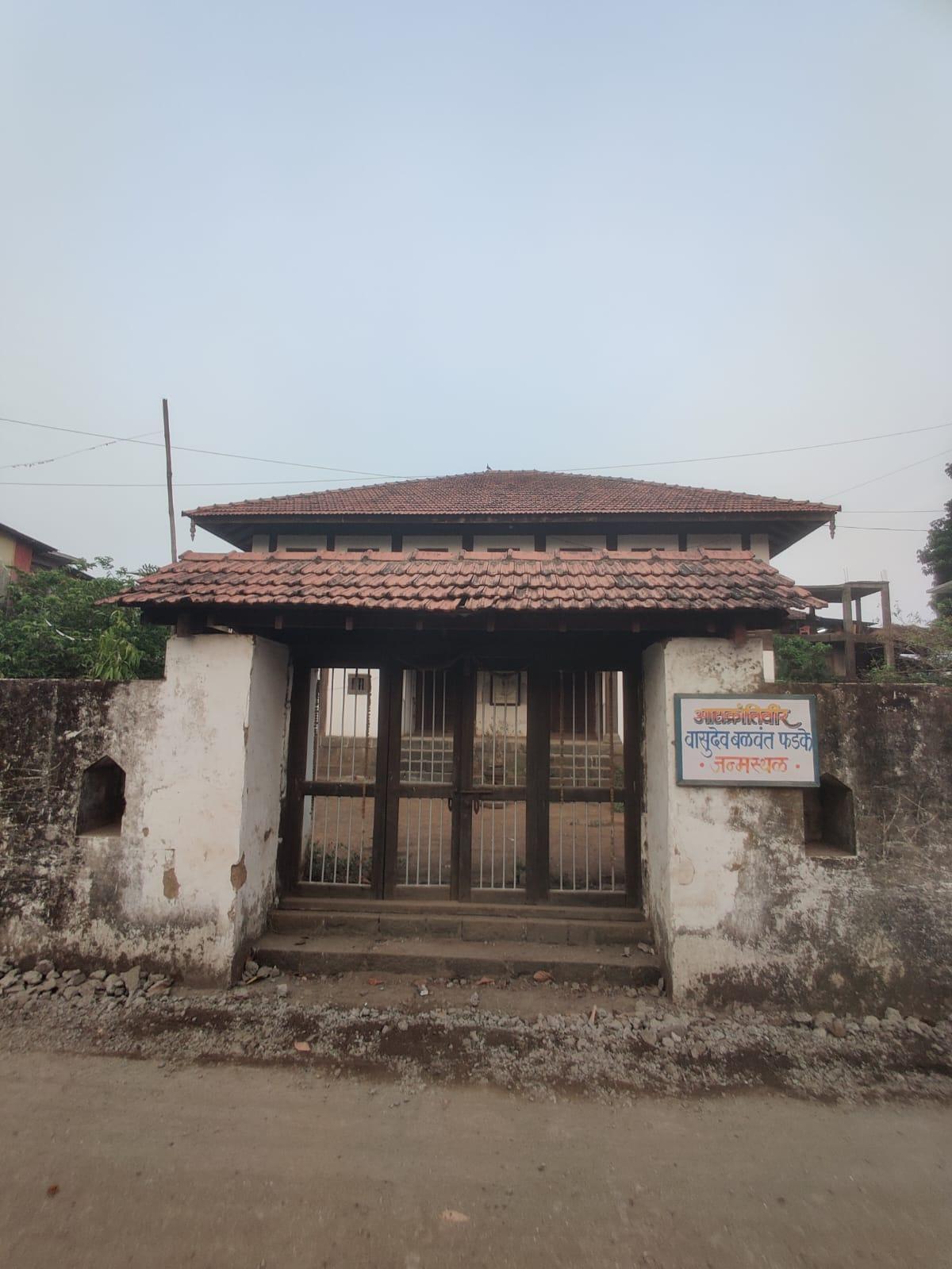
Phadke Wada, Shirdhon
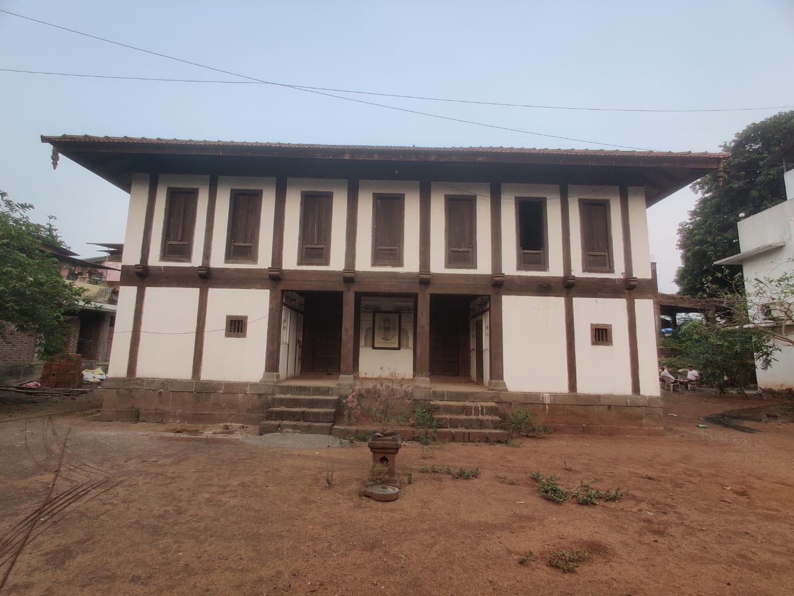
Shirdhon is a village in Raigad district with deep ties to India’s freedom struggle. It is the birthplace of Vasudev Balwant Phadke (1845–1883), a revolutionary leader often referred to as the “Father of the Indian Armed Rebellion.” Phadke began his career as a clerk in British administration but became one of the earliest figures to organize an armed movement against colonial rule. A reward of ₹4,000 was issued for his capture following a series of attacks on British infrastructure.
The Phadke family’s legacy of resistance extends beyond Vasudev. Locals say that his grandfather, Anantrao Phadke, served as the Killedar of Karnala Fort and is remembered for defying British demands to surrender the fort, resulting in a prolonged battle. These values were passed down through generations and shaped Vasudev’s path as a revolutionary.
The family’s ancestral wada still stands in Shirdhon and is accompanied by a Smruti Mandir, a small museum that houses personal belongings of Vasudev Phadke and documents his role in the freedom movement. Intriguingly, local accounts speak of an underground passage linking the wada to the foothills of Karnala Fort, further adding to the site’s historical interest.
Shivthar Ghal
Shivthar Ghal is a culturally significant site located in the Waghjai valley in Raigad district. The site is closely associated with Samarth Ramdas Swami, a 17th-century spiritual teacher known for his influential philosophical text Dasbodh. It is traditionally believed that Ramdas Swami composed this work at Shivthar Ghal.
![Statues of Samarth Ramdas Swami and Shridhar Swami inside the Mandir complex at Shivthar Ghal, Raigad.[11]](/media/culture/images/maharashtra/raigad/cultural-sites/statues-of-samarth-ramdas-swami-and-shr_aXMAb9e.png)
Vadale Lake
Vadale Lake in Panvel is a manmade water body which was formed during the Maratha-era. According to local accounts, it was constructed around 1739, when Chimmaji Appa, brother of Peshwa Baji Rao I, passed through Panvel after the conquest of Vasai Fort. Exhausted and low on supplies, his troops considered raiding homes, but Chimmaji instead advised seeking help from the townspeople.
The Bapat family, then known for their wealth and local leadership, offered their treasury in support. In return, Chimmaji Appa asked how he could repay their generosity. They requested the construction of a lake to address Panvel’s chronic water shortage. In response, Chimmaji Appa directed his men to dig what would become Vadale Lake. Some accounts also credit Balajipant Bapat with overseeing its construction.
Over time, parts of the lake were allocated for farming, and a structure known as bailghat once stood at its edge, though no trace of it remains today. In recent years, the Panvel Mahanagar Palika has undertaken a beautification project, introducing a walking track, benches, lights, and safety measures. A section of the lake is now used for Ganesh Visarjan, and Ballaleshwar Mandir nearby continues to attract people.
Varadvinayak Mandir, Mahad
The Varadvinayak Mandir is a Ganesh Mandir located in Mahad, Raigad district, and is the seventh stop on the Ashtavinayak Yatra (a pilgrimage circuit associated with eight historic mandirs in Maharashtra). It is said that the structure was built in 1725 CE by Peshwa Sardar Biwalkar, a prominent administrator during the Peshwa period, and was offered to the local community as a public place of worship.
According to local accounts, the murti of Bhagwaan Ganesh was found in a nearby lake and was initially worshipped in a smaller Mandir dedicated to a Devi before being formally housed in the Varadvinayak Mandir. The original Mandir resembled a residential structure rather than a formal place of worship. Over time, it was expanded and renovated to accommodate an increasing number of visitors while retaining its early architectural character.
Interestingly, the Mandir has a Nanda Deep, an oil lamp located near the garbhagriha (sanctum) that is believed to have remained continuously lit for over a century.
Walan Kund
Walan Kund, also known as Walan Kondi, is regarded by locals as a jagrut devasthan, an awakened temple, where wishes are believed to be fulfilled. Located in Mahad taluka along the Kal River, the site is dedicated to Vardayini Devi, whose name means “the one who grants all wishes.” Bhakts from nearby villages often visit before major life events, seeking her blessings for new beginnings, marriages, or family ceremonies.
A well-known local legend associated with the site speaks of a time when the Mandir was submerged beneath the kund. It is said that the pujari would dive into the waters each day to perform rituals below the surface. On special occasions, families would pray for ceremonial utensils, particularly gold vessels, to use during their rituals. These would appear by morning, ready for use. But there was one condition: everything had to be returned. When a family broke this unwritten rule, the blessings ceased, and the kund has remained silent ever since.
Though the practice has ended, the legend continues to shape how the site is remembered and revered. Some locals also speak of unusual sightings in the water, whales and other marine life appearing near the banks, further adding to the kund’s sense of mystery and quiet reverence.
The Mandir is positioned along a scenic stretch of riverbank, offering views of Lingana and Raigad forts. Visitors cross a narrow aero bridge and descend a carved stone staircase before reaching the Mandir.
Sources
Aditi Shah. 2020. Elephanta Caves: Celebrating Shiva. Peepul Tree.https://www.peepultree.world/livehistoryindi…
Department of Tourism. Forts. Maharashtra Tourism.https://maharashtratourism.gov.in/tourist-in…
Dipanita Nath. 2021. Know Your City: Vasudev Balwant Phadke, the pioneering Indian revolutionary who made Pune the centre of armed struggle. Indian Express.https://indianexpress.com/article/cities/pun…
Dr Uday Dokras, Srishti Dokras. Janjira Fort – Siddhi Architecture of India. Hypotheses.https://www.academia.edu/121978631/Janjira_F…
Gayatri Desai. Study of Sea Fort Construction Techniques in Maharashtra. ResearchGate.https://www.researchgate.net/profile/Ar-Gaya…
Indian Culture. The Legendary Raigad Fort. Indian Culture.https://indianculture.gov.in/forts-of-india/…
Jewels of Maharashtra. Raigad Fort: The Capital of a Maratha Kingdom. Jewels of Maharashtra Blog.https://jewelsofmaharashtra.wordpress.com/20…
Maharashtra State Gazetteers. 1882 (reprinted in 2000). Thana District. Directorate of Government Printing, Stationary & Publications, Government of Maharashtra, Mumbai.https://gazetteers.maharashtra.gov.in/cultur…
Maharashtra State Gazetteers. 1883 (reprinted in 1989). Kolaba District. Directorate of Government Printing, Stationary & Publications, Government of Maharashtra, Mumbai.https://gazetteers.maharashtra.gov.in/cultur…
Manish Rai. 2014. Archaeology of Gharapuri (Elephanta) Island from Inscribed and Written Records. Heritage and Us. Vol 3, no. 3, ISSN 2319-1201.
Ministry of Culture. Destruction and burning of Raigad Fort. Azadi Ka Amrit Mahotsav.https://amritmahotsav.nic.in/district-reopsi…
Mumbai Tourism. Elephanta Island, Mumbai. Mumbai Tourism.https://mumbaitourism.travel/elephanta-islan…
Pavanpreet Kaur. Reimagining the Mahad Satyagraha in the Age of Google Maps. Critical Collective.https://criticalcollective.in/ArtistInner2.a…
Shubhasree Purkayastha. 2019. Stories & Histories Hidden in Mumbai’s Suburbs. Sarmaya.https://sarmaya.in/spotlight/stories-histori…
Siddhartya Roy. 2016. The Lake Of Liberation. Outlook India.https://www.outlookindia.com/national/the-la…
TravelSole | Shash Wat. 2021. Unique Guide to Murud Janjira Fort. Medium.https://shash-wat2206.medium.com/unique-guid…
Last updated on 22 July 2025. Help us improve the information on this page by clicking on suggest edits or writing to us.