Chandrapur
11,443 sq. km
~23.86 lakh (2019)
953 (2011)
~ ₹32.058 crore (2019)
~ ₹1.34 lakh (2019 est.)
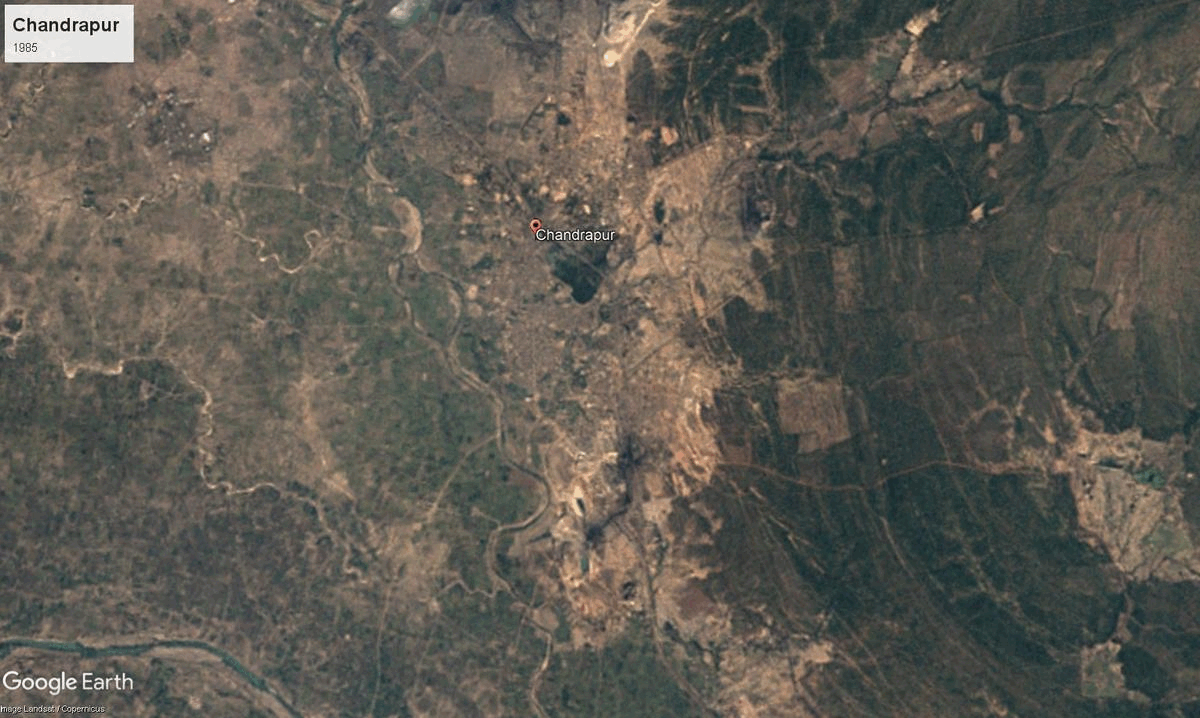
The name Chandrapur, located in the Vidarbha region of Maharashtra, is believed to have originated from "Chandra," meaning moon, possibly referring to the city's founder, Khandkya Ballal Shah of Sirpur (in present day Telangana), a Gond ruler, or its historical association with the moon deity. Formerly known as Chanda, the district was renamed Chandrapur in the 20th century. Known for coal mining and tiger reserve, notably, Chandrapur is also considered to be one of the cleanest districts in the state.
The founding legend tells of King Ballal Sah afflicted with tumors relocated following his wife's counsel to a place near the Wardha River, creating Ballarpur. During a hunt, he found a spring on the Zarpat River, and its water miraculously cured him. The site later became home to the Achaleshwar Temple. Later, after witnessing a hare chasing his dog, the king, again guided by his wife, established the fortified city of Chandrapur, deliberately avoiding constructing at the spot where the hare was killed, believed to be unlucky. This legend intertwines myth and local custom to explain Chandrapur's origins and the revered status of its spring.
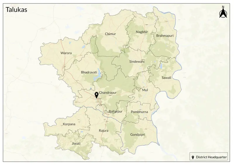
Chandrapur District is rich in Stone Age archaeological sites. Evidence of Neolithic habitation, including pottery-making signs, has been found in the area. Historically, the Gond people, an Adivasi group, have deep roots here and spread across central India. The region has seen successive dynastic control, from the Mauryas, Sungas, Satavahanas, Vakatakas, Kalachuris, Rashtrakutas, Chalukyas, and Yadavas, to the Gond rulers who founded Chandrapur, then the Marathas, and finally the British in 1853. It was part of the Berar province under the Nizam of Hyderabad before becoming part of British India. Post-independence, Chandrapur was incorporated into Bombay State and later into Maharashtra in 1960. The district today consists of 15 talukas, including Chandrapur, Ballarpur, Warora, Rajura, Mul, Bhadravati, Chimur, and Sindewahi.
Chandrapur is home to many historical and cultural landmarks, including the Achaleswar Temple, Manikgad Fort, Gond Raja’s Tomb, Panch Pandav Caves, and Mahakali Mandir. However, the most famous attraction is the Tadoba Andhari Tiger Reserve (TATR), one of India’s oldest and largest tiger reserves, known for its significant tiger population and diverse wildlife. The Reserve is known to have the largest tiger population in the state.
Situated in eastern Maharashtra, Chandrapur lies on the Deccan Plateau and has a tropical climate, with scorching summers, moderate monsoons, and mild winters. The district is rich in coal reserves, forests, and fertile plains, supporting industries and agriculture. Major crops include cotton, soybean, jowar, and paddy, with irrigation supported by the Wardha and Erai rivers.
Chandrapur’s economy is industrially driven, being a major center for coal mining, power generation, and cement production. The Wardha Valley Coalfield, managed by Western Coalfields Limited (WCL), is among India's largest coal reserves. The Chandrapur Super Thermal Power Station (CSTPS) is one of Maharashtra’s primary energy sources. Additionally, Ballarpur Industries Limited (BILT) is a key player in paper manufacturing. While industry dominates, agriculture and small-scale sectors like textiles, handicrafts, and agro-processing also contribute to the economy.
Explore Chandrapur