Kolhapur
7,685 sq. km
~4,181,000 (2019)
957 (2011)
~ ₹72189 crore (2019)
~ ₹1.72 lakh (2019)
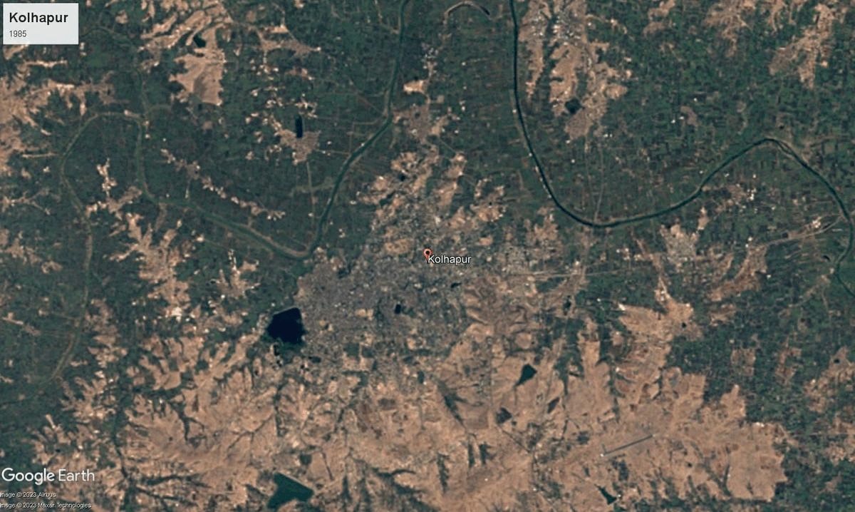
Kolhapur, district in southwestern Maharashtra, is a historic district on the banks of the Panchganga River. The district's name is rooted in the demon Kolhasur, whose last wish was to give the area his name after being slain by Goddess Mahalakshmi. Yet, there is another source, from stone inscription of Terdal during Shilahara kingdom (8th-12th century), which mentions the area to be called as 'kshullakpur' (first stage of Jain monkhood) -- note that the district has one of the largest number of Jains in the country. Previously part of the Shilahara and Rashtrakuta kingdoms and later the seat of the Maratha Bhosale rulers, Kolhapur became a princely state under British rule. "Dakshin Kashi" or "Kashi of the South," as Kolhapur is often called, reflects its deep spiritual heritage, especially as home to the Mahalakshmi (Ambabai) temple, an ancient Shakti Peeth. Over centuries, Kolhapur played a key role in social reform, especially under Shahu Maharaj (who ruled during 1894-2022), who promoted education and known for his progressive reforms that uplifted farmers, artisans, and marginalized communities.
Kolhapur’s cultural vibrancy is renowned across Maharashtra. It is famous for the classical music tradition of the Jaipur-Atrauli gharana, a strong legacy of wrestling (kushti), and its historic ties to the Marathi film industry, once nicknamed "Chitranagari." The district is also known for festivals, local folk arts, and traditional jewelry like the Kolhapuri saaj. Kolhapur’s devotion finds expression in religious fairs and events around its temples, including the Jyotiba and Kopeshwar temples, as well as in the distinctive Kolhapuri cuisine, and the globally recognized Kolhapuri chappals.
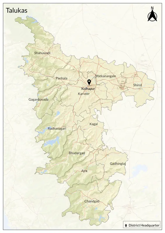
Geographically, Kolhapur lies in the lush Western Ghats, with fertile valleys crisscrossed by rivers such as the Panchganga, Krishna, and their tributaries. The Sahyadri hills, hill stations like Panhala, and forests rich in bauxite and biodiversity surround the region. Its landscape benefits from abundant monsoon rainfall, powering major dams like Radhanagari and nourishing green paddy fields, sugarcane, and horticultural crops. Kolhapur’s location in the riverine and mountainous terrain offers both natural beauty and important hydrological resources for irrigation and energy. Kolhapur has twelve talukas: Gadhinglaj, Karveer, Bhudargad, Panhala, Kagal, Shirol, Hatkanangale, Ajara, Chandgad, Gaganbawada, Radhanagari, and Shahuwadi.
The Mahalakshmi Mandir, one of the Shakti Peethas, attracts many visitors. Other cultural sites include the Jyotiba Mandir (Wadi Ratnagiri), Kopeshwar Mandir (Khidrapur), and Nrusinhawadi Datta Mandir (Narsobawadi). The district is home to Panhala Fort, which played a key role in Maratha history, and Vishalgad Fort, associated with Baji Prabhu Deshpande.
Farmers in Kolhapur grow sugarcane, rice, jowar, cotton, soybean, groundnut, and tobacco, while cashew farming is prominent in Chandgad taluka. Kolhapur’s economy is rooted in local industries. It is known for its Kolhapuri chappals, Kolhapuri jaggery, and Kolhapuri jewelry. The district has a strong artisan and manufacturing base, with auto-ancillary, foundry, and casting industries supporting nearby regions like Pune and Bengaluru. Gokul-Shirgaon MIDC, Shiroli MIDC, and Kagal Five-Star MIDC are key industrial zones, housing local and national enterprises.
Explore Kolhapur