Contents
- History
- Ancient Trade Routes
- Bullock Carts
- Modes of Transport
- Train and Rail Systems
- Overview of Bus Networks
- The Science Core Ground Bus Stand
- Power House Bus Stand
- Autos & Shared Vehicles
- Air Transport
- Traffic Map
- Communication Networks
- Newspapers & Magazines
- Graphs
- Road Safety and Violations
- A. Cases of Road Safety Violations
- B. Fines Collected from Road Safety Violations
- C. Vehicles involved in Road Accidents
- D. Age Groups of People Involved in Road Accidents
- E. Reported Road Accidents
- F. Type of Road Accidents
- G. Reported Injuries and Fatalities due to Road Accidents
- H. Injuries and Deaths by Type of Road
- I. Reported Road Accidents by Month
- J. Injuries and Deaths from Road Accidents (Time of Day)
- Transport Infrastructure
- A. Household Access to Transportation Assets
- B. Length of Roads
- C. Material of Roads
- D. Licenses Issued
- Bus Transport
- A. Number of Buses
- B. Number of Bus Routes
- C. Length of Bus Routes
- D. Average Length of Bus Routes
- E. Daily Average Number of Passengers on Buses
- F. Revenue from Transportation
- G. Average Earnings per Passenger
- Communication and Media
- A. Household Access to Communication Assets
- B. Newspaper and Magazines Published
- C. Composition of Publication Frequencies
- Sources
AMRAVATI
Transport & Communication
Last updated on 6 November 2025. Help us improve the information on this page by clicking on suggest edits or writing to us.
History
Ancient Trade Routes
Amravati, located in the Vidarbha region of Maharashtra, is widely recognised today as one of the state’s major cotton-producing districts. This association has contributed to its position as an important centre for trade, agriculture, and the development of supporting transport and communication networks. However, the region’s link to large-scale cotton trade became prominent relatively recently, after Amravati was integrated into the Berar province and brought under British administration in 1853 as part of the Hyderabad Assigned Districts.
The district’s historical relevance, however, predates this period by several centuries. Amravati is closely linked with the ancient Kingdom of Vidarbha, which is mentioned in early texts and local traditions. According to Major T. W. Haig’s Imperial Gazetteer of the Berar Province (1909), Vidarbha may have covered a much larger area than the modern province of Berar. Haig writes, “If the identification be correct, and it is supported by legend as well as by etymology, we may conclude that the ancient kingdom was far more extensive than the modern province of Berar. Tradition says that its kings bore sway over the whole of the Deccan.” The village of Kaundinyapur, located within present-day Amravati district, is believed by local accounts to have been the capital of this ancient kingdom.
Historical references suggest that Vidarbha’s location along north–south routes contributed to its early economic and cultural role. Poulami Ray (2023), in her paper, refers to the Sabhaparva of the Mahabharata, which mentions Vidarbha as part of a route connecting Aryavarta in northern India with southern regions. This positioning indicates that Amravati was part of important trade corridors long before colonial infrastructure developments.
Bullock Carts
In earlier times, local transport in Amravati depended on animal-drawn carts and pack animals suited to the region’s agricultural economy. Bullock carts and wooden handcarts were commonly used to move goods such as cotton, grain, and timber from villages to trade centres.
The Gazetteer on Berar (1909) records one of the earliest large consignments of cotton from the region. In 1825–26, “the first exportation direct to Bombay was made by Messrs. Pestonji & Co., merchants of Bombay and Hyderabad,” involving about 500 bullock loads, weighing nearly 1,20,000 pounds and valued at Rs. 25,000.
To meet different needs, local carts varied in design and use. The bandi was a larger cart for carrying bales of cotton and produce, the kacher served for passengers, and the rengi was a lighter, faster cart drawn by trotting bullocks. These carts formed the main link between farms, weekly markets, and regional trade routes.
By the late 19th century, the expansion of the Great Indian Peninsula Railway from Bhusawal to Nagpur began to change this pattern. The Gazetteer notes that “after the extension of the railway, the pack-bullock became a thing of the past,” which marked a shift from slow, animal-based transport to faster rail connections that tied Amravati more directly to ports and major cities.
Modes of Transport
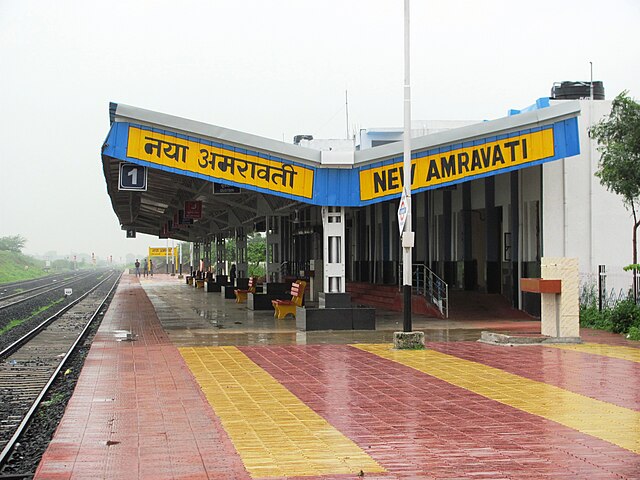
Train and Rail Systems
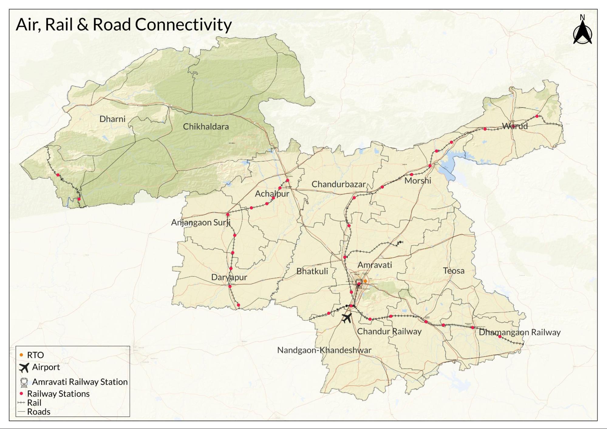
Amravati district is connected by multiple railway lines and stations that link it with major cities in Maharashtra and other parts of India. The main Amravati Railway Station operates under the Central Railway zone and handles both passenger and freight traffic. The district has around ten railway stations that serve local and regional transport needs.
Among these, Badnera Junction remains the primary freight and transit point. Located on the Bombay–Bhusawal–Nagpur trunk line, it provides direct connections for transporting cotton, oilseeds and pulses to major markets, including Mumbai. The district Gazetteer (1968) describes Badnera as “of considerable commercial importance” for its role in bulk exports. Dhamangaon station, situated in one of Vidarbha’s main cotton-growing areas, also emerged as a centre for dispatching raw cotton and timber. Historical figures indicate that in peak trading years, around 25,000 metric tonnes of goods were shipped annually from Dhamangaon alone.
The present rail network has its roots in infrastructure built during the second half of the 19th century. The opening of the Great Indian Peninsula Railway’s extension through Vidarbha transformed the way cotton was transported from interior districts to port cities. As noted by Meshram and Fulzele (2020), “important towns on the railway routes developed into cotton markets in the 1870s” once the rail lines reached the region in the 1860s. The American Civil War created new overseas demand for Indian cotton, prompting priority construction of lines connecting Vidarbha’s cotton-producing centres to Bombay. By 1867, the main cotton towns were linked directly by rail.
The main Bombay–Bhusawal–Nagpur line became the district’s primary trade corridor, connecting Amravati with major cities including Mumbai, Nagpur, Kolkata and Delhi. Additional routes, such as the Murtizapur–Ellichpur narrow gauge line and the Khandwa–Akola–Purna meter gauge line, extended the network westwards and linked Amravati to railway systems in neighbouring states.
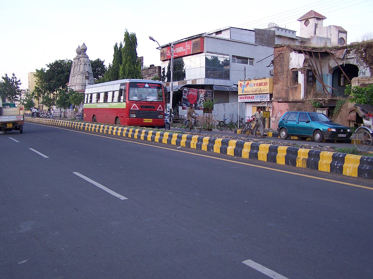
Overview of Bus Networks
Amravati’s bus transport system includes both regional and city services that help connect the district with other parts of Maharashtra and support daily travel within the city. Inter-district and rural routes are operated mainly by the Maharashtra State Road Transport Corporation (MSRTC), which is the principal public transport provider for long-distance travel.
To serve local commuters, Amravati has a separate city bus network designed to handle urban routes within municipal limits. The introduction of this service has reduced the dependence on MSRTC’s regional buses for local travel and aims to ease traffic congestion within the city. In recent years, notably, measures have been introduced to improve the sustainability of the urban bus system. According to Loksatta (2023), the central government has approved 50 electric buses for Amravati to help reduce emissions and meet the rising demand for public transport as the city expands.
The development of bus services in Amravati dates back to the mid-20th century. According to the district Gazetteer (1968), the government first took over passenger transport operations from the Central Provinces Transport Services in 1946. The network was reorganised as the Provincial Transport Services, Nagpur, in 1955 and later became part of the Bombay State Road Transport Corporation after the States Reorganisation Act of 1956. In 1961, it was merged into MSRTC, which has continued to expand regional services since then.
The Science Core Ground Bus Stand
The Science Core Ground Bus Stand, popularly known as the Rajapeth Government Bus Depot, is one of the most important transportation hubs in Amravati. Operated by the Maharashtra State Road Transport Corporation (MSRTC), it connects the city to major towns, villages, and cities across Maharashtra. This stand is the backbone of public travel for long-distance commuters and students, offering frequent and affordable government bus services. Strategically located, it eases passenger flow from central and southern parts of the city, making it a vital link for rural connectivity, intercity travel, and dependable public transportation in Amravati.
Power House Bus Stand
The Power House Bus Stand is a bustling hub for private bus operations, catering primarily to long-distance and interstate travelers. Unlike the government depot, it is run by private operators, offering a wide variety of services including luxury, sleeper, semi-sleeper, and AC buses. Popular routes include major cities like Nagpur, Pune, Mumbai, Hyderabad, and Indore. Known for its flexibility and faster booking systems, the Power House Bus Stand is especially preferred by working professionals and students. Its contribution to easing travel pressure from the government depot makes it an equally crucial transportation hub in Amravati.
Autos & Shared Vehicles
In addition to buses, shared auto-rickshaws are a widely used mode of transport in Amravati. These motorised three-wheelers operate on fixed routes and offer an affordable alternative for short-distance travel within and between local areas. Fares, locals say, typically range between ₹15 and ₹30, depending on the distance and route. Shared autos are preferred for their availability and convenience, particularly on routes where frequent buses are not practical.
Interestingly, Amravati is among one of the few districts in Maharashtra, which retains a distinction between the terms autos (motorised) and rickshaws (these are manually pedalled). While motorised autos handle most local traffic, cycle rickshaws continue to operate in certain parts of the city, especially in older neighbourhoods and busy market areas. Auto services in the district generally do not follow meter-based fares, and prices are set according to fixed local rates or negotiated informally.
Air Transport
Amravati’s air connectivity is served by Amravati Airport, located at Belora, which is being developed to improve regional access within the Vidarbha region. The airport was originally constructed as a small airstrip by the Public Works Department in 1992. In 1997, its management was transferred to the Maharashtra Industrial Development Corporation (MIDC) to plan future expansion.
In 2014, the Government of Maharashtra signed a 60-year lease agreement with the Airports Authority of India (AAI) to oversee its long-term development. According to the Times of India and Hindustan Times, Air India plans to establish South Asia’s largest Flying Training Organisation at this facility by mid-2026. The project is expected to generate around 3,000 jobs and develop Amravati as a centre for pilot training and aviation services in the region.
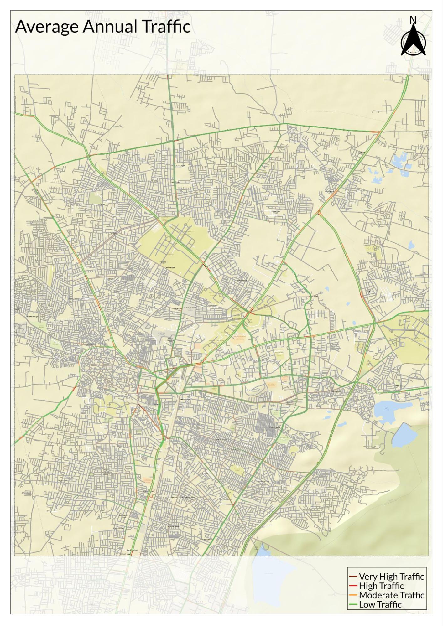
Traffic Map
Communication Networks

Newspapers & Magazines
Amravati’s print media has played an ongoing role in local public life, providing news and commentary for more than a century. According to the district Gazetteer (1968), one of the earliest recorded local publications was Udya, a bi-weekly started by Khaparde in 1920.
Throughout the 20th century, the number of newspapers and periodicals in the district grew steadily. Dailies such as Hindusthan (established 1949) and Suprabhat (1960) are noted for their reporting standards and editorial work. Most local newspapers have been published in Marathi, while Awaz and Amravati Times have served as notable Urdu-language titles. Other well-known periodicals include Nav Vidarbha (1956), Jyoti Prakash (1949), Watchal (1963), Lokdarshan (1963), Shikshan Margdarshan (1950), Pragatik Shikshan (1963), Jeewan (1953), Sahakari Vidarbha (1959), and Gurudev Mozari (1943). Many of these publications continue to operate from Amravati city, which remains a local publishing centre.
Publications from Nagpur and Mumbai have also circulated widely in the district. The Gazetteer lists The Nagpur Times, The Hitavada, Tarun Bharat, and Maharashtra from Nagpur, and The Times of India, The Free Press Journal, Maharashtra Times, and Loksatta from Mumbai, as having regular reach in Amravati.
Graphs
Road Safety and Violations
Transport Infrastructure
Bus Transport
Communication and Media
Sources
Imperial Gazetteer of India. 1909. Provincial Series: Berar. Superintendent of Government Printing, Kolkata.
Maharashtra Public Works Department (Mahapwd). Statistics: Airstrips.http://www.mahapwd.com/statistics/airstrips.…
Maharashtra State Gazetteers. 1968. Amravati District Gazetteer.Directorate of Government Printing, Stationary & Publications, Government of Maharashtra, Mumbai.
Poulami Ray. 2023. Visualising Region in History: Analytical Study of Evolution of Vidarbha as a Region. Vol. 8. Athena Journal.http://athenajournalcbm.in/Pdf/Article/2023/…
Pranita Harad. 2019. Amravati District. Marathi Vishwakosh.https://marathivishwakosh.org/3113/
Shishir Arya. 2024. Nagpur. Modi to Inaugurate Belora Airport and Initiate Major Developments in Nagpur and Shirdi. The Times of India.https://timesofindia.indiatimes.com/city/nag…
Wikipedia Contributors. “Amravati Airport.” Wikipedia.https://en.wikipedia.org/wiki/Amravati_Airpo…
World Health Organization.Road Safety.WHO, Geneva.https://www.who.int/health-topics/road-safet…
Yogesh Naik. 2024. Air India to Set Up South Asia’s Largest Flying School in Amravati. Hindustan Timeshttps://www.hindustantimes.com/cities/mumbai…
Last updated on 6 November 2025. Help us improve the information on this page by clicking on suggest edits or writing to us.