Contents
- History
- Modes of Transportation in the District
- Railway Systems
- Overview of Bus Networks
- Autos & Shared Vehicles
- Traffic Map
- Communication Networks
- Newspapers & Magazines
- Graphs
- Road Safety and Violations
- A. Cases of Road Safety Violations
- B. Fines Collected from Road Safety Violations
- C. Vehicles involved in Road Accidents
- D. Age Groups of People Involved in Road Accidents
- E. Reported Road Accidents
- F. Type of Road Accidents
- G. Reported Injuries and Fatalities due to Road Accidents
- H. Injuries and Deaths by Type of Road
- I. Reported Road Accidents by Month
- J. Injuries and Deaths from Road Accidents (Time of Day)
- Transport Infrastructure
- A. Household Access to Transportation Assets
- B. Length of Roads
- C. Material of Roads
- Bus Transport
- A. Number of Buses
- B. Number of Bus Routes
- C. Length of Bus Routes
- D. Average Length of Bus Routes
- E. Daily Average Number of Passengers on Buses
- F. Revenue from Transportation
- G. Average Earnings per Passenger
- Communication and Media
- A. Household Access to Communication Assets
- B. Newspaper and Magazines Published
- C. Composition of Publication Frequencies
- Sources
BEED
Transport & Communication
Last updated on 6 November 2025. Help us improve the information on this page by clicking on suggest edits or writing to us.
History
Beed is situated within the Marathwada region, which historically lay along routes connecting parts of the Deccan. Bina Sengar (2016) makes note of how broader trade networks in the Deccan during the 18th and 19th centuries linked regions such as Marathwada (where Beed lies), Khandesh, Vidarbha, Warangal, and Hyderabad through a combination of highways and paths that crossed the Vindhya and Satpura ranges. These routes enabled the movement of goods ranging from daily necessities to luxury items.
While little is known of Beed’s commercial prominence during this period, it likely benefited from its proximity to these larger trade corridors. Local communities in the area might have engaged with traders and markets connected to the wider Deccan networks.
Modes of Transportation in the District
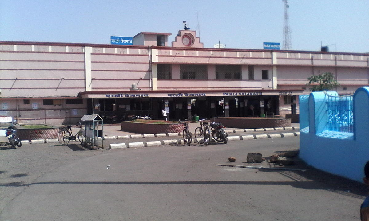
Railway Systems
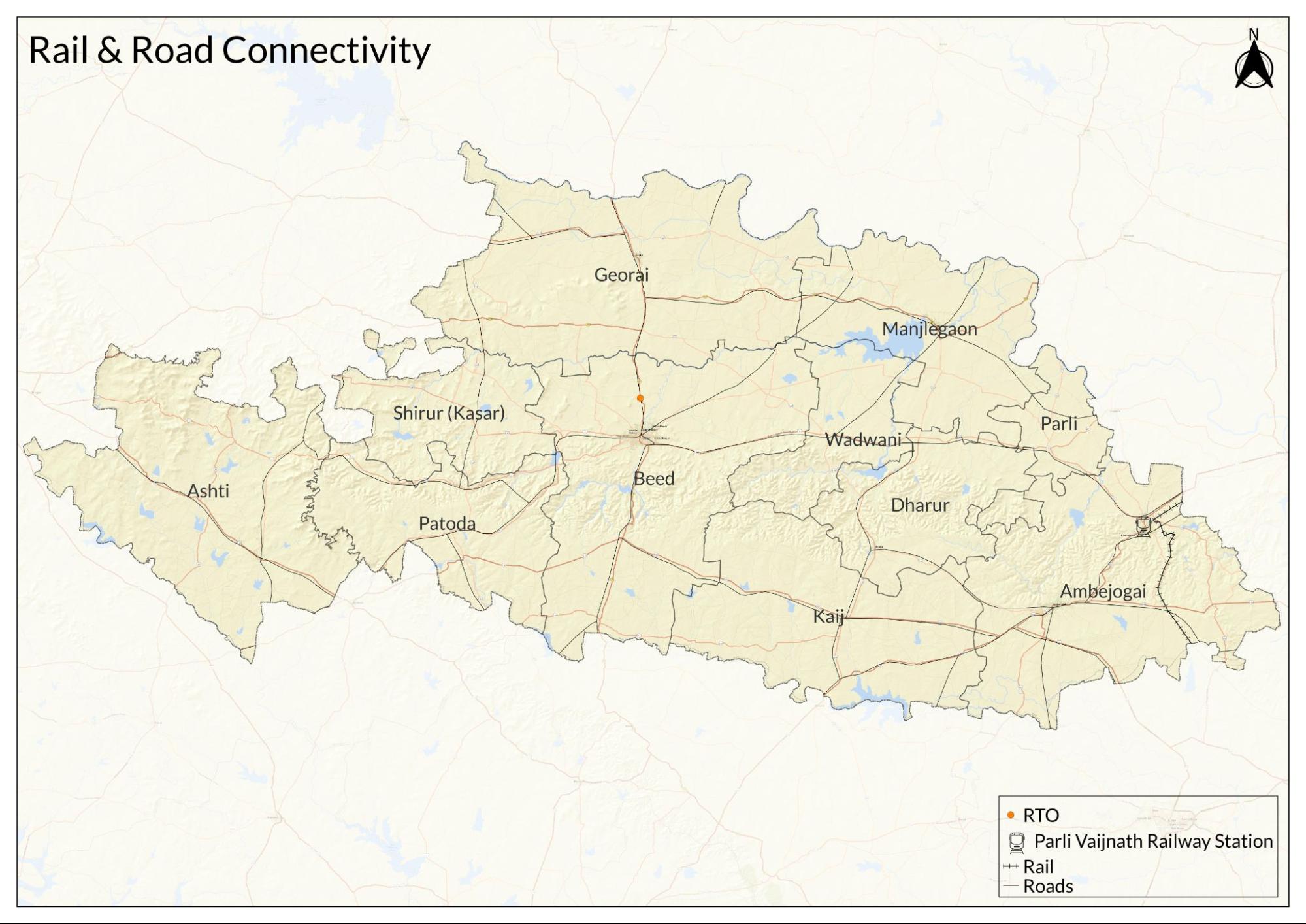
Beed district falls under the South Central Railway Zone, with local operations managed by the Nanded Division. Despite its central location in Maharashtra, the district’s railway network appears to remain limited in reach and capacity.
At present, only three railway stations serve Beed district: Parli Vaijnath, Ukhali, and Ashti. These stations are connected by two main lines, the Parbhani–Parli and Vikarabad–Parli routes, which cover mainly the eastern part of the district, particularly Ambejogai taluka and parts of Parli. The recently completed Ahmednagar–Ashti line has added limited rail access to Ashti taluka. However, out of Beed’s 11 talukas, the majority still lack direct railway service, leaving much of the district dependent on road transport.
Historically, Beed seems to have faced significant obstacles when it comes to its rail development. According to the district Gazetteer (1969), a 1921 survey by the Nizam State Railway noted the area’s sparse population as a barrier to viable railway construction. Several proposed lines, including a Jalna–Beed route and a connection from Manwath Road (Parbhani district), were not realized due to low expected traffic and economic concerns. An out-of-agency once set up to support goods transport in the area was later closed for the same reason.
In 2021, a 60 km railway extension from Ahilyanagar to Ashti was completed, marking the first rail connection into the interior parts of the district. This new link is expected to improve access to nearby markets and strengthen the district’s overall transport network.
Overview of Bus Networks
Road transport remains the main mode of public travel in Beed district today, with bus services connecting towns, villages, and markets across the region. Most passenger services are operated by the Maharashtra State Road Transport Corporation (MSRTC), which maintains depots at Beed and Parli and provides vital links for daily travel, goods transport, and access to services. With railway facilities still limited in reach, buses continue to serve as the primary means of transport for most residents.
The organized bus network in Beed has its origins in the early 20th century under the Nizam’s State Government, which began steps toward nationalizing passenger transport in 1932. After the former Hyderabad State was reorganized, the State Transport (Marathwada) Aurangabad service was established. Following the formation of Maharashtra, the Transferred Road Transport Undertakings managed operations until 1961, when the service was merged into the newly created Maharashtra State Road Transport Corporation. By 1962, it is noted in the district Gazetteer (1969) that two bus depots at Beed and Parli provided scheduled services across the district.
Despite steady expansion, road transport in Beed still faces challenges in reaching remote areas. Villages such as Tat Borgaon, in Ambejogai taluka, remain without direct bus access, forcing residents to walk several kilometers to the nearest stop. Poor road conditions continue to limit regular services in certain parts, affecting travel for work, education, and daily needs. While improvements to rural roads are underway in some areas, the need for reliable bus connectivity remains a priority for communities across the district.
Autos & Shared Vehicles
In Beed district, road transport remains the main means of local travel, especially in rural areas not directly served by regular bus routes. Many villages continue to rely on small shared vehicles such as six-seater autos to reach nearby towns and main roads. These shared rides provide a practical option for daily travel where State Transport buses do not operate.
A 2016 study by Kalyani Vartak noted that in some villages, residents often had to walk up to three km to reach the nearest bus stop on the highway, as buses did not serve their settlements directly. Before 2010, State Transport buses operated closer to such villages, but notably, many of these services were discontinued as shared vehicles became more popular and offered greater flexibility. By 2016, most villagers in areas like Kaij taluka relied on six-seater autos to reach the highway or nearby towns such as Kaij and Ambejogai for work, markets, and other daily needs.
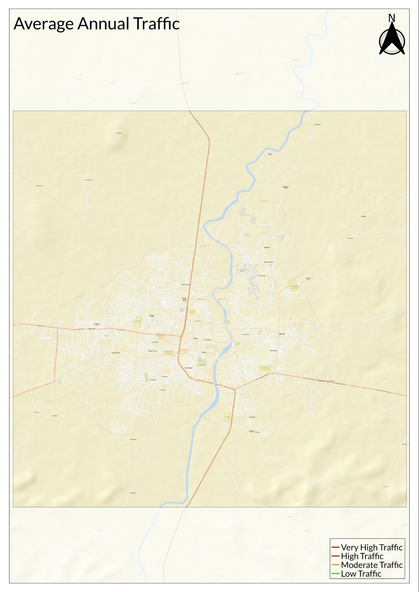
Traffic Map
Communication Networks
Newspapers & Magazines
According to the district Gazetteer (1969), the Bhir Samachar was once the only newspaper published in the area, issued every Thursday. It served as a key source of local news and became known for highlighting grievances and giving residents a voice on matters of local concern.
At one point, a short-lived paper titled Zunjar Neta was also circulated, and notably, it was established to represent the interests of the backward classes. Though brief in circulation, it addressed pressing social issues of the time and reflected a local interest in using the press to advocate for change.
Alongside these local publications, newspapers from outside the district have circulated widely in Beed. English-language dailies such as The Times of India and The Indian Express have long been available to readers. Marathi newspapers, including Lok Satta and Maharashtra Times, also remain popular, serving a broad regional audience.
In addition, Hindi and Urdu newspapers such as Navbharat Times and Inquilab have contributed to the district’s diverse news landscape, providing coverage that reflects the region’s linguistic variety.
Graphs
Road Safety and Violations
Transport Infrastructure
Bus Transport
Communication and Media
Sources
Government of Maharashtra. 1969. Maharashtra State Gazetteers: Bhir District. Directorate of Govt. Printing, Mumbai.
Kalyani Vartak. 2021. Role of Caste in Migration: Some Observations from Beed District, Maharashtra. Vol 2, no 2. Social Science Spectrum.https://www.socialspectrum.in/index.php/sp/a…
PTI. 2024. Beed Village Struggles with Poor Road Infrastructure, Transportation Woes. Free Press Journal.https://www.freepressjournal.in/pune/beed-vi…
World Health Organization. Road Safety. WHO, Geneva.https://www.who.int/health-topics/road-safet…
Last updated on 6 November 2025. Help us improve the information on this page by clicking on suggest edits or writing to us.