Contents
- History
- Modes of Transportation in the District
- Train and Rail Systems
- Overview of Bus Networks
- Autos & Shared Vehicles
- Cars & Two-wheelers
- Air Travel
- Traffic Map
- Communication Networks
- Newspapers & Magazines
- Graphs
- Road Safety and Violations
- A. Cases of Road Safety Violations
- B. Fines Collected from Road Safety Violations
- C. Vehicles involved in Road Accidents
- D. Age Groups of People Involved in Road Accidents
- E. Reported Road Accidents
- F. Type of Road Accidents
- G. Reported Injuries and Fatalities due to Road Accidents
- H. Injuries and Deaths by Type of Road
- I. Reported Road Accidents by Month
- J. Injuries and Deaths from Road Accidents (Time of Day)
- Transport Infrastructure
- A. Household Access to Transportation Assets
- B. Length of Roads
- C. Material of Roads
- Bus Transport
- A. Number of Buses
- B. Number of Bus Routes
- C. Length of Bus Routes
- D. Average Length of Bus Routes
- E. Daily Average Number of Passengers on Buses
- F. Revenue from Transportation
- G. Average Earnings per Passenger
- Communication and Media
- A. Household Access to Communication Assets
- B. Newspaper and Magazines Published
- C. Composition of Publication Frequencies
- Sources
CHH. SAMBHAJI NAGAR
Transport & Communication
Last updated on 6 November 2025. Help us improve the information on this page by clicking on suggest edits or writing to us.
Chhatrapati Sambhaji Nagar district's position in the Deccan has long given it a significant place in inland trade and movement. Historically, the region formed part of ancient trade routes that connected India’s interior to its western ports and beyond. Towns such as Paithan (once known as Pratishthana) and Daulatabad (once known as Devagiri) were major centers of commerce and strategic strongholds that helped guard the flow of goods across the plateau. This legacy continues to influence its role as a major trade and transit hub even today. Over time, the district has witnessed significant infrastructure development to support both intra-city movement and regional connectivity. The district is connected by rail, bus, auto-rickshaw, and air travel, with the availability and reach of these systems offering a glimpse into its evolving landscape.
History
The region now known as Sambhaji Nagar has long formed an important part of inland trade routes in the Deccan. Notable places within it, such as Paithan (the ancient Pratishthana) and Daulatabad (formerly Devagiri), were held to be of much significance as major centers of commerce and strongholds guarding the movement of goods across the plateau.
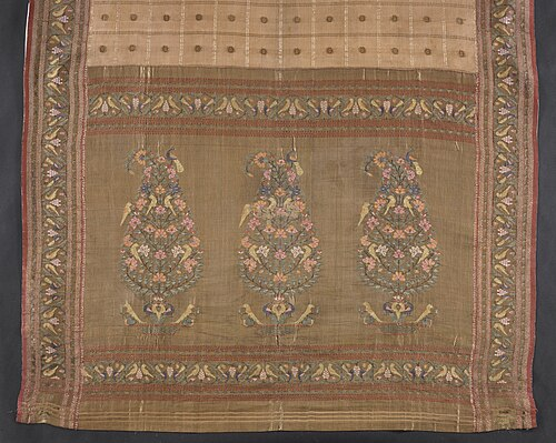
Paithan, mentioned in early records such as the Periplus of the Erythraean Sea, was once a chief inland mart supplying goods to the western ports. Its cloth, known as Paithani, was especially valued. Woven with gold and silver threads mixed with silk and cotton, this fabric was carried as far as Greece and Rome from at least the 2nd century BCE. Roman writers note that such luxury imports became so popular that the Senate sought to restrict them to check wasteful spending. The fabric remained highly prized for court dress long afterwards and was still favored by the Maratha Peshwas.
Goods such as carnelian and textiles were sent from Paithan and Tagara (modern Ter) to ports like Chaul, Sopara, and Kalyan, where they entered wider Indian Ocean routes. Interestingly, it is mentioned in the Periplus that Paithan was about twenty days’ journey south of Barygaza (Bharuch) and Tagara a further ten days inland at that time, showing the line of movement between these marts and the coast.
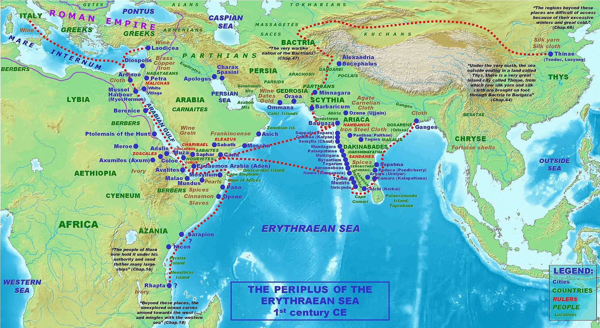
The region’s position on ancient inland roads was also important. Trade from Paithan and nearby Tagara (modern Ter in Dharashiv) moved along ancient roads known as the Dakshinapatha and Uttarapatha. These routes are mentioned in the Puranas and epics and are recorded by Kautilya in the Arthashastra as lines along which valuable goods, including precious stones and pearls, were conveyed.
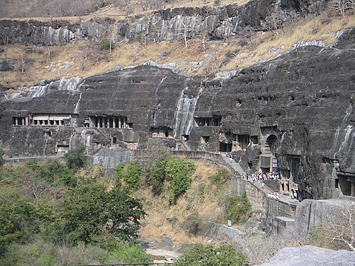
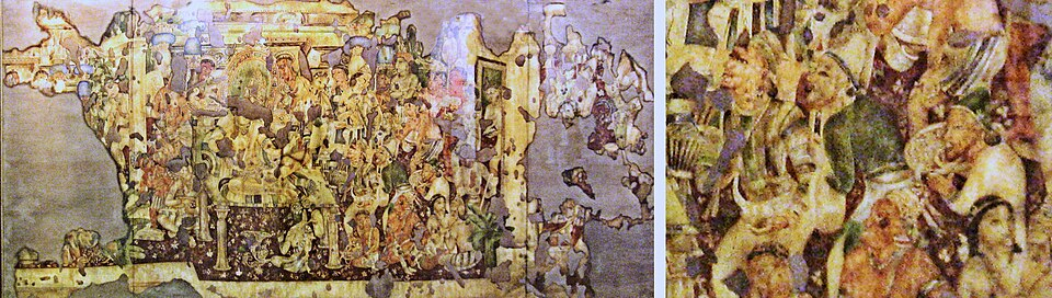
The remains at Ajanta, Ellora, and Pitalkhora stand as further testimony to this traffic. These cave complexes, cut along ancient trade routes, served both as places of worship and rest for merchants and monks travelling between the north and the ports further south.
The region also lay on branches of the Silk Route, which brought goods and influences from Central Asia through Kamboja (now Afghanistan and Tajikistan) towards Paithan and the coastal towns. Such connections carried trade in silk and other luxuries but also ideas and customs, which spread along the same tracks.
Modes of Transportation in the District
Train and Rail Systems
Sambhaji Nagar district falls under the South Central Railway zone and the Nanded Division, which together handle passenger and freight traffic across this part of Maharashtra. The district lies primarily on two important broad-gauge lines: the Secunderabad–Manmad line and the Purna–Manmad line. These routes link Sambhaji Nagar to key cities such as Hyderabad (Telangana), Secunderabad (Telangana), Manmad (Nashik, Maharashtra), and beyond.
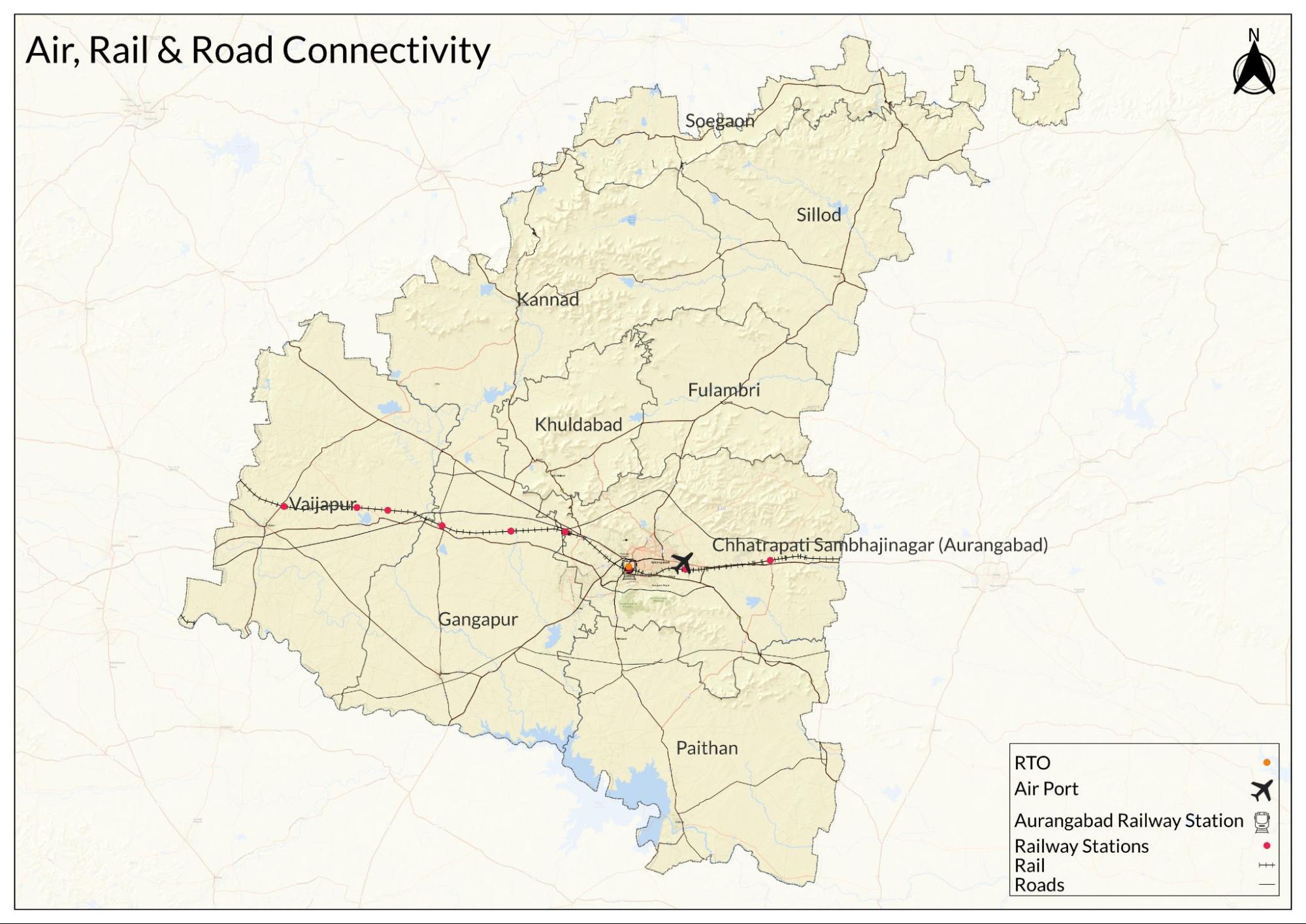
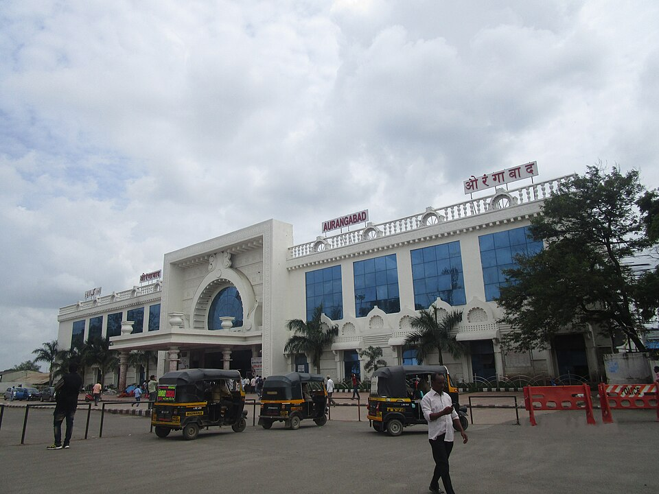
Aurangabad Station (AWB) serves as the district’s main railway station. Other stations include Lasur (LSR), Rotegaon (RGO), Daulatabad (DLB), Parsoda (PSD), Potul (POZ), Mukundwadi Halt (MKDD), Karanjgaon (KAJG), Chikalthana (CTH), and Pandharpur (PVR). These stations link towns and villages in the district to the wider railway network.
In the late 19th and early 20th centuries, the district formed part of the Hyderabad State under the Nizam’s rule. During this period, the Nizam’s administration played an important role in developing railway lines to strengthen trade and improve connections across the Deccan.
A major development of that time was the Hyderabad–Godavari Valley Railway, which opened in phases between 1899 and 1901. This meter-gauge line, at the time, extended roughly 630 km from Hyderabad to Manmad and included stops within what is now Sambhaji Nagar district. Although the district’s stations were not major termini, they improved local travel and supported trade under the Nizam’s Guaranteed State Railway system.
Overview of Bus Networks
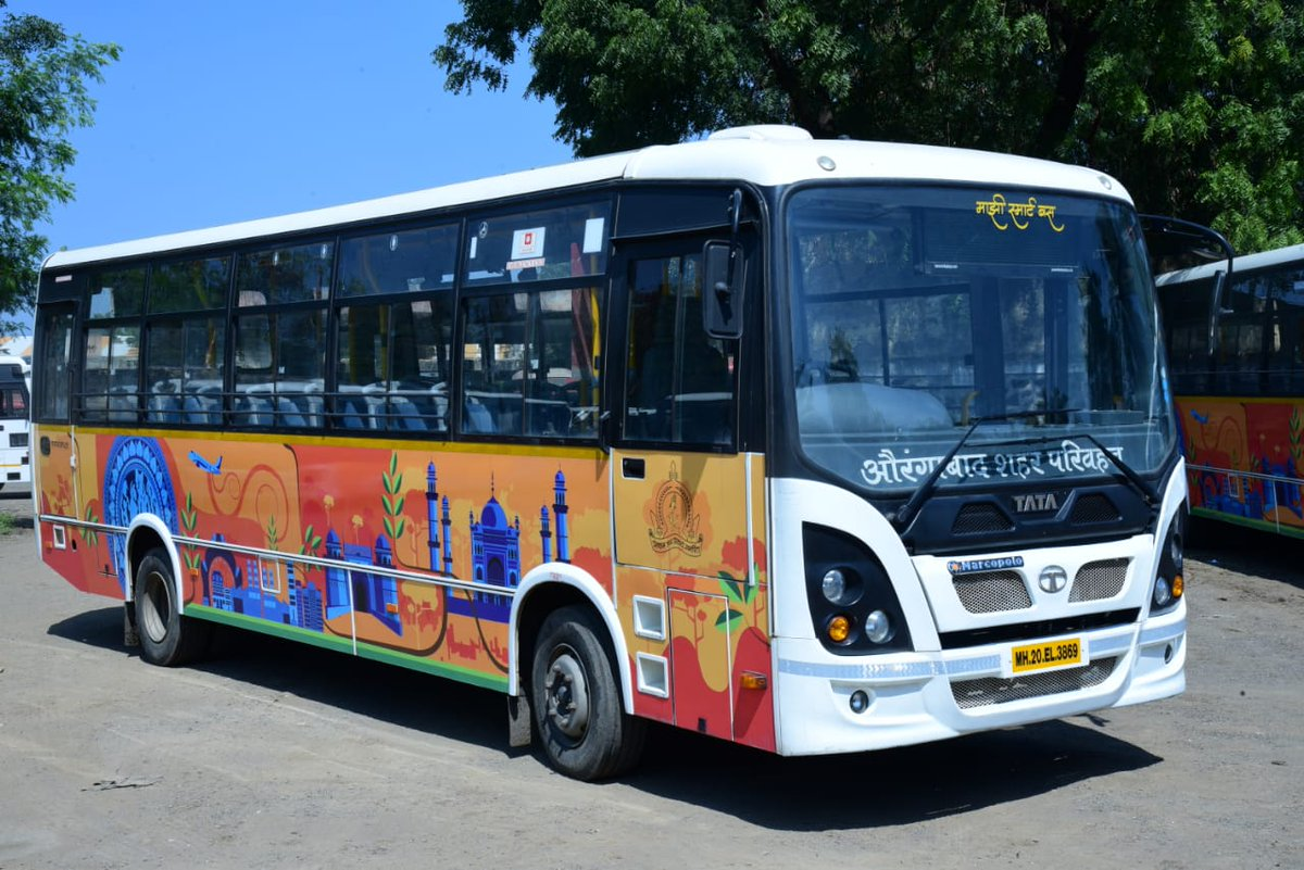
Bus services today form a crucial part of daily life in the Sambhaji Nagar district, providing residents with affordable and reliable connectivity within the city and to surrounding towns and villages. The Maharashtra State Road Transport Corporation (MSRTC) operates both intercity and rural services across the district.
For local commuting within the city, the Smart Bus service provides scheduled routes with frequent buses during working hours and offers monthly passes to make daily travel more convenient. Operated jointly by the Aurangabad Smart City Development Corporation Limited (ASCDCL) and MSRTC, the Smart Bus Division was launched on 23 January 2019. As of 2024, it runs a fleet of about 100 buses across 27 city routes.
Sambhaji Nagar’s public bus network has deep historical roots. The district’s transport infrastructure owes much to the reign of the Nizam of Hyderabad, who laid the groundwork for early modern roads and bus routes. The evolution of bus services here began in 1932 under the Nizam’s Guaranteed State Railway (NGSR), which managed both bus and rail services. By the early 1940s, the NGSR operated nearly 500 buses; it is noted in a Deccan Herald article (2018) that its network covered around 7,200 km, connecting remote parts of what is now Maharashtra and Telangana.
After India’s independence, the MSRTC took over public bus operations, expanding services to strengthen both inter- and intra-district travel. In the 2000s, the Aurangabad Municipal Transport (AMT) began city bus services under the Mahanagar Palika but faced operational and financial hurdles, including corruption and debt, which led to service suspensions.
In 2016, the Aurangabad Municipal Corporation (AMC) prepared plans to develop the city under India’s Smart City Mission. A survey at the time found that residents saw improved public transport as one of the most important priorities. The Smart Bus initiative was introduced in response, aiming to provide a stable, organized bus service that could meet the needs of a growing urban population. Today, Sambhaji Nagar City’s bus system continues to fill this gap, connecting people within the city and supporting wider plans for the district’s vision of becoming a Smart City.
Autos & Shared Vehicles
In the 1980s, cycle rickshaws were a common mode of transport in Sambhaji Nagar. Over time, locals say shared auto rickshaws replaced many of these, becoming one of the most popular ways for residents to get around. Most auto rickshaws in the city do not use fare meters; instead, drivers set fares in advance, so passengers usually need to negotiate the price before starting a trip.
In recent years, e-rickshaws have also become part of the city’s transport system. These battery-operated vehicles offer a low-emission alternative and have grown in number as demand for more sustainable transport has increased. Their use supports efforts by the Mahanagar Palika to reduce urban pollution and improve local mobility as part of Sambhaji Nagar’s broader Smart City plans.
Cars & Two-wheelers
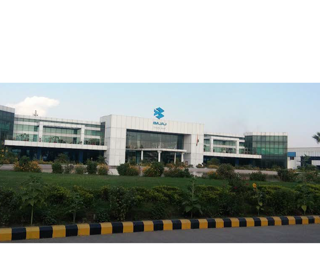
Alongside auto rickshaws and e-rickshaws, private cars and two-wheelers are a major part of daily transport in Sambhaji Nagar. Interestingly, what stands out about the district in this regard is that it is home to production and manufacturing units for brands such as Audi, Bajaj, and Skoda, which has influenced local vehicle ownership patterns. Bajaj vehicles, in particular, are common on the district’s roads, from auto rickshaws to motorcycles, due to their local availability and affordability. The presence of these manufacturing units supports a steady supply of vehicles and parts, adding to the range of transport options used by residents and visitors alike.
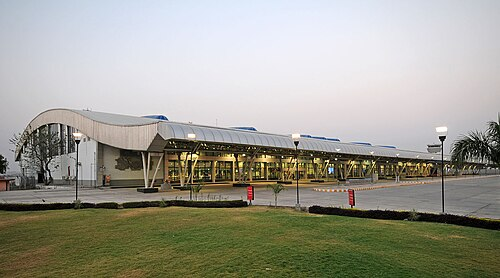
Air Travel
Sambhaji Nagar district is served by Aurangabad Airport (IATA: IXU, ICAO: VAAU), which was developed in the late 20th century to support the region’s growing tourism sector and expanding industries. The airport mainly handles domestic flights but also operates limited seasonal international services. Its convenient location makes it an important gateway for visitors to local heritage sites and for business travelers connected to the district’s industrial hubs.
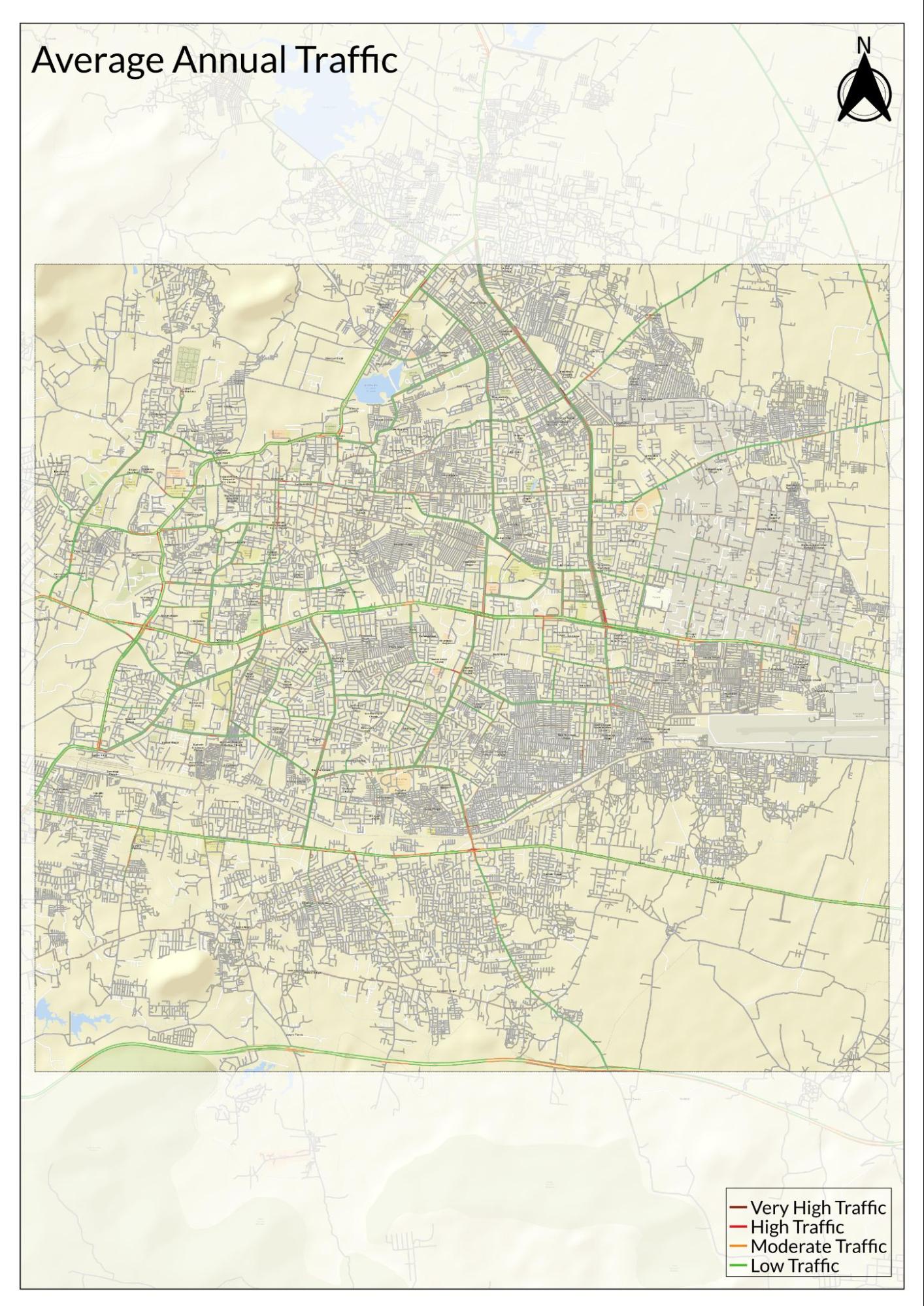
Traffic Map
Communication Networks
Newspapers & Magazines
Sambhaji Nagar has long been recognized as an important center for Marathi journalism in Maharashtra. The Maharashtra State Gazetteers: Language and Literature (1971) records the district as one of the key places for newspaper publication in the state. During this period, it is noted that the Marathi daily Ajintha was printed in the district before the Second World War, at a time when few Marathi dailies were produced in smaller towns.
This early presence formed part of the district’s growing local press. Today, newspapers such as Sakal, Lokmat, and the local daily Sanjvarta continue to serve the district, providing news and regional coverage to residents.
Graphs
Road Safety and Violations
Transport Infrastructure
Bus Transport
Communication and Media
Sources
Aurangabad Smart City. About Smart Bus.https://aurangabadsmartcity.in/sb112522820?t…
Deccan Herald. 2018. He was Way Ahead of His Time. Deccan Herald.https://www.deccanherald.com/content/328902/…
Gazetteer Department. 1909. Imperial Gazetteer of India: Provincial Series – Hyderabad State. Calcutta: Superintendent of Government Printing.
Government of Maharashtra. 1977. Maharashtra State Gazetteers: Aurangabad District.Gazetteers Department, Mumbai.
Maharashtra Times. 2021.पैठणीचा रुबाब! साड्यांची महाराणी पैठणीचा 'हा' इतिहास माहीत आहे का? वाचा सविस्तर. Maharshtra Times.https://maharashtratimes.com/lifestyle-news/…
Mohamed Akhef. 2015. AMC is Still Reluctant to Restart Public Transport Service. The Times of India.https://timesofindia.indiatimes.com/city/aur…
N.N Mahapatra. 2016. Sarees of India. Woodhead Publishing India Pvt. Limited.https://books.google.com/books/about/Sarees_…
Navhind Times. 2018. The Market Towns of Konkan. The Navhind Times.https://www.navhindtimes.in/2018/05/06/magaz…
Peter Frankopan. 2015. The Silk Roads: A New History of the World. Bloomsbury.
S.M. Katreet al, eds.1971. Maharashtra State Gazetteers: Language and Literature. Directorate of Government Printing, Stationery and Publications, Maharashtra State, Mumbai.
The Nizams Government. 1884. Gazetteer of Aurangabad. Times of India Steam Press.
Times Property. 2024. All About Aurangabad Airport. TimesProperty.com.https://timesproperty.com/article/post/all-a…
UNESCO. Silk Road Sites in India.https://whc.unesco.org/en/tentativelists/549…
Walter M Spink. 2007. Ajanta: History and Development, Volume 5: Cave by Cave. Brill.
Wikipedia Contributors. Aurangabad Railway Station. Wikipedia.https://en.wikipedia.org/wiki/Aurangabad_rai…
Last updated on 6 November 2025. Help us improve the information on this page by clicking on suggest edits or writing to us.