Contents
- History
- Modes of Transport
- Train and Rail Systems
- Overview of Bus Networks
- Autos & Shared Vehicles
- Cars & Two-Wheelers
- Traffic Map & Congestion
- Communication Networks
- Newspapers & Magazines
- Graphs
- Road Safety and Violations
- A. Cases of Road Safety Violations
- B. Fines Collected from Road Safety Violations
- C. Vehicles involved in Road Accidents
- D. Age Groups of People Involved in Road Accidents
- E. Reported Road Accidents
- F. Type of Road Accidents
- G. Reported Injuries and Fatalities due to Road Accidents
- H. Injuries and Deaths by Type of Road
- I. Reported Road Accidents by Month
- J. Injuries and Deaths from Road Accidents (Time of Day)
- Transport Infrastructure
- A. Household Access to Transportation Assets
- B. Length of Roads
- C. Material of Roads
- Bus Transport
- A. Number of Buses
- B. Number of Bus Routes
- C. Length of Bus Routes
- D. Average Length of Bus Routes
- E. Daily Average Number of Passengers on Buses
- F. Revenue from Transportation
- G. Average Earnings per Passenger
- Communication and Media
- A. Household Access to Communication Assets
- B. Newspaper and Magazines Published
- C. Composition of Publication Frequencies
- Sources
DHARASHIV
Transport & Communication
Last updated on 6 November 2025. Help us improve the information on this page by clicking on suggest edits or writing to us.
History
In the context of India’s early history, few places exemplify the intricate web of trade and communication as vividly as Ter, known in the past as Tagar. Fascinatingly, what is now a small village in Dharashiv once flourished as a vital trading centre during the Satavahana period, spanning from the 3rd century BCE to the 2nd century CE. Tagar was not just a place on a map; it was a dynamic crossroads of commerce and culture, linking India to far-off lands like Rome.
Tagar's strategic location positioned it as a key node in the trade routes linking the eastern and western coasts of India. According to the Periplus of the Erythrean Sea, an important ancient maritime text, Tagar was recognised as a significant market town, situated on a ten-day journey from the Satavahana capital of Pratishthan (modern-day Paithan).
What made Tagar truly special was its trade with the Romans. Goods like textiles, beads, and jute flowed from Tagar to Rome, transforming it into an international trading powerhouse. Tagar wasn’t just about trade; it was a melting pot of cultures. Traders and travellers brought not only goods but also ideas and stories. The exchange of Roman pottery significantly influenced local artisans, who began crafting their pieces with a distinctive red polish, a nod to their Roman counterparts. Dr. Maya Sahapurkar Patil, an archaeologist, captures this transformation perfectly, stating, “The local people imitated the fine Roman pottery, with a characteristic red polish, that came with the Romans.”
Tagar, referenced in the works of the Chinese traveller Hsuan-Tsang, was populated from the 3rd century BCE to the 3rd century CE, spanning the pre-Satavahana, Satavahana, later-Satavahana, and Vakataka periods. During this time, the site saw the flourishing of Hindu, Buddhist, and Jain traditions, which contributed to its rich cultural landscape. Archaeological excavations at Tagar reveal a vibrant community engaged in both commerce and the exchange of ideas.
The success of Tagar as a trading hub would have relied heavily on its robust transport networks. Navigable roads and waterways likely served as vital lifelines for this bustling centre, facilitating the efficient flow of goods in and out. Notably, it was during the Satavahana period that maritime trade flourished, which may have contributed to Tagar's development as a key mercantile centre and an important link to Rome.
Modes of Transport
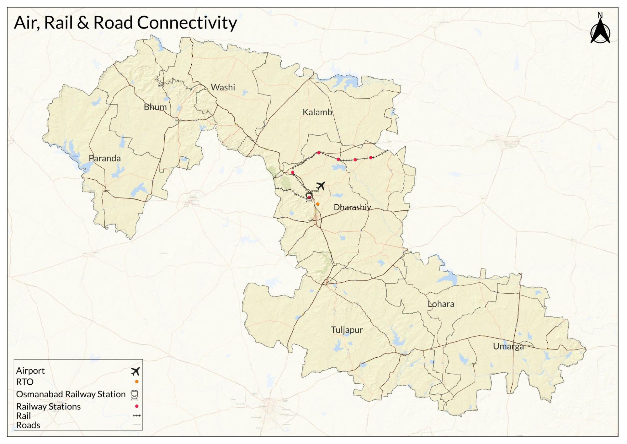
Train and Rail Systems
The advent of British rule introduced concrete roads and railways, transforming the landscape of transport and trade in India. In Dharashiv, two primary railway lines emerged as vital arteries during both the colonial and post-independence periods: the Vikarabad-Parali-Vaijnath broad-gauge line and the Miraj-Latur narrow-gauge line, as noted in the Gazetteer.
In the early 20th century, the Miraj-Latur narrow-gauge line, formerly known as the Barshi Light Railway, was established through an agreement between the Nizam's government and the Barshi Light Railway Company in 1909. This line traversed the Dharashiv and Latur tehsils, opening for traffic in 1911. Running from Miraj toward the northwest, it terminated at Latur station.

While this narrow-gauge line enhanced local connectivity, it presented challenges for the seamless flow of goods, often necessitating transhipment between different gauges in later years, as noted in the gazetteer. Despite these challenges, the line served as a critical link for the movement of people and goods, further integrating the district into the broader economic landscape of Maharashtra.
The Vikarabad-Parali-Vaijnath railway line also played a crucial role in connecting key towns within the district. This broad-gauge line entered the district in the Udgir tehsil and stretched across relatively dry terrain characterised by plains and hills. With 16 stations, it facilitated access to both urban and rural areas. Notably, towns like Latur and Udgir benefited significantly from this connection, enhancing trade and mobility for the local population.
During this era, the broad-gauge railway system was managed by H. E. H. the Nizam's Guaranteed State Railways Company. Sections of the railway were funded and constructed under the Nizam's government, establishing important routes connecting to major centres in Hyderabad and beyond. By the end of the colonial period, these railways had become integral to the regional economy, supporting agriculture and trade.
Following India’s independence in 1947, the railways continued to shape the socio-economic fabric of Dharashiv. The management of the railways shifted, with the Nizam's Guaranteed State Railways coming under central government control after the Federal Financial Integration on April 1, 1950.
The railway network had significantly transformed the economic landscape of the region. Proposals for new railway lines, such as the anticipated connection between Solapur and Sambhaji Nagar (Aurangabad), were expected to further enhance connectivity and accessibility, promising to reshape the district's economy.
Today, Dharashiv is served by around seven railway stations. While most trains passing through the region facilitate inter-district travel, there are relatively few services specifically designated for Dharashiv. Despite its significance as a pilgrimage site, there are no dedicated train services that seem to be catering to this aspect.
Overview of Bus Networks
The history of bus transport in Dharashiv reflects broader changes in governance, infrastructure, and public service priorities in the region. The scheme for the nationalisation of passenger transport services in the erstwhile Hyderabad State, which included what is now Osmanabad district, began in 1932. This marked the beginning of a systematic approach to public transportation, aiming to improve the standard and accessibility of services for the travelling public.
In response to the deteriorating state of transport services, the government took significant steps to nationalise road transport after Independence. The State Transport (Marathwada) Aurangabad was established as part of this initiative, evolving from the trifurcation of the former Hyderabad State. The reorganisation of states in 1956 placed the operations in Marathwada under a separate department within the former Government of Bombay.
However, this department was abolished on July 1, 1961, leading to a consolidation of operations. The State Transport (Marathwada) Aurangabad and the Vidarbha region's transport services were amalgamated with the Bombay State Road Transport Corporation, which later became the Maharashtra State Road Transport Corporation.
With nationalisation, several improvements were made to enhance the passenger experience. Temporary bus stations were established in Osmanabad and Latur, equipped with basic amenities such as waiting rooms and food stalls. Additionally, pick-up stands were created in key locations throughout and beyond the district, including Latur, Ahmadpur, Kalam, Dhoki, Murud, and Sirur-Tajband, improving access to bus services.
Today, the bus transport system in Dharashiv remains a critical part of the region's infrastructure. Nationalisation and infrastructure improvements have addressed many past issues, but ongoing assessments are essential to adapt to the changing needs of the population. Government buses, such as the ‘Lal Pari,’ connect residents to nearby villages at approximately half-hour intervals, catering primarily to those travelling between talukas. However, due to the village's size and level of development, there is no city bus service available. Currently, private bus operators have emerged as significant players in the transport landscape to fill this gap, offering increased frequency and a variety of routes that are well-received by passengers.
Autos & Shared Vehicles
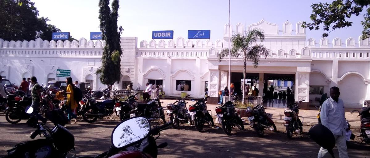
Auto-rickshaws and shared vehicles primarily serve the district, although traditional meter-based autos are less common. Many residents own bikes, with four-wheelers, rickshaws, and jeeps also frequently seen. However, ride-hailing services like Ola and Uber are not operational in the district, and many locals remain unaware of their existence.
Cars & Two-Wheelers
Over the past decade, the number of private vehicles in Dharashiv has significantly increased. Two-wheelers, particularly brands like Maruti Suzuki, Pulsar, and Bullet, dominate the roads and are in high demand. The emergence of electric vehicles is also noteworthy, driven by rising fuel costs. However, the presence of CNG cars remains limited, primarily due to a scarcity of refuelling stations. As a result, two-wheelers continue to be the preferred mode of transport for many residents.
Traffic Map & Congestion
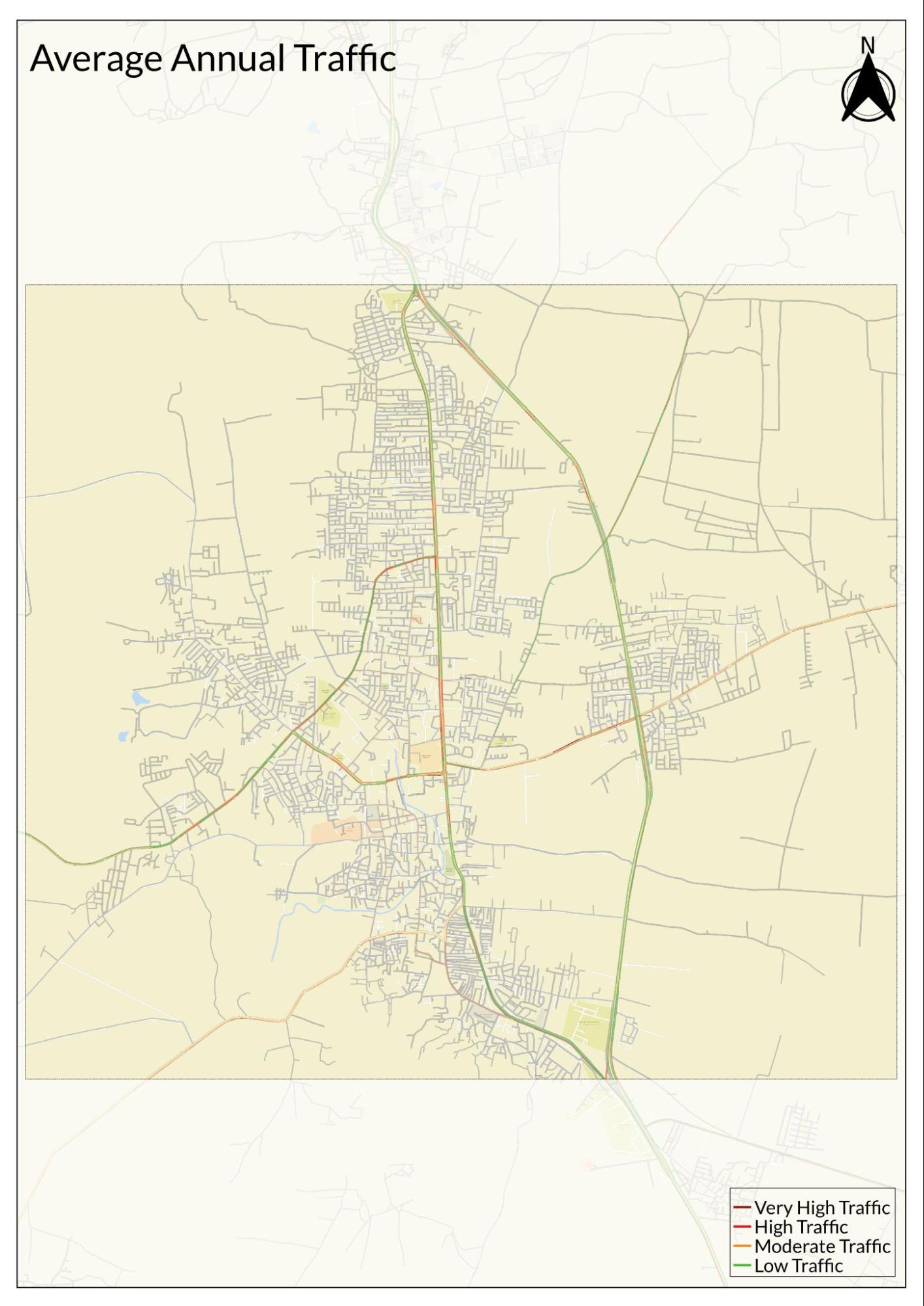
Locals state that traffic congestion in Dharashiv has notably risen over the last five to ten years. This increase can be attributed to the growing population and heightened pilgrimage activity, although it still pales in comparison to larger metro areas. Morning hours see a spike in traffic due to school and college commutes, resulting in crowded roads during peak times.
While the city is not densely populated, residents observe that traffic signals are few and far between, with congestion mainly occurring at two or three key intersections. Generally, locals adhere to traffic rules in these areas, although helmet use is infrequent, particularly in rural areas.
Communication Networks
Newspapers & Magazines
The presence of local newspapers in Dharashiv has been significant since the 20th century, playing a crucial role in fostering political awareness and voicing the concerns of the common man. Although no daily newspapers are published in the district, the gazetteer states that several weekly publications like Panati in Gunjoti and Maratha Samachar in Osmanabad circulate locally, albeit with limited reach. In contrast, the broader array of Marathi and English newspapers from Mumbai and Pune, such as Loksatta, Sanchar, and Tarun Bharat, are and continue to remain widely available throughout the district.
Graphs
Road Safety and Violations
Transport Infrastructure
Bus Transport
Communication and Media
Sources
Kalamb Road Railway Station. Railyatri.inhttps://www.railyatri.in/stations/kalamb-roa…
Maharashtra State Gazetteer Department. Communication (from the Osmanabad District Gazetteer). Osmanabad District Gazetteer.https://gazetteers.maharashtra.gov.in/cultur…
Shubha Khandekar. 2015. Ter excavations to throw light on ancient Roman trade. The Metrognome.https://www.themetrognome.in/places/ter-exca…
Solapur Under the Pre-Satvahana & Satvahana Period. ir.unishivaji.ac.in.http://ir.unishivaji.ac.in/bitstream/1234567…
Last updated on 6 November 2025. Help us improve the information on this page by clicking on suggest edits or writing to us.