Contents
- History
- Ancient Trade & Trade Routes
- Panhala Fort and its Role in Trade
- Modes of Transportation in the District
- Railway Network
- Overview of Bus Networks
- Autos and Shared Vehicles
- Air Travel
- Ferries & Water Transport
- Traffic Map
- Communication Networks
- Newspapers & Magazines
- Graphs
- Road Safety and Violations
- A. Cases of Road Safety Violations
- B. Fines Collected from Road Safety Violations
- C. Vehicles involved in Road Accidents
- D. Age Groups of People Involved in Road Accidents
- E. Reported Road Accidents
- F. Type of Road Accidents
- G. Reported Injuries and Fatalities due to Road Accidents
- H. Injuries and Deaths by Type of Road
- I. Reported Road Accidents by Month
- J. Injuries and Deaths from Road Accidents (Time of Day)
- Transport Infrastructure
- A. Household Access to Transportation Assets
- B. Length of Roads
- C. Material of Roads
- Bus Transport
- A. Number of Buses
- B. Number of Bus Routes
- C. Length of Bus Routes
- D. Average Length of Bus Routes
- E. Daily Average Number of Passengers on Buses
- F. Revenue from Transportation
- G. Average Earnings per Passenger
- Communication and Media
- A. Household Access to Communication Assets
- B. Newspaper and Magazines Published
- C. Composition of Publication Frequencies
- Sources
KOLHAPUR
Transport & Communication
Last updated on 6 November 2025. Help us improve the information on this page by clicking on suggest edits or writing to us.
The location of the Kolhapur district has long shaped its role in connecting regions through trade and transport. As early as the 2nd century CE, the Greek geographer Ptolemy mentioned a place called Hippokura, which is believed to be Kolhapur, highlighting its early prominence. Over time, the district has witnessed significant infrastructure development to support both intra-city movement and regional connectivity. Notably, one of the major figures who contributed to this was Chhatrapati Rajarshi Shahu Maharaj and Chhatrapati Rajaram Maharaj, whose vision and leadership helped shape Kolhapur’s unique railway and air travel history. The district is connected by rail, bus, auto-rickshaw, and air travel, with the availability and reach of these systems offering a glimpse into its evolving landscape.
History
Ancient Trade & Trade Routes
The history of Kolhapur district is closely bound up with the development of its trade routes and defensive outposts, which have long served to connect the region with distant parts of India and beyond.
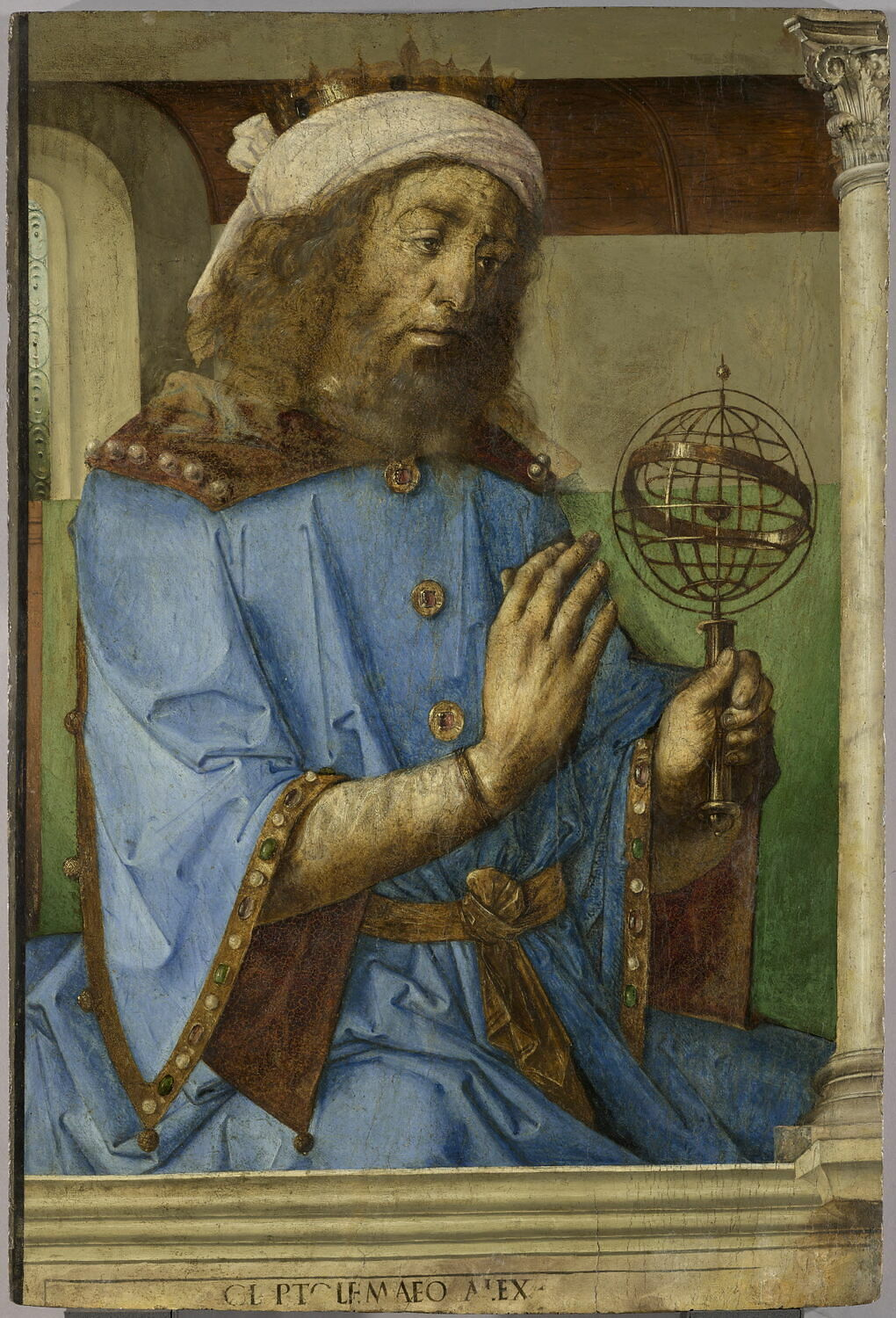
Fascinatingly, one of the earliest recorded mentions of this region appears in the writings of Claudius Ptolemy, the Greek geographer of the second century CE. Ptolemy, writing around 150 CE, refers to a place called Hippokura, which is generally identified by scholars with the present-day Kolhapur. Such references indicate that Kolhapur formed part of the wider trading world known to the classical geographers.
Traces of early trade and religious activity in the district are found in the rock-cut Buddhist caves that remain in several locations. Among these are the Pandavdara caves near Panhala and the Pavala or Pohale caves situated close to Jyotiba’s Hill. Many scholars hold that such Buddhist caves were commonly established along trade routes, serving as resting places and monastic retreats for travelling merchants and monks. Their presence in this district, therefore, suggests that the area lay on routes used for both commerce and religious activity in earlier times.

Panhala Fort and its Role in Trade
Situated near Kolhapur, Panhala Fort occupies a commanding position on the Deccan plateau and has long been regarded as one of the principal fortifications of the region. Its origins are commonly ascribed to the Shilahara dynasty, who are thought to have constructed the fort as a means of securing the trade routes that linked the Konkan coast with the inland plains.
The fort’s location was selected with care, standing at an elevation of 3,177 ft. and extending over a perimeter of approximately 7.5 km. From this vantage point, those who held Panhala could oversee and regulate the movement of goods and people between the coastal ports and the interior markets of Maharashtra and Karnataka.
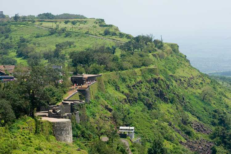
Control of Panhala Fort thus brought with it not only military advantage but also influence over the flow of trade through the region. Over time, this strategic position drew the fort into the wider contests for power that shaped the Deccan, as Maratha rulers and other forces, including the Mughals and later the British, sought to command these lucrative routes.
Modes of Transportation in the District
Railway Network
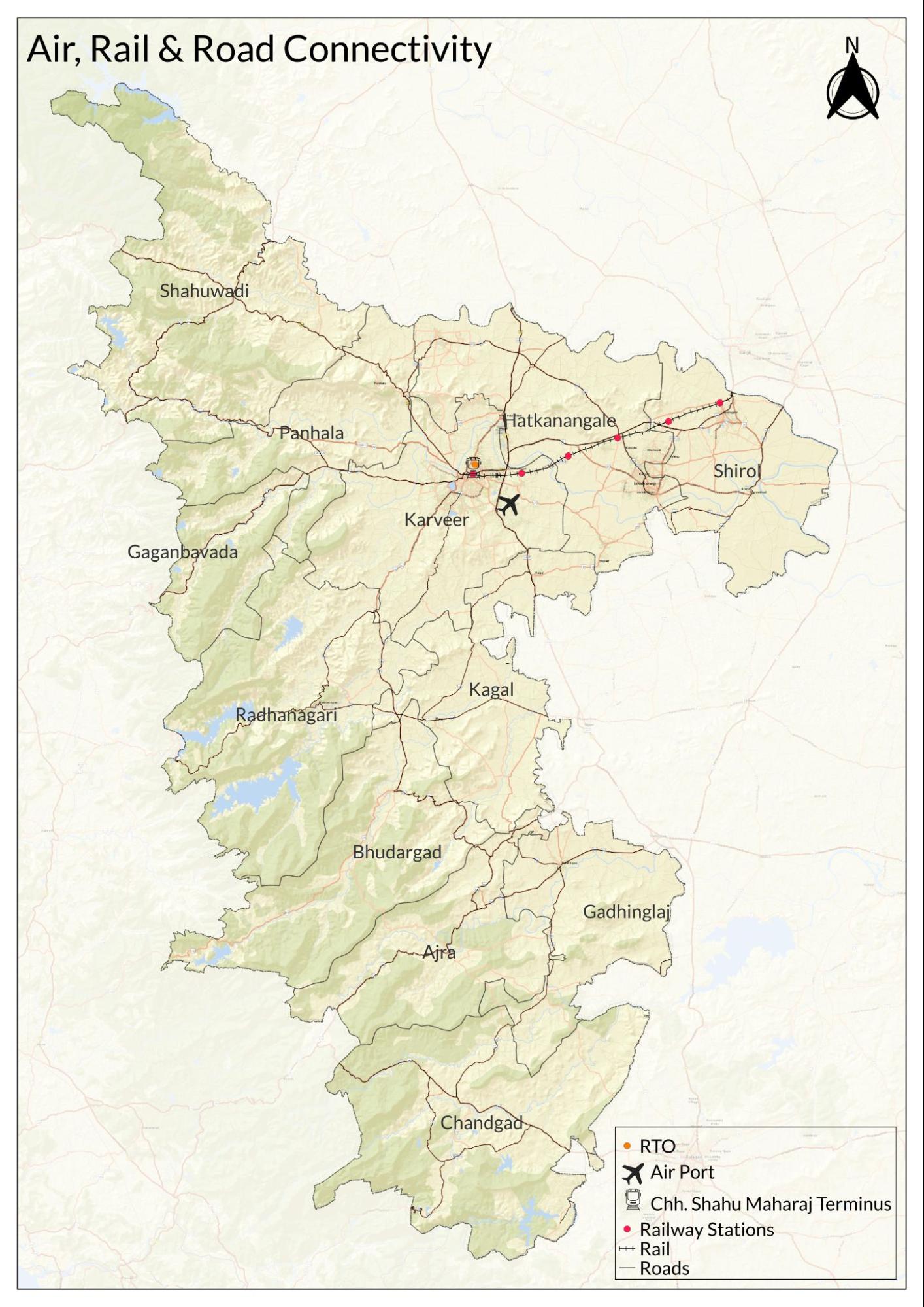
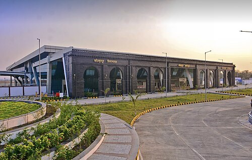
Kolhapur district falls under the Central Railway zone, within the Pune Railway Division, which oversees operations in this part of Maharashtra. The principal station serving the district is the Shri Chhatrapati Shahu Maharaj Terminus, Kolhapur, which connects the region with several major cities by rail. Regular services operate on routes linking Kolhapur with Mumbai, Pune, Hyderabad, Tirupati, and Dhanbad. Among these, the Mahalaxmi Express (Kolhapur–Mumbai), Deekshabhoomi Express (Kolhapur–Dhanbad), and Haripriya Express (Kolhapur–Tirupati) remain important for passengers and goods alike.
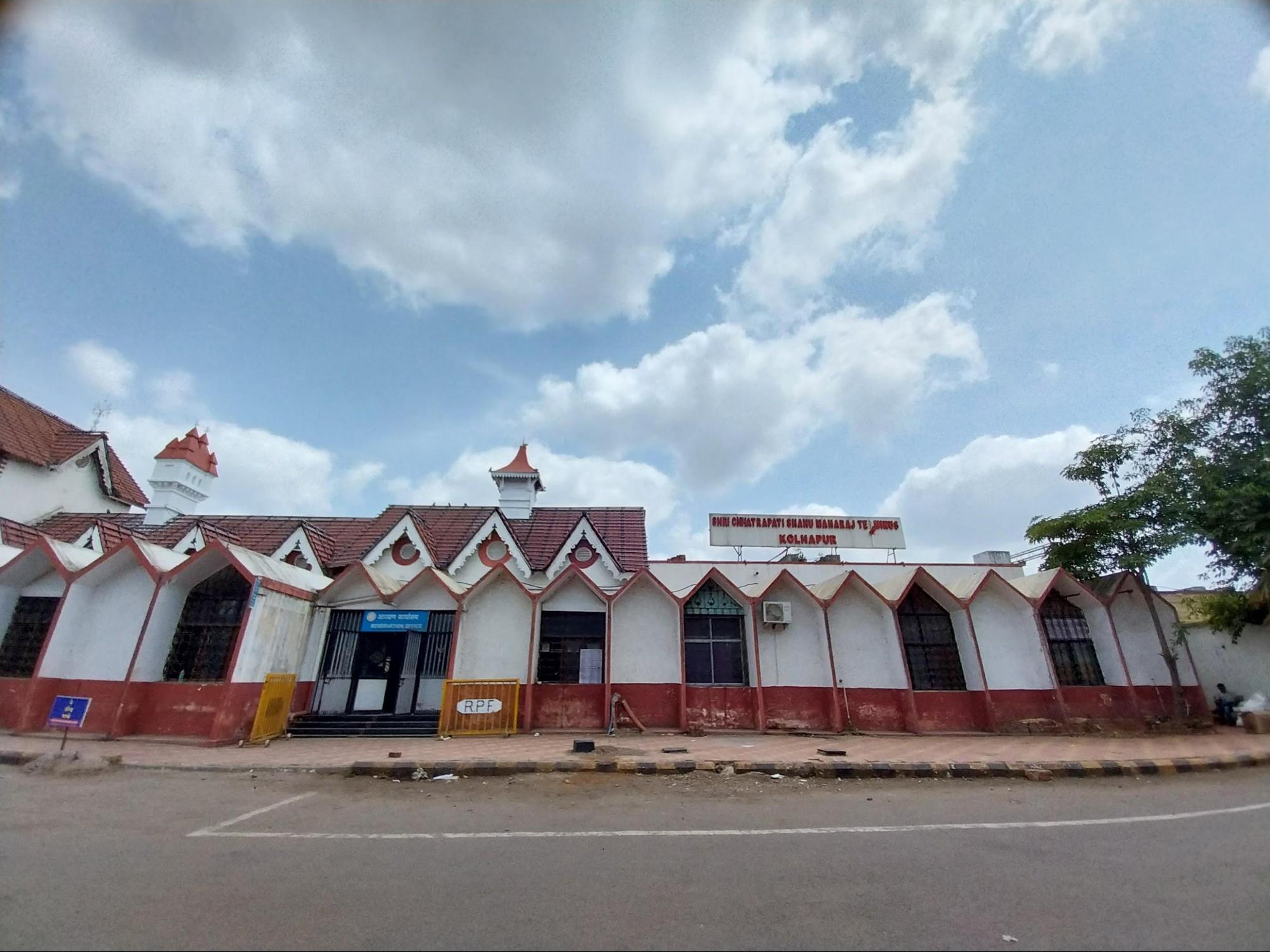
The railway’s development in Kolhapur is interesting and quite notable for the active involvement of the local ruler, Chhatrapati Shahu Maharaj, whose efforts distinguished the district’s railway history from those driven primarily by British commercial interests elsewhere in India. After ascending the throne on 3 May 1888, Shahu Maharaj initiated construction of the Kolhapur–Miraj line, which became significant in the district’s transport history.
Locals say that the location of the main station was decided after careful consideration of two sites: the present location and an alternative near Padmala (Mangalwar Peth). The Padmala site was ultimately set aside for logistical reasons, and the chosen site remains in use today. The line was completed in 1891 and inaugurated on 21 April 1891 by Lord Harris, then Governor of Bombay.
In 1944, the line came under the control of the central government. Following the merger of Kolhapur Sansthan (Kolhapur Princely State) with Bombay State in 1949, the route became part of the larger Madras and Maratha Railway network, linking Kolhapur more closely with the wider railway system.
Overview of Bus Networks
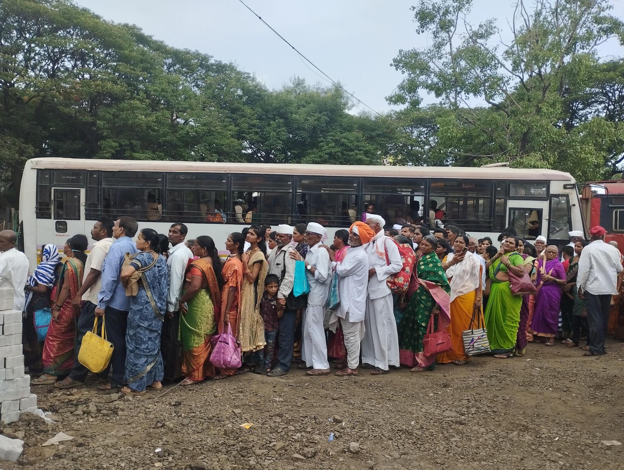
Kolhapur district today is served by an extensive network of bus services operated primarily by the Maharashtra State Road Transport Corporation (MSRTC), alongside numerous private luxury and semi-luxury operators. Buses run daily from major stops such as CBS, Sambhajinagar, Rankala, and Ichalkaranji, connecting towns and villages within the district and providing vital links to cities such as Pune, Mumbai, Goa, and parts of Karnataka, Sindhudurg, and Ratnagiri. Modern options like the e-Shivai buses, fitted with air conditioning and electric engines, have also been introduced on select routes to offer improved comfort and efficiency. Although online booking facilities exist, many passengers continue to prefer queuing at ticket windows, especially for routine travel.
Women passengers today benefit from reduced fares when travelling across talukas, and the number of bus stops and services continues to expand to meet rising demand. Despite steady growth, some parts of the district, such as Shirol taluka, have historically lacked sufficient bus coverage, with recent improvements only being reported in the years leading up to the 2024 Lok Sabha elections.
The present bus network of the district has its roots in post-independence transport reforms. In 1947, the Government of Bombay nationalised the motor transport industry to reduce unregulated competition and bring stability to fares and operations. Before this, it is said that the years following the First World War saw the entry of many small private operators who often competed by lowering fares unsustainably, resulting in overcrowded vehicles and frequent breakdowns.
Motor transport in Kolhapur was brought under state control on 1 July 1950, when nationalisation formally took effect in the district. Fares at the time were structured according to “stages” of travel, each covering approximately 6.4 km, with a minimum fare of 20 paise. In its early decades, the bus system was the primary means of public transport, alongside cycles, tangas, and walking.
The main bus stop was once located at Bhavani Mandap (then known as Nagarkhana). In those years, the limited fleet made crowding manageable, and conductors would ensure every passenger was on board before ringing the bell. Many residents recall a time when children could travel alone to visit relatives, relying on the watchful eye of the conductor. Double-decker buses, too popular for a time, added to the appeal of public transport and remain fondly remembered. Over the years, the system has grown and adapted, expanding stops, routes, and fleet size to accommodate greater movement across talukas and beyond.
Autos and Shared Vehicles
Auto rickshaws have become an essential part of everyday transport in Kolhapur’s urban areas. Today, dedicated rickshaw stands can be found near railway stations, bus stops, markets, and key junctions throughout the city. However, this mode of transport is relatively recent in the district’s history. Local accounts recall that around seventy-five years ago, no rickshaws were seen on the roads, and residents typically relied on bicycles, walking, or tangas for short-distance travel.
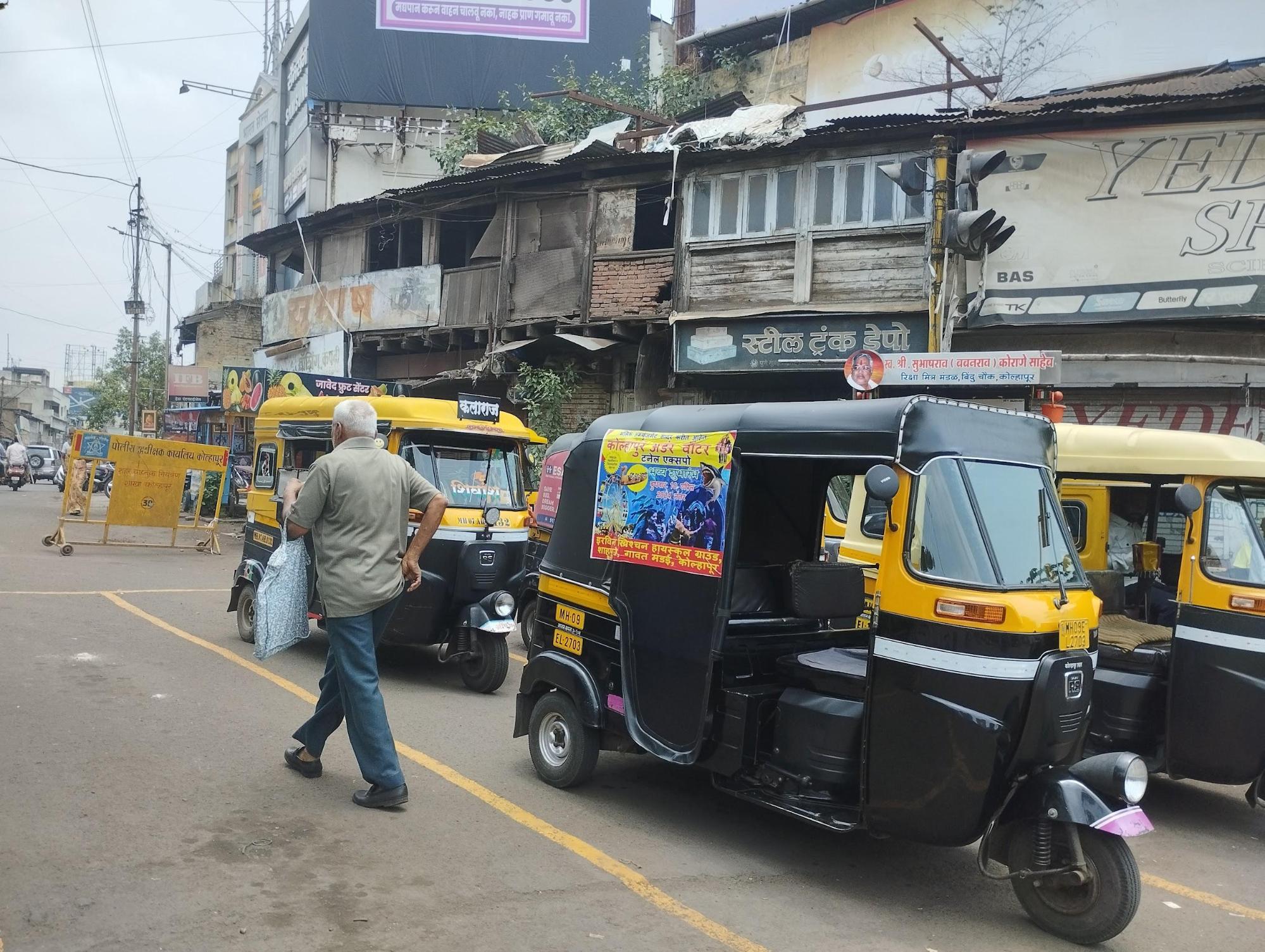
The introduction of rickshaws in Kolhapur began in the 1960s and 1970s, though their numbers remained limited for many years. Early models often featured front engines and were met with some public scepticism. The Lambretta was among the first popular brands, but today Bajaj has become the dominant name in the local market. Over time, design changes have shifted most models to rear-engine layouts, making them more practical for city use.
In earlier decades, locals say that the demand for rickshaws was relatively low, as public buses offered a more economical option for daily commuting. However, in the past 10 to 15 years, there has been a marked increase in rickshaw usage, driven largely by a preference for quicker and more convenient travel, especially as navigating crowded buses has become more challenging for many residents. The steady rise in private vehicles has also made short, flexible trips by auto rickshaw more appealing.
Unlike larger metropolitan areas, Kolhapur has seen limited uptake of app-based taxi services such as Ola or Uber. Though technically available, such cabs are rarely seen on local roads and are usually reserved for specific needs such as airport travel. Instead, most residents continue to depend on auto rickshaws or shared autos, locally known as Vadaps, for daily journeys.
Meter use varies within the city. At major stands like CBS, many drivers agree on fixed fares rather than using meters, while within the city, meter readings are more common. Tourists and visitors often encounter fixed fares, particularly at night, when higher charges are not unusual.
Air Travel
When it comes to air travel, the district is served by Chhatrapati Rajaram Maharaj Airport, located at Ujalaiwadi, approximately 9 km from the city centre. Scheduled flights operated by airlines such as Indigo and Star Air connect Kolhapur to major cities including Bangalore, Hyderabad, Mumbai, and Tirupati, strengthening the region’s links to wider domestic networks and supporting local economic activity.
Kolhapur’s airport opened in 1939 and was an important milestone in strengthening transport links during the colonial period. The project was initiated under the leadership of Chhatrapati Rajaram Maharaj, whose focus on better connectivity laid the foundation for the district’s air services.
Ferries & Water Transport
In earlier times, boats formed an important means of travel across the district’s rivers, particularly during the monsoon season. The colonial district Gazetteer (1886) records twelve rivers, Chitri, Dudhganga, Ghatprabha, Hiranyakeshi, Kasari, Krishna, Kumbhi, Varna, Vedganga, Bhogavati, Panchganga, and Kadvi, as supporting active ferry routes from June to October each year. Boats varied in size, from small craft measuring about seven by two feet to larger vessels up to thirty-six by twelve feet.
These boats were constructed by craftsmen in towns such as Kagal, Kharepatan, and Malkapur, using timber from teak, babhul, mango, and silk-cotton trees. Ferries were operated by boatmen from various communities, including Bagdis, Bhandaris, Chambhars, Kolis, Kunbis, Lingayats, and Muslims, who were often granted service lands instead of wages. Larger boats carried between 200 and 400 passengers at a time, with fees collected for both people and livestock.
Until about fifty years ago, such river crossings continued to serve daily travel needs in many areas. Boats were commonly used between Nandgaon village and Khebavde, even after a bridge had been built, as vehicle ownership remained limited. Similar routes connected Naagdevwadi and Shignapur with Prayag along the Bhogawati–Panchganga River, while in Shahuwadi taluka, the Kadavi Nadi was often crossed by boat.
With the spread of roads and wider use of motor vehicles, boat travel for daily crossings has largely disappeared. Today, waterways in the district are mainly used for recreation, with Rankala Lake remaining a popular spot for leisure boating.
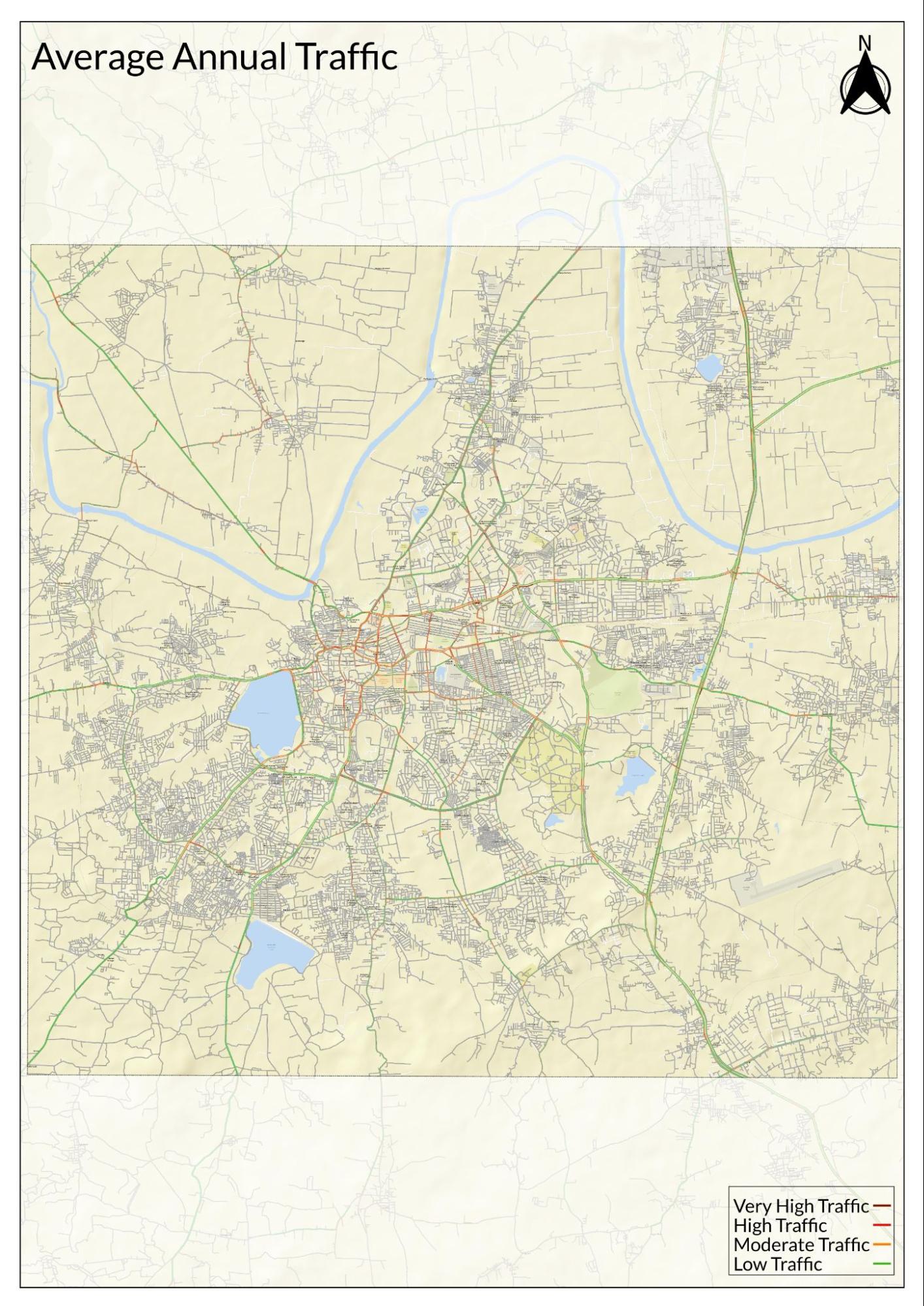
Traffic Map
Communication Networks
Newspapers & Magazines
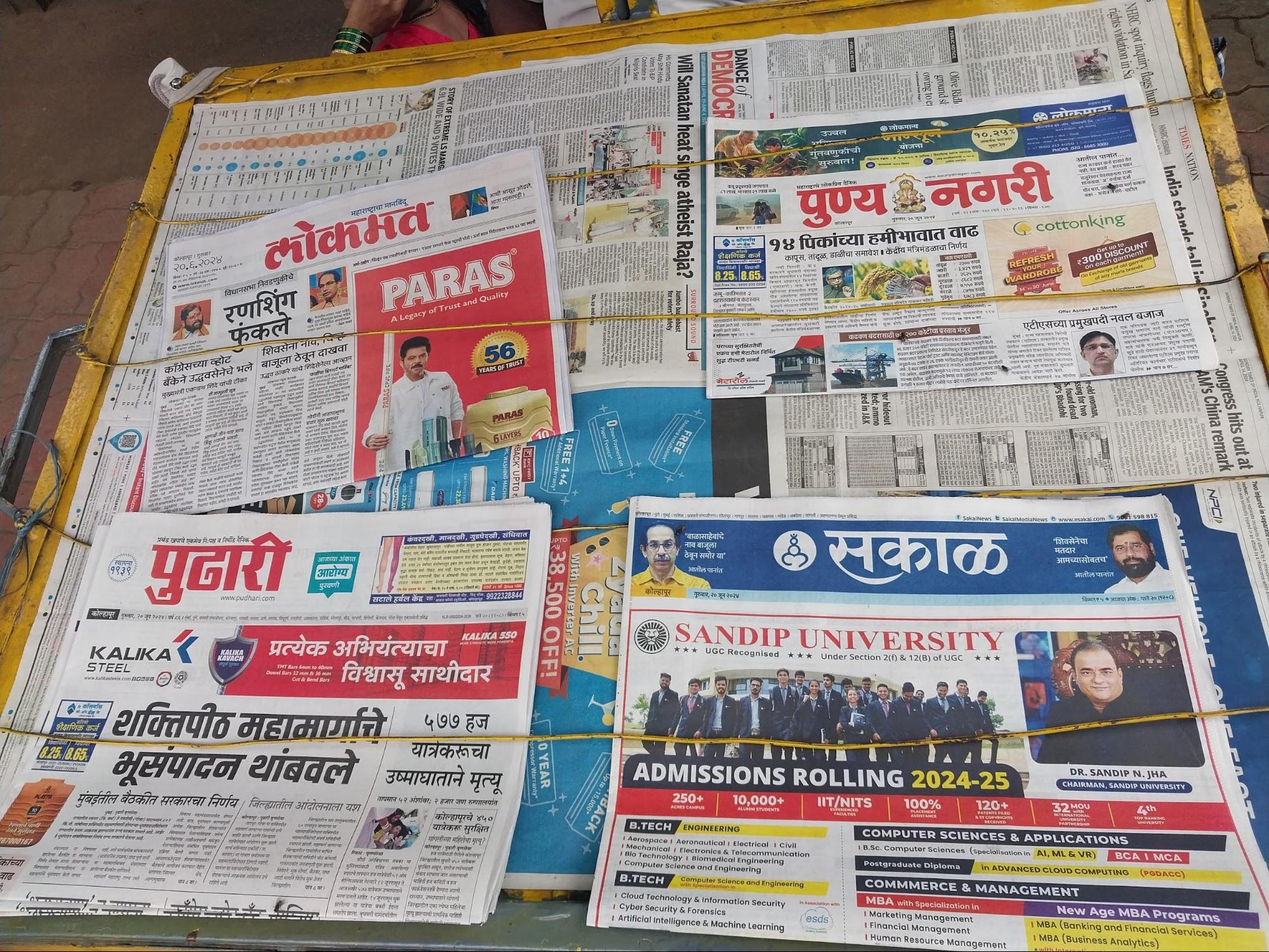
According to the colonial district Gazetteer (1886), a weekly Marathi newspaper titled Jnyan Sagar ("Ocean of Knowledge") was established in 1870 and had a circulation of approximately 150 subscribers. This early publication perhaps marked the beginnings of local journalism in the district.
In the present day, several newspapers and magazines continue to shape the media environment of Kolhapur. Prominent Marathi dailies such as Pudhari, Sakal, Lokmat, and Tarun Bharat have a strong readership base across urban and rural areas of the district. Among these, Pudhari, which originated in Kolhapur itself, holds particular local significance.
In addition, Kolhapur Times serves as a district-focused publication, offering coverage of regional developments, civic issues, and events specific to Kolhapur.
Graphs
Road Safety and Violations
Transport Infrastructure
Bus Transport
Communication and Media
Sources
Gazetteer Department. 1886 (reprinted in 1999). Gazetteer of the Bombay Presidency: Kolhapur District, Volume XXIV. Gazetteer Department, Government of Maharashtra, Mumbai.https://gazetteers.maharashtra.gov.in/cultur…
TNN. 2023. “Rename Kolhapur's Airport After Chhatrapati Rajaram Maharaj: MP.” Times of India.http://timesofindia.indiatimes.com/city/kolh…
World Health Organization. Road Safety. WHO, Geneva.https://www.who.int/health-topics/road-safet…
Last updated on 6 November 2025. Help us improve the information on this page by clicking on suggest edits or writing to us.