Contents
- Physical Features
- Climate
- Geology
- Soil
- Minerals
- Rivers
- Botany
- Wild Animals
- Birds
- Land Use
- Environmental Concerns
- Water Scarcity
- Deforestation
- Climate Change Vulnerability
- Soil Degradation
- Conservation Efforts/Protests
- Farmers in Nanded Demand Immediate Aid from State Minister Amid Rain Damage Crisis
- Environmental NGOs
- Eco Warriors Nanded
- Godavari Bachao Abhiyan
- Paryavaran Sanrakshan Samiti
- Shri Guru Gobind Singh Ji Environment Awareness Group
- Vasundhara Foundation
- Graphs
- Water
- A. Rainfall (Yearly)
- B. Rainfall (Monthly)
- C. No. of Rainy Days in the Year (Taluka-wise)
- D. Evapotranspiration Potential vs Actual Numbers (Yearly)
- E. Annual Runoff
- F. Runoff (Monthly)
- G. Water Deficit (Yearly)
- H. Water Deficit (Monthly)
- I. Soil Moisture (Yearly)
- J. Seasonal Groundwater Levels: Bore Wells
- K. Seasonal Groundwater Levels: Dug Wells
- Climate & Atmosphere
- A. Maximum Temperature (Yearly)
- B. Maximum Temperature (Monthly)
- C. Minimum Temperature (Yearly)
- D. Minimum Temperature (Monthly)
- E. Wind Speed (Yearly)
- F. Wind Speed (Monthly)
- G. Relative Humidity
- Forests & Ecology
- A. Forest Area
- B. Forest Area (Filter by Density)
- Human Footprint
- A. Nighttime Lights
- Sources
NANDED
Environment
Last updated on 6 November 2025. Help us improve the information on this page by clicking on suggest edits or writing to us.
Nanded district, located in the Marathwada region of Maharashtra, is endowed with abundant natural resources, including the Godavari River, which plays a vital role in the area's ecosystem and agricultural practices. The district features a diverse landscape that combines plains and forested regions, fostering a rich variety of flora and fauna. With the passage of time, the district is confronting environmental challenges such as water scarcity, deforestation, and soil deterioration; conservation efforts by the inhabitants continue.
Physical Features
Nanded district in the state of Maharashtra located in the eastern part along with the eastern part of the Marathwada region of the Aurangabad Division. It includes the region between 18°15' to 19°55' north latitudes and 77° to 78°25' east longitudes, spreading over an area of 10,332 square kilometers.
The district is bordered by several districts: Yavatmal district of Vidarbha to the north, Latur district to the south-west, and Parbhani and Hingoli districts to the west. It borders the state of Telangana to the east, where it shares borders with the Adilabad, Nirmal, Nizamabad, and Kamareddy districts, while the Bidar district of Karnataka state lies to the south.
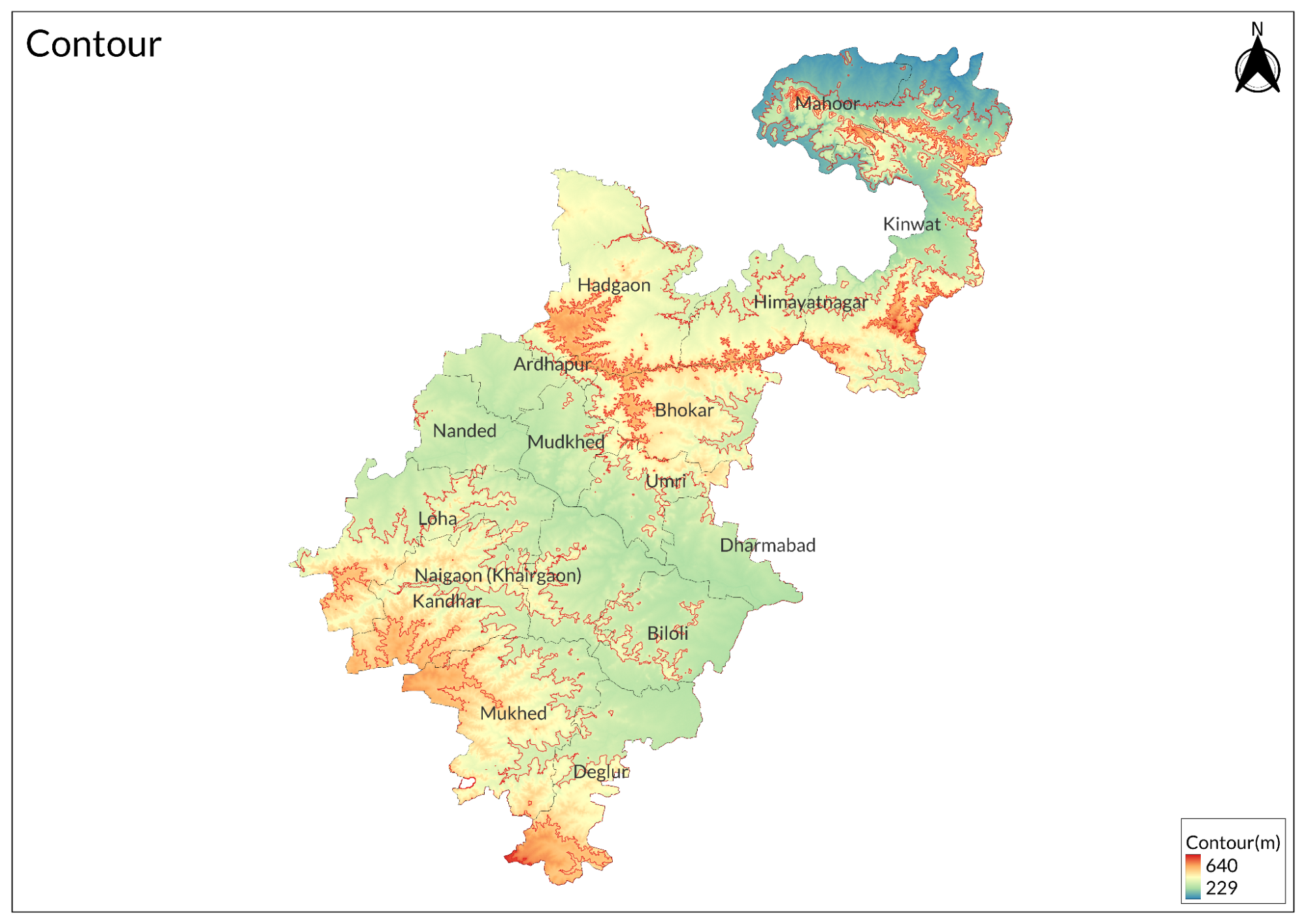
Nanded can be broadly classified physiographically into two distinct regions, namely, the hilly terrain of North and North East, and the low-lying tracts on the banks of rivers Godavari, Manjra, Manyad, and Penganga. The undulating topography has uneven hills, plateau regions, gentle slopes, and valley plains.
Climate
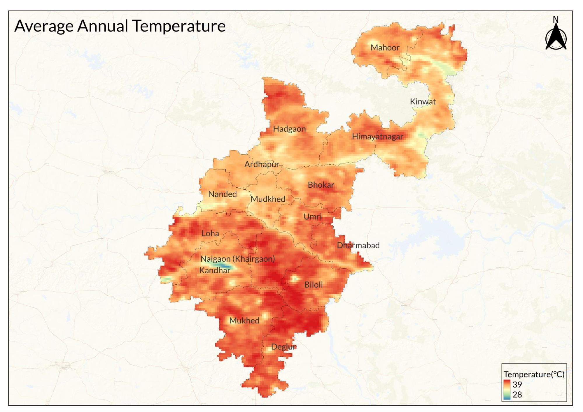
Nanded has a semi-arid tropical climate with marked seasonal variations in temperature, rainfall, and humidity. The highest temperatures are reported during summer. The maximum temperature recorded is 46.7°C (116.1°F) during June, and the minimum temperature of 3.6°C (38.5°F) was recorded in December. The mean daily maximum temperatures vary between 30.5°C and 40.7°C, while the minimum temperatures range from 13.1°C to 25.7°C throughout the year.
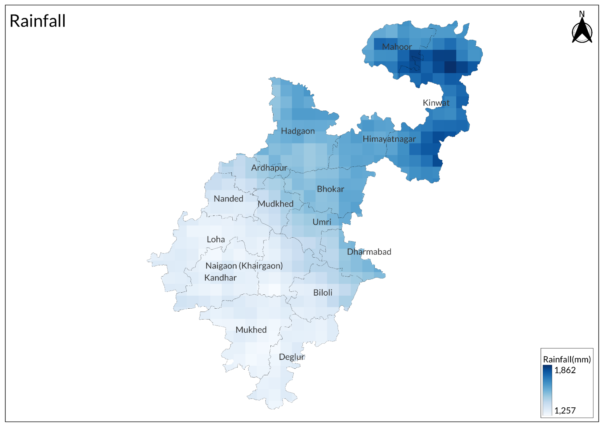
There is a concentrated monsoon in Nanded. The average annual rainfall in the district is 823.5 mm (32.42 inches). July and August are the wettest months during which 217.5 mm and 214.2 mm of rainfall occurs respectively. The region faces about 44 rainy days in a year, during which most of the fall occurs between June and September. December and January are relatively dry months as the rainfall only amounts to 1.7 mm and 3.3 mm, respectively.
Humidity varies significantly in Nanded, ranging from 17:30 IST. During the monsoon months of July and August, humidity reaches its highest levels of between 64-68%. The lowest humidity is found during the peak summer season in March and April at 23-30%. The annual average humidity in the area is 44%, making it semi-arid.
Geology
The Nanded district falls under the Deccan Trap terrain, which was formed during the Cretaceous-Eocene age. This geological formation is characterized mainly by basaltic rock structures, typical of the Deccan volcanic province.
The geology of the region is mainly characterized by three formations. The oldest of these is the Deccan Trap basalt, which forms the base of the area. This is overlain by lateritic formations in certain regions, particularly evident in the elevated areas. The newest formations are the alluvial deposits, found predominantly along the river valleys of the Godavari and its tributaries.
Deccan Traps have characteristically step-like formations with lava flows along the ground. These commonly have basalt layers as vesicular and massive basalts. Volcanic rocks also play a pivotal role in the formation of black cotton soils in this region, which are mineral-rich with basalts undergoing weathering. The sediments across the river courses are also made up of alluvial deposits resulting from prolonged fluvial processes of deposition.
Soil
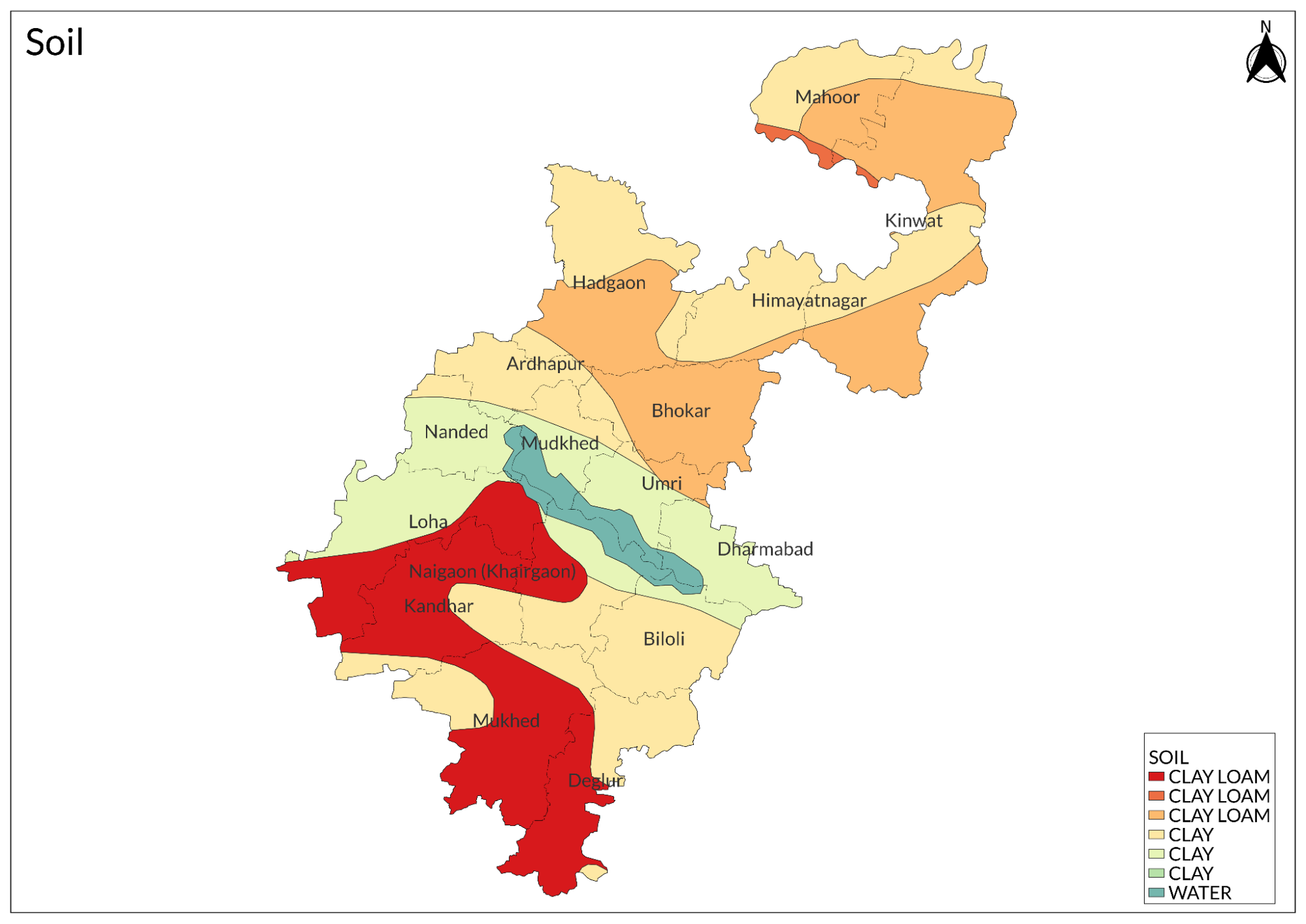
The soils of Nanded district can be primarily classified into four main categories based on their characteristics and distribution patterns.
The predominant soil type is the deep black cotton soil (Regur), derived from the weathering of basaltic rocks of the Deccan Trap. These soils are characterized by their high clay content, moisture retention capacity, and fertility. They are particularly suitable for growing cotton, jowar, and other traditional crops of the region.
Medium black soils occupy significant portions of the district, especially in the central and western parts. These soils, while similar to deep black soils in origin, are of moderate depth and slightly lighter in texture. Along the river valleys of the Godavari and its tributaries, fertile alluvial soils have developed from fluvial deposits. These soils are highly productive and support intensive agriculture.
In the elevated areas and parts of the northern region, shallow soils and lateritic soils are found. These soils are relatively less fertile and have lower moisture retention capacity compared to the black soils. The variation in soil types across the district has influenced the agricultural patterns and crop selection in different areas.
Minerals
The mineral resources of Nanded district are relatively limited, primarily consisting of industrial and construction materials. The district's geology, dominated by Deccan Trap basalt, determines the nature of available minerals.
Building stone constitutes the main mineral resource of the district, with basalt being extensively quarried for construction purposes. The basaltic rock is crushed to produce aggregates used in road construction and building materials. Additionally, the district has numerous brick earth quarries, utilizing the clay-rich soils for brick manufacturing.
River sand deposits along the Godavari and its tributaries form another significant mineral resource, essential for construction activities. Minor minerals include murrum (weathered rock material) and ordinary earth, which are used locally for construction and land filling purposes. The district does not have any significant metallic mineral deposits or precious stones.
Rivers
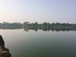
The Manjara River serves as a natural boundary along the southeast edge of the district for almost 40 kilometers. The two major tributaries supplementing this river are the Manar and Lendi Rivers, which altogether make the waterways available for irrigation and water supply in the region.
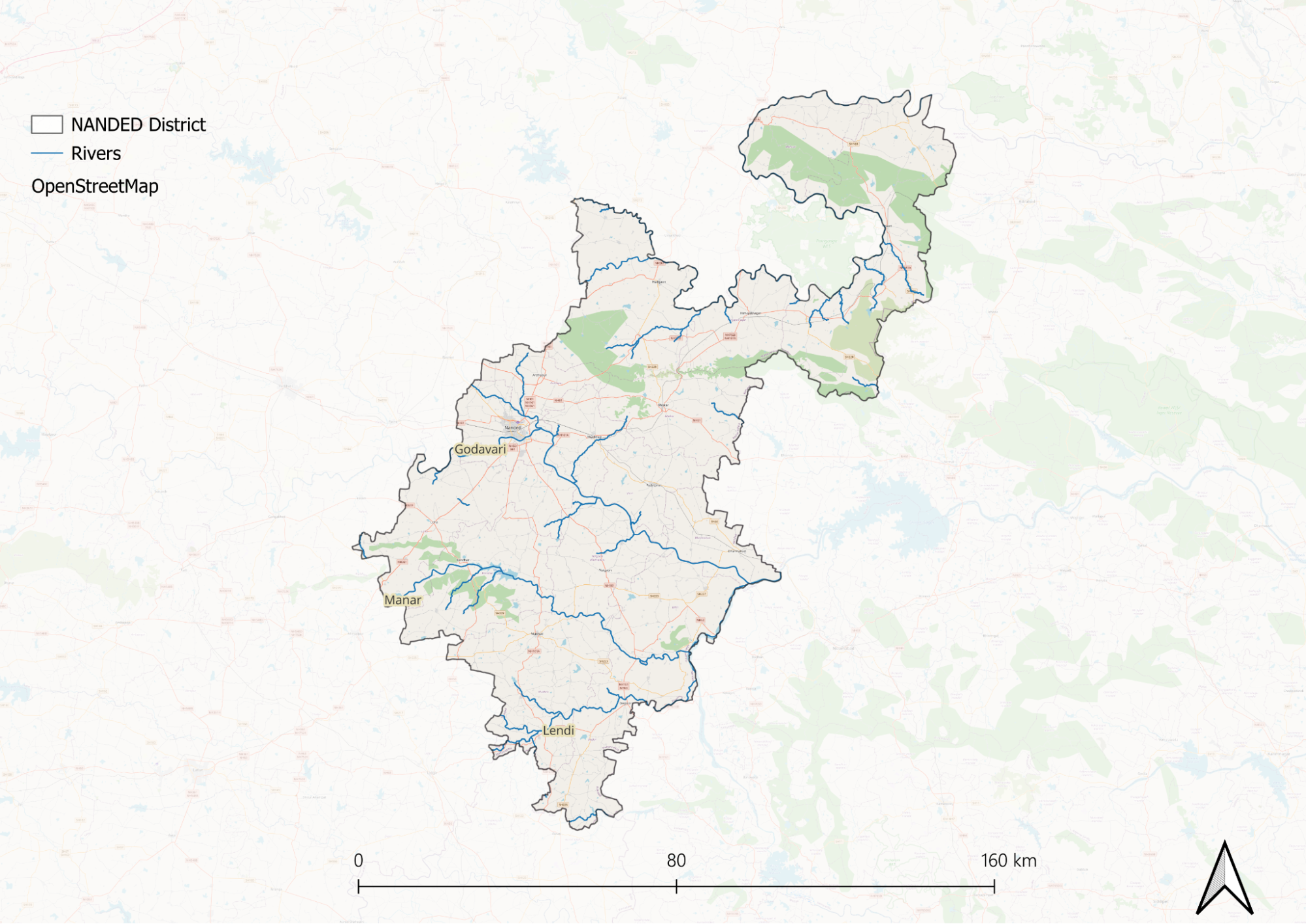
The north boundary of the district is marked by the Penganga River flowing in an east-west direction. One of the prominent landmarks on this river is 'Sahastra-kunda' waterfall, which gives more variety to the geographical landscape in this region.
This river system plays a vital role in the district's climate, which remains mainly dry except during the southwest monsoon season. The southwest monsoon is very significant, contributing to around 89% of the total annual rainfall in the district.
Botany
The botanical profile of Nanded district reflects its semi-arid climate and varied topography. The region supports primarily tropical dry deciduous forests, characterized by species that adapt to seasonal water availability. The dominant tree species found in the district include Teak, Ain, Dhawda, and Bamboo. The forest understory consists of smaller trees and shrubs such as Karwand, Bor, and various species of Acacia, including Babul. Common roadside and agricultural boundary trees include Neem, Peepal, Banyan, and Tamarind.
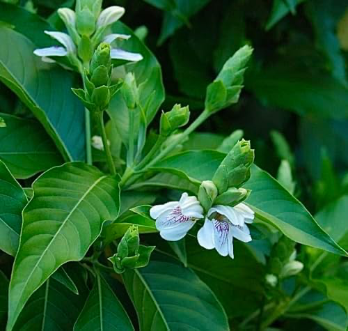
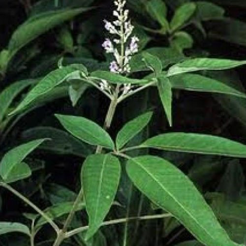

The district also harbors various medicinal plants used in traditional medicine, including Adulsa, Nirgudi, and Bel. In the low-lying areas and along water bodies, moisture-loving vegetation such as grasses and sedges predominate.
Wild Animals
The wildlife of Nanded district comprises various species adapted to its dry deciduous forests and agricultural landscapes. The district's diverse habitats, from forested hills to river valleys, support different animal populations.
Among the larger mammals, Leopards are found in forested areas, particularly in the hilly regions of the north and northeast. Wild Boar, Nilgai, and Blackbuck are commonly seen in the grasslands and agricultural areas.
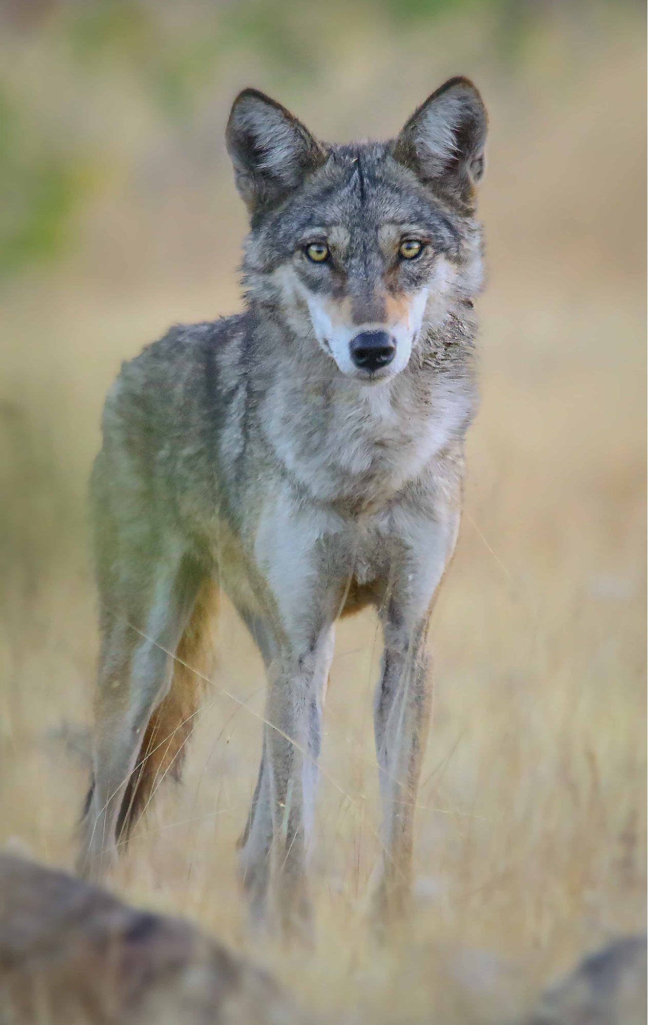
Smaller mammals include the Indian Fox, Jungle Cat, Indian Jackal, Common Palm Civet, and various species of mongooses. The district also supports populations of Indian Hare, Indian Porcupine, and several species of rodents. The river systems provide habitat for the Smooth-coated Otter and various other riparian species.
Birds
The avifauna of Nanded district is rich and varied, reflecting the region's mix of habitats that include forests, grasslands, agricultural areas, and wetlands along the rivers. The district is an important habitat for both resident and migratory bird species.
Common resident birds are Indian Peafowl, Grey Francolin, and Red-wattled Lapwing. Different species of raptors have been recorded in the area, such as Black-winged Kite, Shikra, and Black Kite. In urban and semi-urban areas, common birds are House Sparrows, Common Mynas, and Rose-ringed Parakeets.
The wetland areas along the Godavari and its tributaries are a great attraction for several water birds. These comprise the Little Cormorant, Common Kingfisher, White-throated Kingfisher, and many species of herons, egrets, and ducks. During the winter months, the water bodies also attract migratory birds comprising various species of waders and waterfowl. The agricultural landscapes serve as feeding grounds for birds such as the Indian Roller, Black Drongo, and other species of larks and pipits.
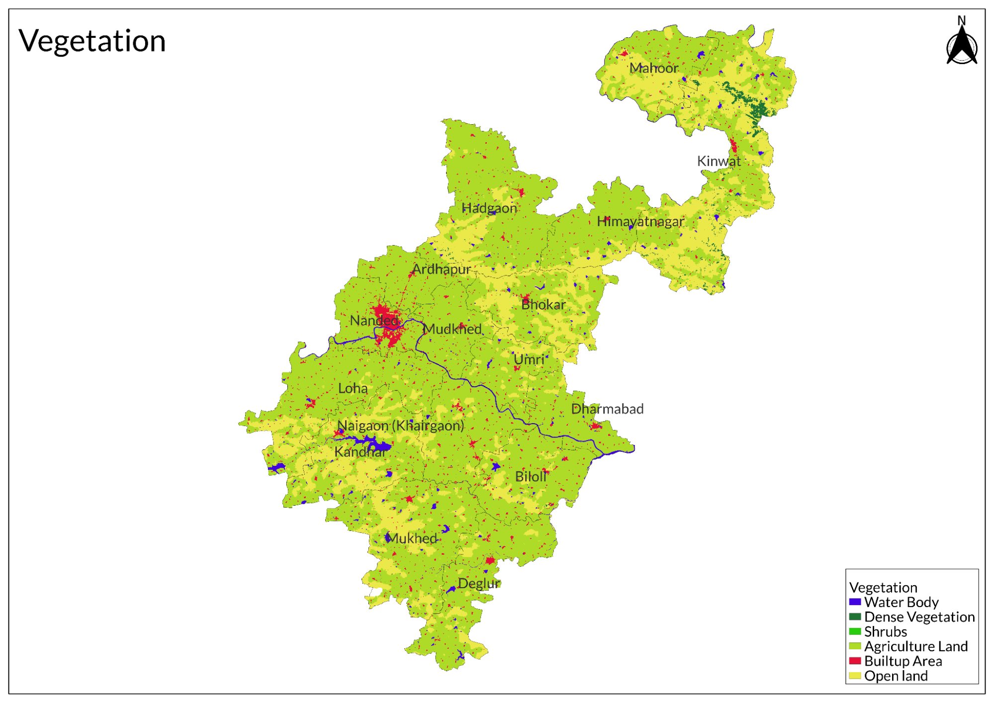
Land Use
Environmental Concerns
Water Scarcity
In 2024, Nanded faced severe water scarcity due to climate change, erratic weather patterns, and overuse of water resources. The region receives 900–1100 mm of annual rainfall but remains vulnerable to droughts and floods. High irrigation demand for sugarcane cultivation and over-extraction of aquifers have led to slow recharge rates and groundwater depletion. As a result, lakes and dams have dried up or reached critical levels, affecting 114 villages facing acute water shortages. Residents in remote areas travel long distances for water, while migrants rely on nearby hotels or borewells. Reports indicate that 35 lakes have dried up, with Shrigavadi Lake at 10% capacity and major dams like Limboti and Barul at 4.72% and 24.30%, respectively. The administration is supplying water through tankers and utilizing private wells for public use.
Deforestation
Deforestation in Nanded district, Maharashtra, is driven by agricultural expansion and local household needs, including fuel, construction, and fencing. Paddy cultivation necessitates tree removal, reducing forest cover. This leads to soil degradation by lowering organic carbon content and essential nutrients, impacting agricultural productivity. Deforestation also disrupts the water cycle, reducing transpiration and altering rainfall patterns, which range from 853 mm to 1150 mm annually. Additionally, forest loss increases greenhouse gas emissions, contributing to climate change, droughts, and biodiversity loss. Soil erosion from deforestation creates stagnant water pools, which serve as breeding grounds for mosquitoes, increasing the risk of malaria and dengue fever.
Climate Change Vulnerability
Nanded district, Maharashtra, is highly vulnerable to climate change impacts, including droughts, floods, and shifting rainfall patterns. A study by Chaitanya Adhav from the Indian Council of Agricultural Research (ICAR) identifies Nanded among the most affected districts, with over two-thirds of Maharashtra's arable land facing similar risks. Using a socio-economic vulnerability index, the study assesses exposure, sensitivity, and adaptive capacity, highlighting that Nanded and ten other districts are particularly at risk from extreme weather events. Major crops cultivated in these areas include jowar, rice, wheat, sugarcane, cotton, ragi, cashew nut, barley, and millets.
Soil Degradation
Soil degradation in Nanded district, Maharashtra, is driven by intensive agricultural practices and excessive chemical inputs. A study by Biswas and Kaplay highlights the overuse of nitrogen, phosphorus, and potassium (NPK) fertilizers in oil seed cultivation, leading to reduced organic carbon content, nutrient depletion, and increased soil acidity. Continuous soybean farming has further depleted topsoil nutrients, threatening long-term agricultural sustainability. Excessive pesticide application contaminates the soil, posing risks to human health and biodiversity. Additionally, improper disposal of industrial waste from agro-based industries introduces hazardous substances like cadmium and mercury, contributing to soil and water contamination.
Conservation Efforts/Protests
Farmers in Nanded Demand Immediate Aid from State Minister Amid Rain Damage Crisis
Farmers in Nanded district, Maharashtra, affected by heavy rainfall, halted Minister Vijay Wadettiwar’s convoy, demanding immediate aid instead of government surveys. They submitted a petition urging the declaration of a 'wet famine' and warned of protests in Mumbai. During his visit to assess rain damage, Wadettiwar assured farmers that assistance would be provided after survey reports were received and stated that the state would seek additional support from the central government. Farmers also raised concerns about difficulties in obtaining crop loans from banks.
Environmental NGOs
Nanded district is home to several dedicated environmental NGOs that focus on various aspects of ecological conservation and community engagement.
Eco Warriors Nanded
An organization dedicated to creating environmental awareness through tree plantation drives, cleanliness campaigns, and educational workshops.
Godavari Bachao Abhiyan
A grassroots initiative aimed at protecting and rejuvenating the Godavari River from pollution and encroachments.
Paryavaran Sanrakshan Samiti
Works on various environmental issues, including pollution control, solid waste management, and preservation of natural habitats.
Shri Guru Gobind Singh Ji Environment Awareness Group
Focused on promoting eco-friendly practices and raising awareness about conservation in urban and rural areas of Nanded.
Vasundhara Foundation
Focuses on afforestation, water conservation, and promoting sustainable agricultural practices among local communities.
Graphs
Water
Climate & Atmosphere
Forests & Ecology
Human Footprint
Sources
B, B., & R.D, K. 2012. Environmental Impact Assessment of Agro Products in Nanded District of Maharashtra. Archives of Applied Science Research, 4(1), 323–329.https://www.scholarsresearchlibrary.com/arti…
Central Ground Water Board. 2023. Ministry of Jal Shakti, Dept. of Water Resources River Development and Ganga Rejuvenation; Government of India.https://cgwb.gov.in/en/system/404?destinatio…
District Nanded. Water Supply and Sanitation Department, Groundwater Surveys and Development Agency; Government of Maharashtra..https://gsda.maharashtra.gov.in/district-nan…
Gajbhiye, M. 2024, May 27. Water Crisis Deepens in Nanded District as Lakes Dry Up and Dams Reach Critical Levels. Free Press Journal.https://www.freepressjournal.in/pune/water-c…
Geological Survey of India. 2025. Ministry of Mines; Government of India.https://www.gsi.gov.in/webcenter/portal/OCBIS
Maharashtra Forest Department. 2025, March 13. Government of Maharashtra.https://mahaforest.gov.in/
Maharashtra Pollution Control Board. 2024.https://mpcb.gov.in/
Maharashtra: Study says 11 districts highly vulnerable to extreme weather events, droughts. 2021, August 6. The Times of India.https://timesofindia.indiatimes.com/city/mum…
Rain-hit farmers in Maharashtra stop Minister’s convoy, seek aid. 2020, October 18. The Hindu.https://www.thehindu.com/news/national/other…
Last updated on 6 November 2025. Help us improve the information on this page by clicking on suggest edits or writing to us.