Contents
- Physical Features
- Climate
- Geology
- Soil
- Minerals
- Rivers
- Botany
- Wild Animals
- Birds
- Egret
- Land Use
- Environmental Concerns
- Water Scarcity
- Soil Degradation
- Deforestation
- Climate Change Vulnerability
- Graphs
- Water
- A. Rainfall (Yearly)
- B. Rainfall (Monthly)
- C. No. of Rainy Days in the Year (Taluka-wise)
- D. Evapotranspiration Potential vs Actual Numbers (Yearly)
- E. Annual Runoff
- F. Runoff (Monthly)
- G. Water Deficit (Yearly)
- H. Water Deficit (Monthly)
- I. Soil Moisture (Yearly)
- J. Seasonal Groundwater Levels: Bore Wells
- K. Seasonal Groundwater Levels: Dug Wells
- Climate & Atmosphere
- A. Maximum Temperature (Yearly)
- B. Maximum Temperature (Monthly)
- C. Minimum Temperature (Yearly)
- D. Minimum Temperature (Monthly)
- E. Wind Speed (Yearly)
- F. Wind Speed (Monthly)
- G. Relative Humidity
- Forests & Ecology
- A. Forest Area
- B. Forest Area (Filter by Density)
- Human Footprint
- A. Nighttime Lights
- Sources
PARBHANI
Environment
Last updated on 6 November 2025. Help us improve the information on this page by clicking on suggest edits or writing to us.
Parbhani, a district in Maharashtra’s Marathwada region, stands at the crossroads of rich natural heritage and pressing environmental challenges. Nestled within the Deccan Plateau, the district is shaped by basaltic rock formations, fertile black cotton soils, and a semi-arid climate. It is home to diverse ecosystems, ranging from dry deciduous forests and agricultural landscapes to riverine habitats sustained by the Godavari, Purna, and Dudhana rivers.
Despite its ecological wealth, Parbhani faces critical environmental concerns, including water scarcity, soil degradation, deforestation, and biodiversity loss. Understanding Parbhani’s ecological landscape is essential for crafting effective solutions that harmonize development with environmental sustainability.
Physical Features
The region's hydrology is dominated by three principal rivers - the Godavari, Purna, and Dudhana - along with their network of tributaries. The Godavari, serving as the primary waterway, meanders through multiple talukas including Pathari, Manwat, Sonpeth, Parbhani, Gangakhed, Palam, and Purna, covering a distance of 79 kilometers within the district.
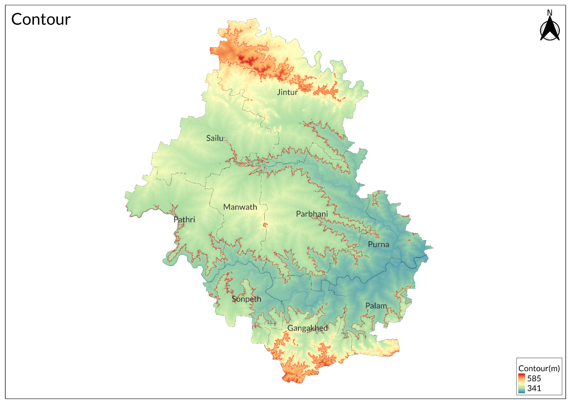
Situated on the Deccan plateau, the district lies at elevations ranging from 375 to 475 meters above sea level. It shares boundaries with five districts: Hingoli, Jalna, Beed, Latur, and Nanded. The landscape is marked by two significant mountain ranges - the Ajantha range extending along the northern border in Jintur Taluka, and the Balaghat range stretching along the western border through Gangakhed and Palam Taluka.
Climate
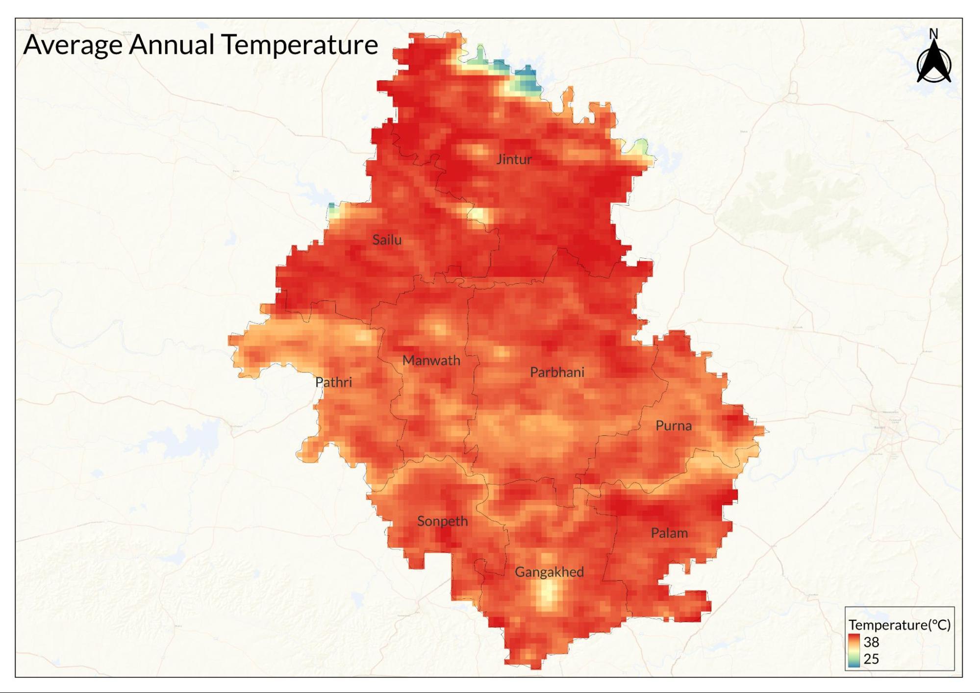
Parbhani experiences a semi-arid climate and it has been classified as tropical. This means it doesn't receive a lot of rainfall annually compared to other regions, and the weather tends to be hotter and drier. This season is characterized by scorching temperatures. The daytime temperatures often exceed 40°C. It's the hottest time of the year in Parbhani.
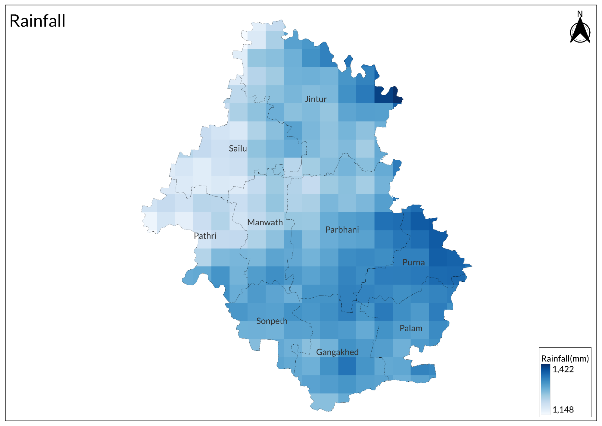
Parbhani receives most of its annual rainfall during the monsoon. While the rain provides a much-needed relief from the heat, it's not as heavy as in other parts of Maharashtra. The average annual rainfall is about 800 mm. Winter in Parbhani is mild. Temperatures can drop to around 10°C in the coldest months, but the days remain relatively warm and pleasant.
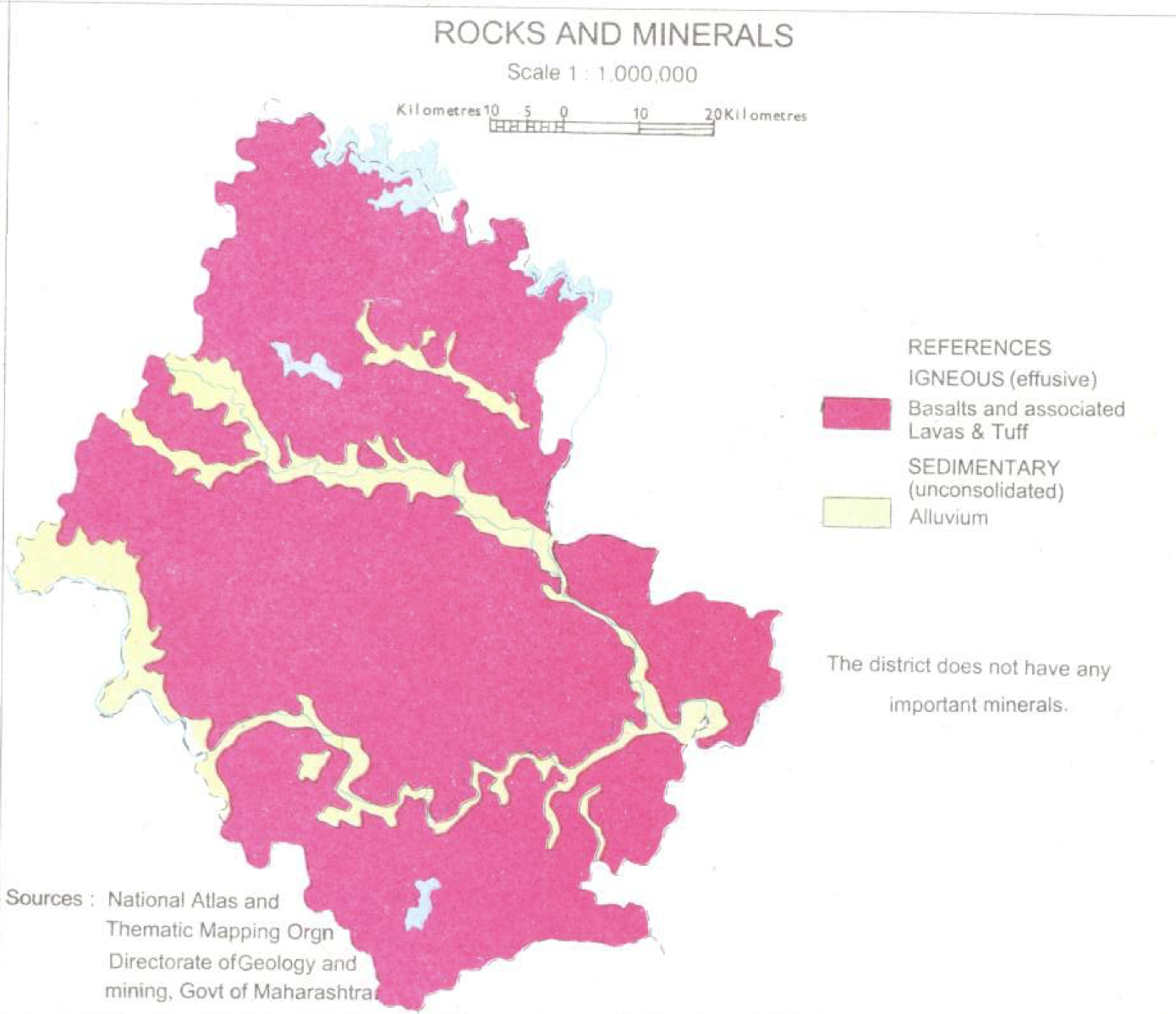
Geology
The region's geological foundation consists of basaltic lava flows dating from the Upper Cretaceous to Lower Eocene periods. These basalts are arranged in horizontal layers stacked one above another. Each flow consists of two distinct units: a massive lower unit and a vesicular upper unit. When weathered, these basaltic units decompose to form black cotton soils of varying depths. Between some flows, there are distinctive layers of reddish-brown or grayish clay known as 'redbole', ranging in thickness from a few centimeters up to 1.20 meters.
More recent geological deposits include patches of alluvium (river-deposited sediments) found along the banks of the three major rivers - the Dudhana, Purna, and Godavari. These alluvial deposits represent the newest geological formations in the area, contrasting with the much older underlying basalt.
Soil
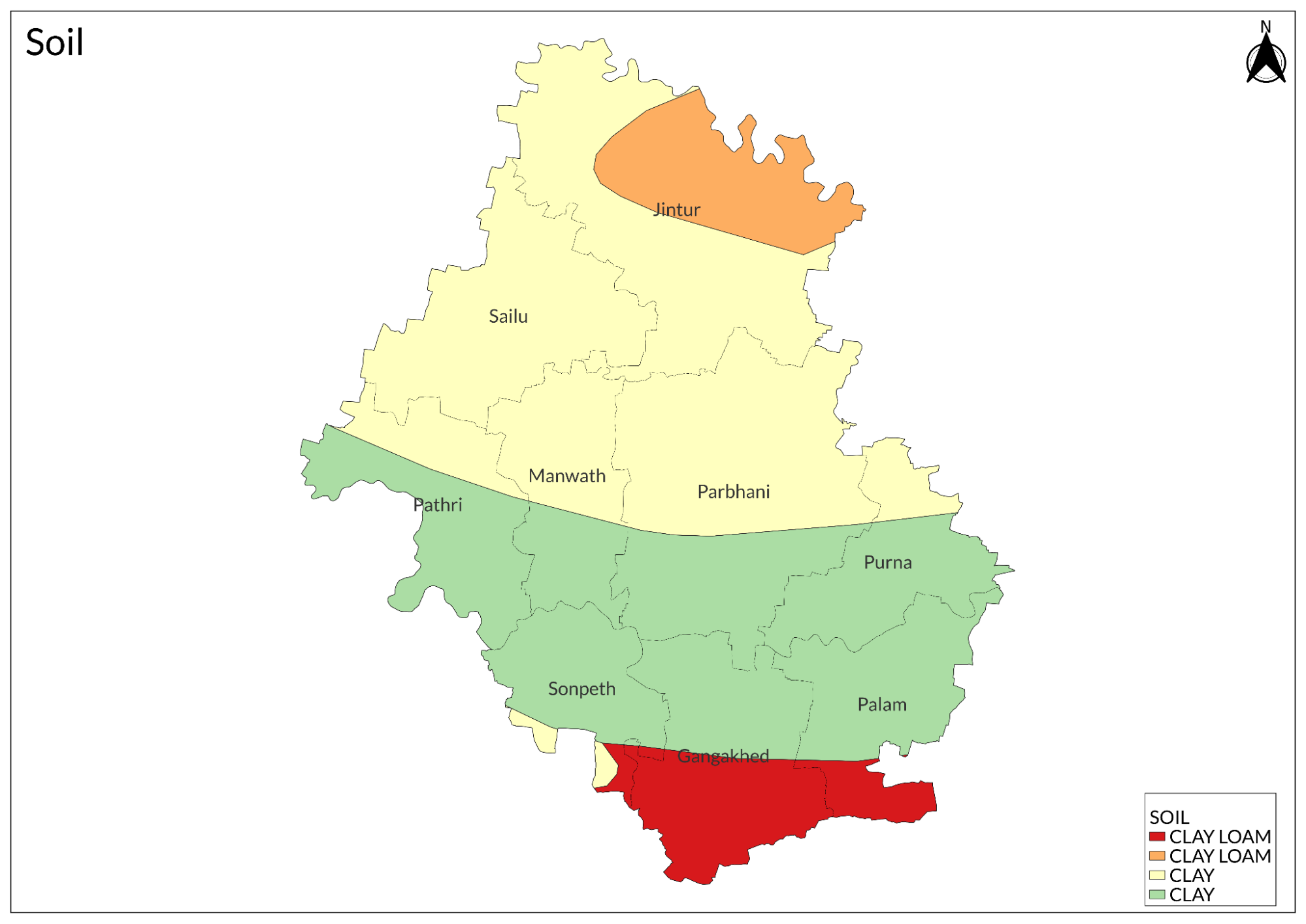
Parbhani's soil composition primarily reflects its geological heritage of basaltic bedrock formed through ancient volcanic activity.
The district's river systems, particularly the Godavari and its tributaries, have created zones of alluvial soil along their courses. These soils represent more recent geological deposits, formed by river sediments over time. Their composition differs from the dominant black soils, offering good fertility and easier cultivation conditions, which has historically influenced settlement and farming patterns in these areas.
In the elevated regions and plateau areas, the soil profile changes to a shallower mix of rocky and soil content. These areas feature variable soil depths, moderate fertility levels, and occasional exposed basalt rock. This soil variation creates distinct microenvironments that support different types of vegetation and agricultural practices.
Minerals
Parbhani's mineral resources are fundamentally linked to its basaltic geology, characterized primarily by industrial and construction minerals rather than precious metals or gemstones. The district's mineral profile is shaped by its location on the Deccan Trap, with horizontal layers of basaltic rock forming the foundation of its mineral deposits.
The most economically significant minerals in the district are construction materials. Building stone, derived from basalt, forms the cornerstone of local construction activities, while murrum and black trap serve essential roles in road construction and infrastructure development. Stone metal, produced by crushing local rock, provides crucial material for various construction projects. River sand, deposited along the courses of the Godavari, Purna, and Dudhana rivers, offers valuable construction material for concrete mixing and building purposes.
Secondary mineral resources include clay deposits used in brick making and pottery, and kankar (limestone nodules) which finds application in cement production and road construction. The distribution of these minerals follows the district's geological structure, with most quarrying activities concentrated in areas where erosion and weathering have made the deposits accessible.
Rivers
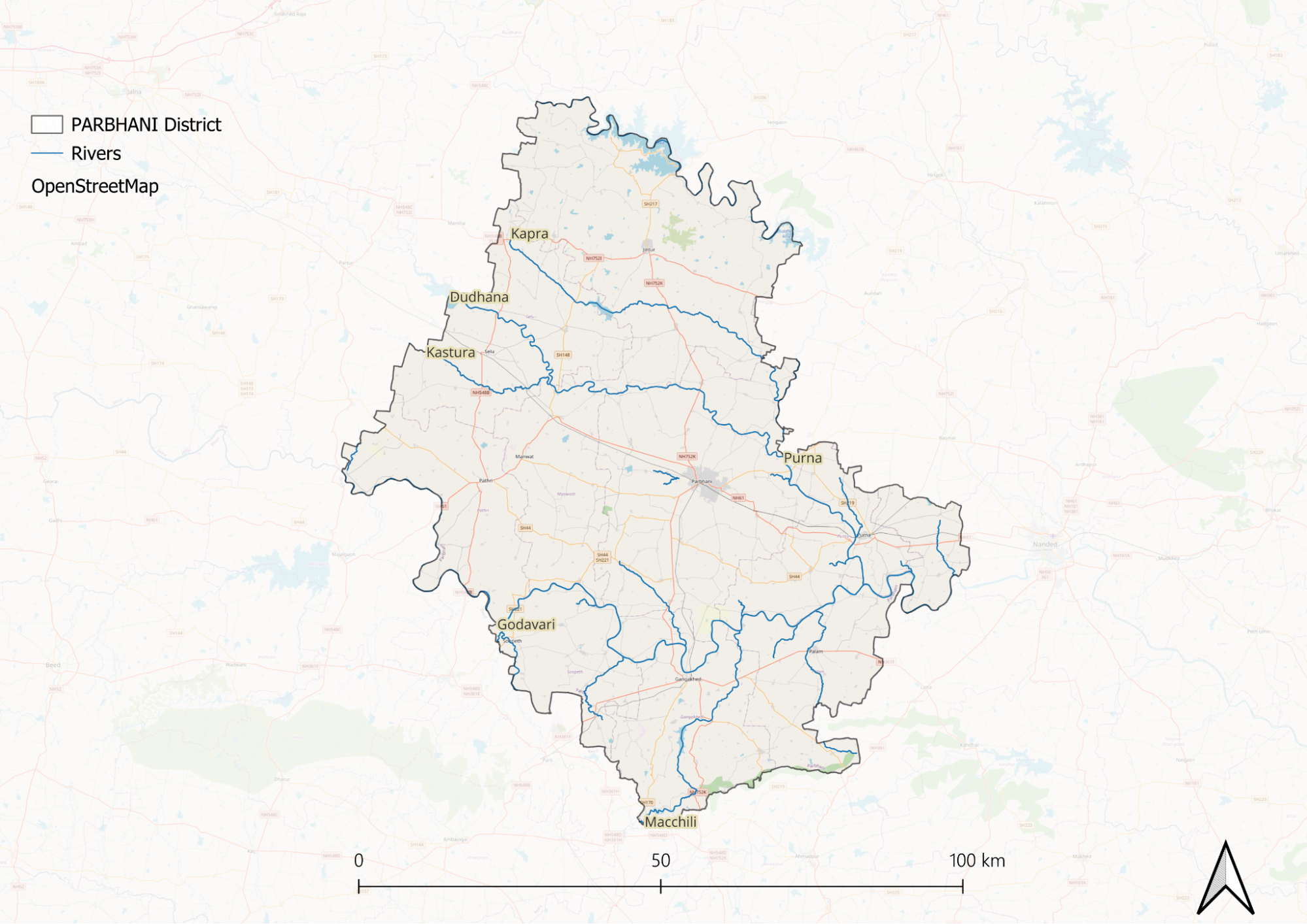
Parbhani has many rivers, lakes, and ponds. The most important river among these is the Godavari River, which flows through the middle of the city. The Godavari River is the primary source of water supply for the city.
Botany
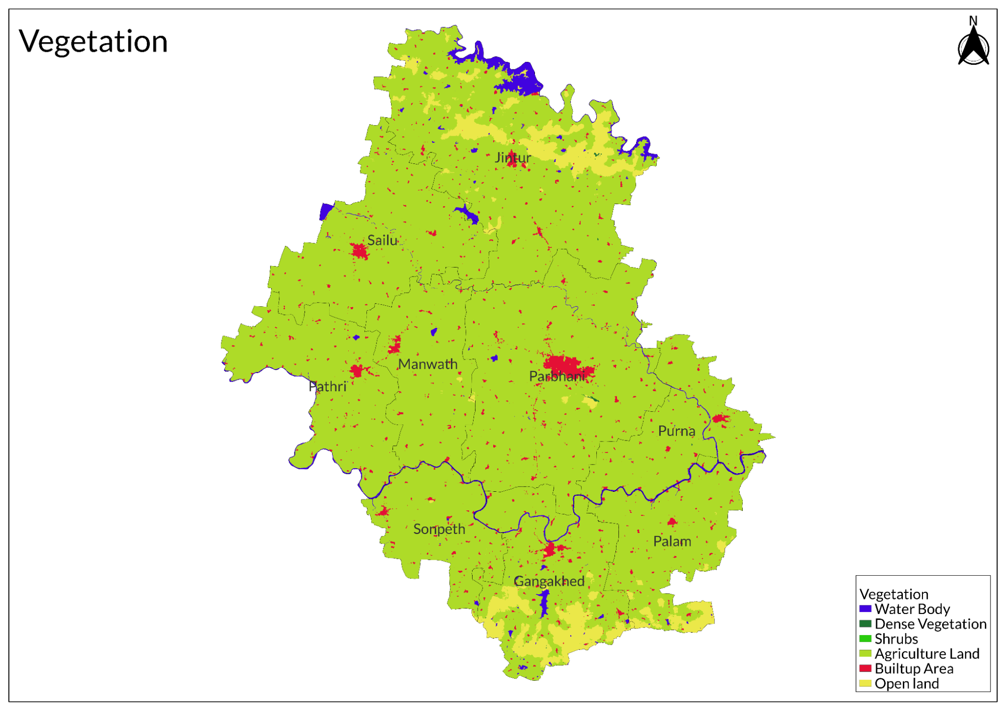
The district historically supported dry deciduous forests and scrub vegetation, with native trees like neem, babul, and various acacia species adapted to the seasonal rainfall patterns. However, much of this natural vegetation has been modified over time due to agricultural expansion and urban development, leaving only patches of original plant communities in protected areas and along waterways.
Agricultural plants dominate the district's current vegetation landscape, showcasing its transformation into a significant farming region. The area produces a diverse range of crops including food grains like jowar and wheat, cash crops such as cotton and sugarcane, oilseeds including sunflower and safflower, and various fruits and vegetables. This agricultural diversity is supported by the region's fertile black soil and irrigation infrastructure, enabling year-round cultivation.
Wild Animals
Wild animal populations in Parbhani have evolved to adapt to the district's semi-arid conditions and agricultural landscape. The remaining wildlife is primarily concentrated around water bodies, scrubland areas, and agricultural peripheries. Common mammals in the region include jackals, foxes, and Indian grey mongoose, which have adapted well to the human-modified landscape. Larger herbivores like nilgai (blue bull) and wild boars are found in less disturbed areas, often venturing into agricultural fields.
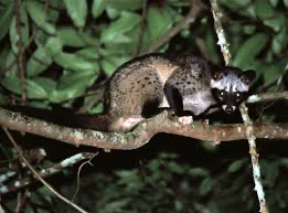
Smaller mammals including Indian hares, palm civets (above), fruit bats, and various rodent species form an important part of the local ecosystem.
Birds
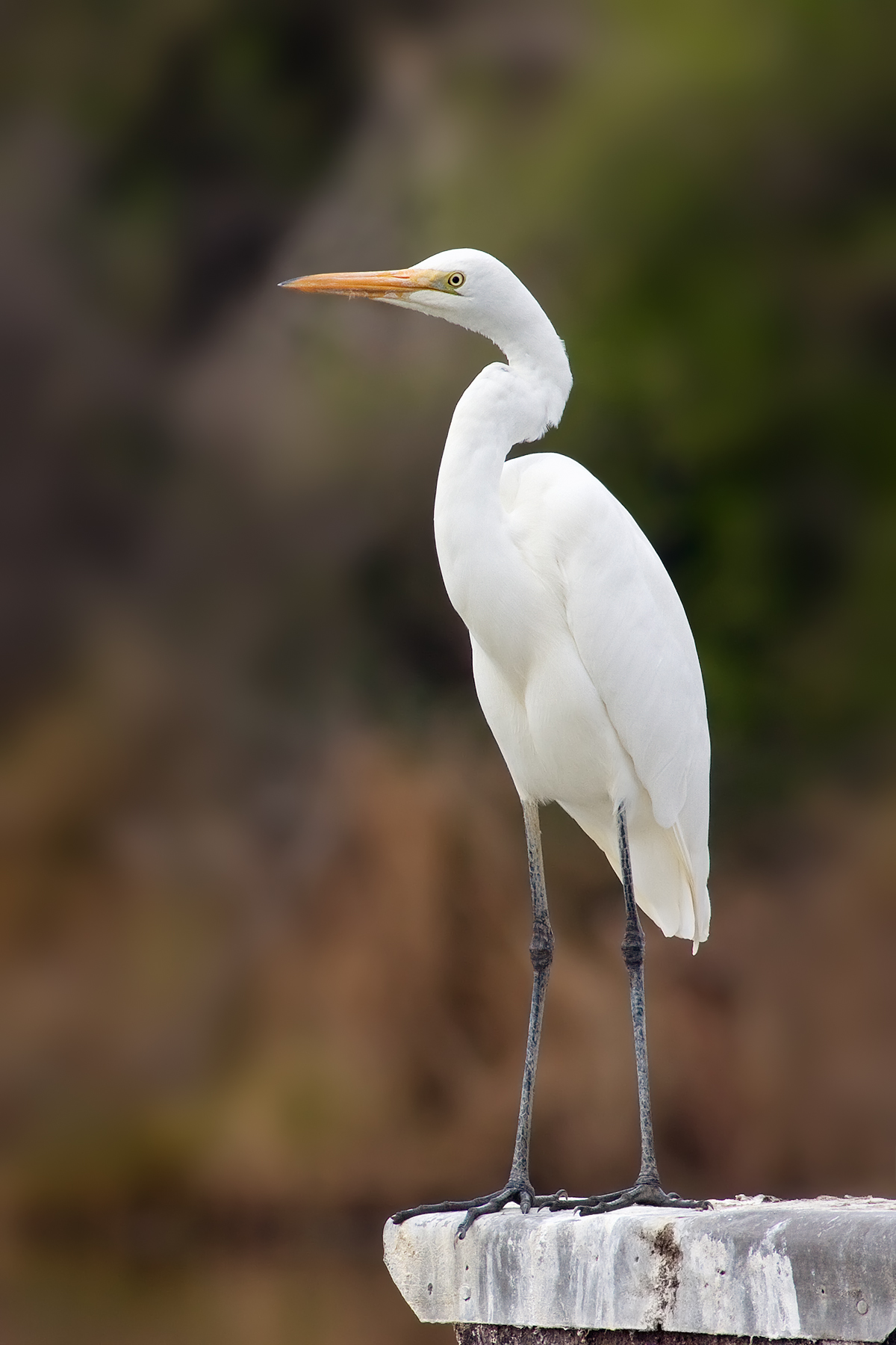
Egret
The district's avian diversity is significant, particularly around water bodies and agricultural areas. Common birds include peacocks, parakeets, grey partridges, and various species of waterbirds near rivers and water bodies. Raptors such as kites and small eagles can be seen hunting over agricultural fields, while egrets and herons frequent the wetland areas.
Land Use
Environmental Concerns
Water Scarcity
Parbhani district in Maharashtra is currently facing significant water scarcity and overexploitation of groundwater, primarily driven by agricultural practices. The main crops cultivated in the region, such as cotton, sugarcane, soybean, sorghum, and green gram, demand substantial amounts of water for irrigation. This high water requirement has led to the rapid depletion of groundwater resources, with extraction rates surpassing natural recharge rates.
The situation is further aggravated by the continued cultivation of water-intensive crops like sugarcane and cotton, even during drought years, which places additional stress on already limited water supplies. As a result, groundwater levels in Parbhani are declining, leading to poor water quality characterized by elevated nitrate concentrations. The district experiences acute water shortages, particularly during drought cycles.
Soil Degradation
The soil degradation in Parbhani district stems from multiple interconnected factors, overgrazing, removing vegetation cover, deforestation, which disrupts soil structure, poor farming practices, which include monocropping and chemical overuse, along with groundwater overexploitation. These factors create a negative feedback loop where diminished soil quality leads to reduced agricultural productivity, which then drives more aggressive land use practices that further degrade the soil.
Deforestation
Deforestation in Parbhani district, Maharashtra, has primarily resulted from agricultural expansion and various human activities. Villagers often clear land to establish paddy fields and cultivate other crops, leading to significant loss of tree cover. Additionally, trees are removed to meet household needs for fuel, construction materials, fencing, and burial purposes. Encroachment into reserved forests for agricultural purposes further aggravates the situation.
Climate Change Vulnerability
Parbhani district in Maharashtra is highly vulnerable to climate change, facing significant challenges such as droughts, extreme weather events, and declining water security. Studies have indicated that Parbhani is particularly susceptible to the adverse effects of climate change, with research highlighting its high vulnerability to extreme weather and dwindling water resources. A comprehensive assessment conducted by Chaitanya Ashok Adhav examined climate change adaptation and mitigation strategies in the district, revealing that Parbhani is among the districts most affected by these climatic challenges. The findings underline the need for effective adaptation measures to enhance resilience against climate-related impacts.
Graphs
Water
Climate & Atmosphere
Forests & Ecology
Human Footprint
Sources
Adhav, C. A., R, S., Chandel, B. S., Bhandari, G., Ponnusamy, K., & Ram, H. (2021). Coping strategies for climate change: Evidence from vulnerable regions of Maharashtra, India (SSRN Scholarly Paper 4368297).https://doi.org/10.2139/ssrn.4368297
Home—Parbhani District. (2025, March 6). Groundwater Surveys and Development Agency; Government of Maharashtra, Water Supply and Sanitation Department..https://gsda.maharashtra.gov.in/parbhani-dis…
Last updated on 6 November 2025. Help us improve the information on this page by clicking on suggest edits or writing to us.