Contents
- Physical Features
- Geology
- Soil
- Minerals
- Rivers
- Botany
- Wild Animals
- Birds
- Forest Reserves
- The Sanjay Gandhi National Park
- Tansa Wildlife Sanctuary
- Tungareshwar Wildlife Sanctuary
- Land Use
- Environmental Concerns
- Deforestation
- Air Pollution
- Water Pollution
- Wetland Destruction
- Conservation Efforts/Protests
- Water Conservation Initiatives
- Lake Conservation Efforts
- Forest Regeneration Projects
- Environmental NGOs
- Graphs
- Water
- A. Rainfall (Yearly)
- B. Rainfall (Monthly)
- C. No. of Rainy Days in the Year (Taluka-wise)
- D. Evapotranspiration Potential vs Actual Numbers (Yearly)
- E. Annual Runoff
- F. Runoff (Monthly)
- G. Water Deficit (Yearly)
- H. Water Deficit (Monthly)
- I. Soil Moisture (Yearly)
- J. Seasonal Groundwater Levels: Bore Wells
- K. Seasonal Groundwater Levels: Dug Wells
- Climate & Atmosphere
- A. Maximum Temperature (Yearly)
- B. Maximum Temperature (Monthly)
- C. Minimum Temperature (Yearly)
- D. Minimum Temperature (Monthly)
- E. Wind Speed (Yearly)
- F. Wind Speed (Monthly)
- G. Relative Humidity
- Forests & Ecology
- A. Forest Area
- B. Forest Area (Filter by Density)
- C. Wildlife Projects (Area and Expenses)
- Human Footprint
- A. Nighttime Lights
- Sources
THANE
Environment
Last updated on 6 November 2025. Help us improve the information on this page by clicking on suggest edits or writing to us.
Physical Features
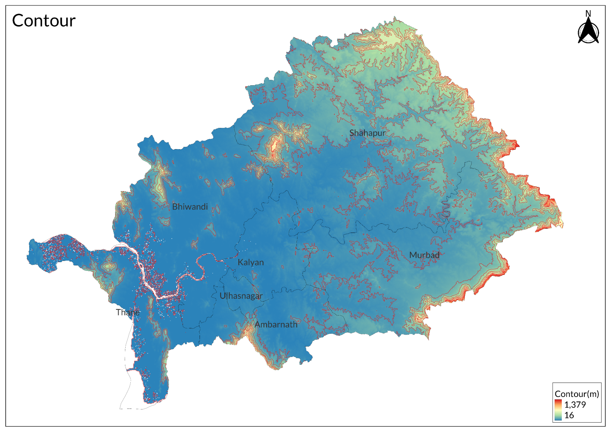
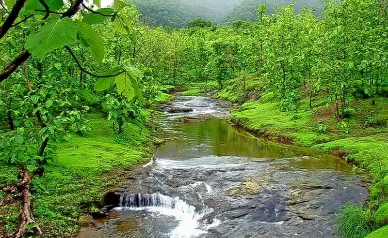
Thane District occupies a strategic position in western Maharashtra along the coast with diverse topography including coastline, hills, valleys and plains. The district is bounded by the Sahyadri mountain range or Western Ghats to the east, which significantly influences its climate and ecology. Elevation varies from sea level at the coast to over 1,000 meters in the Ghats sections. The landscape contains several prominent hill ranges with the Yeoor Hills forming an important green belt and the Parsik Hill range running along the Thane creek creating natural boundaries between urban areas. The district features extensive forest cover surrounding the hills with tropical deciduous forests extending approximately thirty kilometers along the Thane creek. The creek ecosystem includes extensive mudflats and dense mangrove forests. Traditional village settlements have historically developed in patterns following the creek's natural contours, though expansion has been limited by the sensitive coastal environment and terrain. Multiple river systems, including the Ulhas and Vaitarna, cut through the district creating fertile valleys between the hills. The diversity of landforms from coastal plains to highland plateaus supports varied microclimates and ecosystems throughout different parts of the district. Significant forest cover remains, particularly in the Western Ghats sections, providing important wildlife corridors and watershed protection.
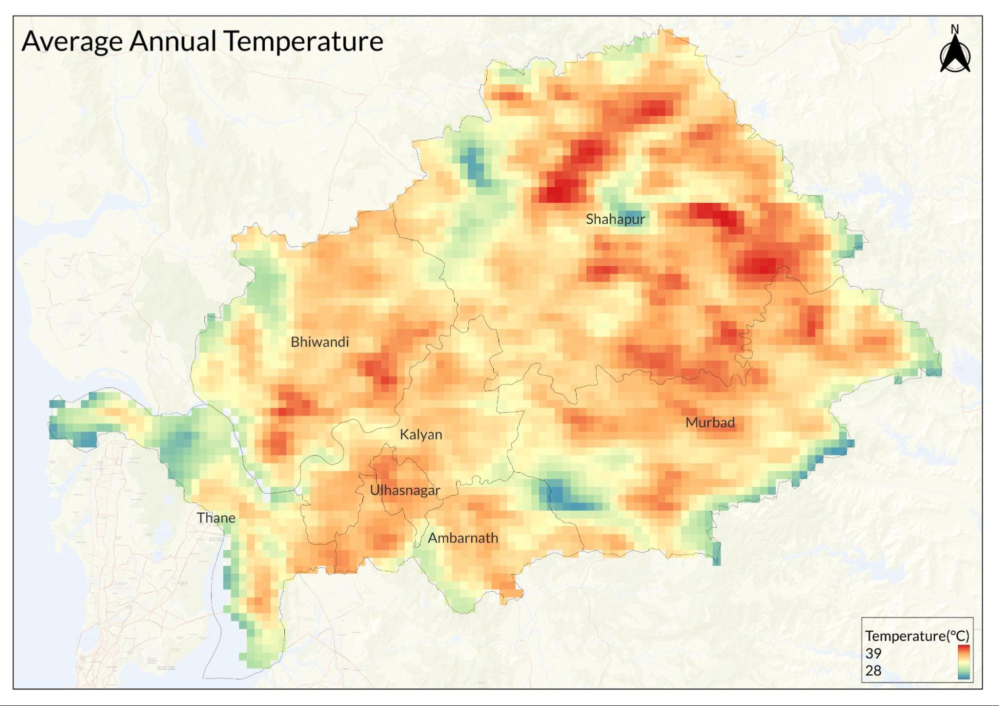
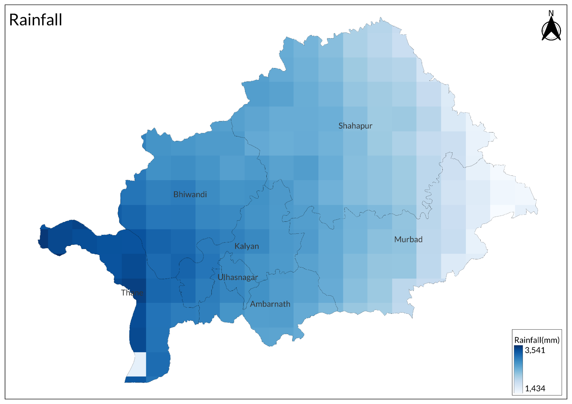
Compared to the Thane District Gazetteer, 1882, the climate patterns of the Thane district show both continuities and significant changes. The basic monsoon pattern remains remarkably similar, with the southwest monsoon still dominating the rainfall pattern from June to September. However, the average rainfall has increased significantly from the historical 99.98 inches (approximately 2,540mm) to current averages of around 2,800-3,000mm in many parts of the district. The geographical distribution pattern persists; Matheran and inland areas still receive more rainfall than coastal regions, and the south continues to get more precipitation than the north.
Temperature patterns show notable changes, particularly in urban areas. While the 1882 Gazetteer recorded a mean annual temperature of 79.98°F (approximately 26.7°C), current temperatures are generally higher, especially in urbanized parts of the district. Modern Thane experiences maximum summer temperatures reaching 38-39°C (around 100°F) compared to the historical mid-90s°F (around 35°C). Minimum temperatures in winter remain similar to historical records, though urban heat island effects have reduced the frequency of lower temperatures in developed areas.
The health concerns have shifted dramatically. While the 1882 Gazetteer emphasized malaria risks particularly in October, and noted fever prevalence in wooded areas, modern Thane faces different health challenges. Air pollution, particularly in urban areas, has become a significant concern, unlike in the historical period. However, some forested inland areas still experience seasonal malaria, though improved healthcare and prevention measures have significantly reduced its impact compared to 1882.
The historical hot winds mentioned during March-April have become more intense, likely due to changes in land use patterns and deforestation. Urban development has also altered local microclimates significantly; areas that were noted as relatively cooler in the 1882 Gazetteer now experience higher temperatures due to concrete structures and reduced vegetation cover. The shorter and milder cold season noted in the historical record has become even more pronounced in recent decades.
Geology
A geological comparison of Thane district from 1882 to present shows both persistent features and notable changes. The fundamental geology described in the 1882 Gazetteer, dominated by Deccan trap basalts and their associates, remains the basic geological framework. The key historical observations of basaltic columns at Dongri in Salsette, Bassein, and the old Kalyan fort are still visible today, though some sites are now affected by urban development.
The Gazetteer's description of coastal geological processes, particularly the "extensive degradation and partial reproduction of land" north of Bassein, has proven prescient. Modern coastal areas continue to experience significant erosion and deposition, though now accelerated by climate change and human activities. The historical observations of sand-stone strata at Kelva-Mahim and Shirgaon remain relevant, though some documented cliff sections have been altered by coastal development and erosion.
The most significant changes since 1882 relate to human impact on geological features. Many of the exposed trap rocks and geological sections described in creek areas have been modified by urban expansion, quarrying, and infrastructure development. The geological landscape of Bombay (Mumbai) island, described in detail in the Gazetteer, has been particularly transformed by extensive reclamation and construction.
The weathering patterns of trap rock noted in creek areas continue, though urbanization has altered natural drainage patterns and weathering processes. While the basic geological structure remains unchanged, modern geological studies have enhanced understanding of the region's volcanic history and the nature of the Deccan traps, building upon the early observations of features like the basaltic dykes that the Gazetteer linked to the Rajpipla hills volcanic center.
Soil
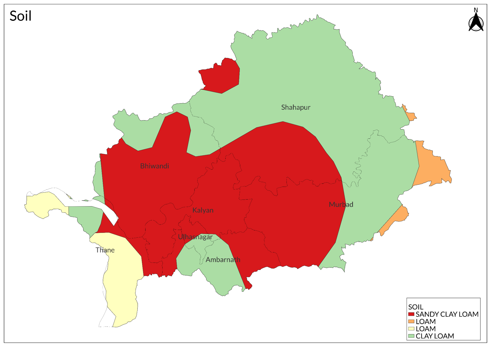
The primary soil types include lateritic soil in upland areas particularly along the Western Ghats, alluvial deposits in river valleys and coastal plains, and black soil derived from basaltic rock weathering. Coastal areas feature marine alluvium and marsh soils with high salt content. Valley regions contain deep fertile alluvial soils formed by river deposition suitable for agriculture. Hill slopes have relatively shallow soil cover over bedrock, often showing red or reddish-brown coloration due to iron oxide content. Areas with dense forest cover have developed rich organic soils though these are limited in extent. The basaltic parent material weathers to form moderately deep to deep black soils in lowland areas, especially in the eastern parts. Some regions feature mixed soil profiles showing characteristics of both lateritic and alluvial soils. Soil erosion is significant on steeper slopes, particularly where vegetation cover has been removed. The soil fertility varies considerably with the most productive agricultural soils found in the alluvial valleys, while upland soils tend to be less fertile and more prone to erosion. Coastal soils face increasing salinization issues while urban areas show extensively modified and often degraded soil profiles.
Minerals
The mineral resources of Thane district are primarily associated with its geological formation of Deccan trap basalt. Building stones are extensively quarried from basaltic rock formations across the district for construction purposes. Sand extraction occurs along river beds and coastal areas, though this faces increasing environmental regulations. Stone quarrying is particularly active around urban centers, providing material for construction and infrastructure development. Clay deposits suitable for brick making are found in alluvial areas and are utilized by local industries. Minor mineral deposits include silica sand, garnet and some low-grade iron ore occurrences. Historical records indicate some prospecting for base metals though no significant deposits were proven economically viable. Lateritic deposits provide material for road construction and civil works. The quality of building stone varies, with the best material coming from compact basalt formations.
Quartzite and other metamorphic rocks occur in limited areas, providing specialized construction material. While not rich in precious or strategic minerals, the district's mineral resources have supported local construction and development needs, though many quarrying sites now face environmental concerns and urban expansion pressures.
Rivers
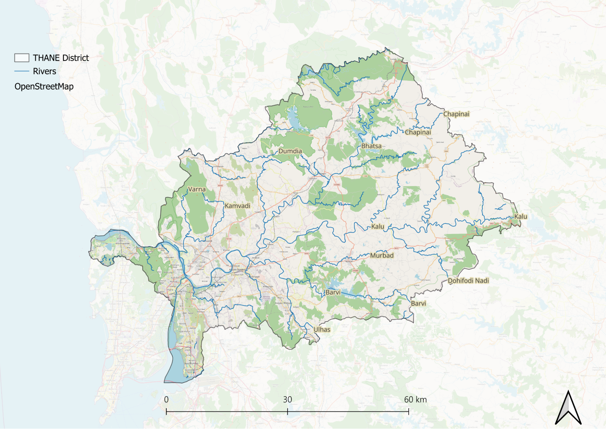
The Vaitarna, still the district's largest river, maintains its course from the Trimbak hills through Manor to Agashi, though its flow is now regulated by dams and its water quality is affected by urban and industrial development. The historical religious significance of the river, particularly at Agashi and Gorha, continues in modern times. Its tributaries, the Pinjal, Deherja, Surya, and Tansa, remain important, though their navigability has been impacted by siltation and development.
The smaller streams mentioned in the Gazetteer, the Varoli, Kalu, Ganga, and Patalganga, continue to exist but face severe environmental pressures. Their tidal reaches, once important for navigation and local commerce, now struggle with pollution, mangrove degradation, and urban encroachment. The historic port functions of places like Panvel, served by these waterways, have largely given way to modern transportation networks.
Botany
The botany of Thane district shows a diverse range of vegetation influenced by its varied topography, from coastal areas to the Western Ghats. The district supports several distinct forest types, though much has changed since historical times due to urbanization and development pressures.
In the Western Ghats sections, moist deciduous forests dominate, characterized by species like teak, ain, kinjal, and bamboo species. These forests show seasonal patterns of leaf shedding, particularly during the dry months. The undergrowth includes various shrubs, climbers, and herbs that flourish during the monsoon season.
Along the coast, mangrove vegetation forms distinctive ecosystems, with species like Avicennia marina, Sonneratia alba, and Rhizophora mucronata. These mangrove forests, though reduced from their historical extent, play crucial roles in coastal protection and marine biodiversity. Behind the mangroves, coastal scrub vegetation includes species adapted to saline conditions.
The intermediate areas between the coast and the Ghats support mixed moist deciduous and semi-evergreen vegetation. Common species include Terminalia, Syzygium, and various Ficus species. The understory vegetation is rich in medicinal plants and seasonal herbs. Many areas now show secondary growth where original forests have been disturbed.
Wild Animals
In the Western Ghats and adjacent forests, larger mammals include leopards which persist even near urban areas, wild boar, sambar deer, barking deer, and various species of monkeys including the bonnet macaque and common langur.
Small carnivores found in the district include jungle cats, jackals, Indian fox, and mongoose species. The district also supports populations of Indian pangolin, though their numbers have declined. Flying foxes and various other bat species are common, particularly in urban areas.
In the coastal regions, especially in mangrove areas, smooth-coated otters can be found, though their populations are under pressure. Small Indian civets and palm civets occur throughout the district, adapting well to human-modified landscapes.
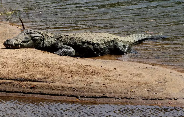
Reptiles are well represented with species like the Indian rock python, Russell's viper, Indian cobra, and various species of lizards and geckos.
The district's wildlife has faced significant pressure from habitat loss and fragmentation due to urbanization, though some species have adapted to human-modified landscapes. Protected areas and forest patches continue to serve as important refuges for wildlife.
Birds
In coastal areas and creek systems, waders and waterbirds are prominent, including different species of egrets, herons, sandpipers, and plovers. The mangrove areas support species like the striated heron and collared kingfisher.
Forest areas host typical Western Ghats species including hornbills, various woodpeckers, barbets, and flycatchers. The Malabar Trogon and racket-tailed drongo can be found in well-preserved forest patches. Common forest birds include the red-whiskered bulbul, jungle babbler, and various species of sunbirds. In agricultural and open areas, birds like the Indian roller, black drongo, and various species of mynas and munias are common. Birds of prey include the black kite, brahminy kite, and shikra. Urban areas support adaptable species like house crows, rock pigeons, rose-ringed parakeets, and common mynas. Seasonal migrants visit the district, particularly waterbirds in coastal areas during winter.
Forest Reserves
The Sanjay Gandhi National Park
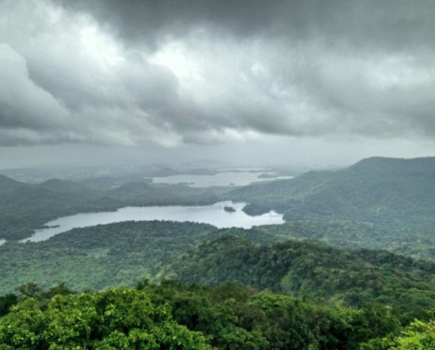
The physical features of SGNP are diverse, with terrain varying from hilly to undulating and elevations ranging from sea level to about 468 meters. The park contains two major lakes, Tulsi and Vihar, that continue to supply water to Mumbai. It is characterized by moist deciduous forest ecosystems, with multiple streams and seasonal waterfalls during the monsoon season. One of its most notable features includes the Kanheri Caves, ancient Buddhist structures carved into basaltic rock formations dating back to the 1st century BCE.
The park's flora is dominated by teak and other deciduous species, containing approximately 1,300 species of plants. These include significant populations of karanj, kadamba, and various bamboo varieties. The understory vegetation is particularly rich in medicinal plants, while the monsoon season brings out numerous seasonal wildflowers. Small patches of semi-evergreen forest persist in sheltered valleys, adding to the park's botanical diversity.
The fauna of SGNP is remarkable, particularly given its urban setting. The park maintains a notable population of leopards that have adapted to the urban interface. Other mammals include spotted deer, sambar, rhesus macaque, and bonnet macaque. The park supports rich bird diversity with over 250 recorded species, various reptiles including pythons, cobras, and monitor lizards, and numerous butterfly species and other invertebrates.
As an urban protected area, SGNP faces significant conservation challenges. The park is surrounded by dense urban development, creating substantial edge effects and human-wildlife conflict situations, particularly involving leopards. Encroachment pressures along boundaries, pollution impacts from surrounding urban areas, and tourism management challenges during peak seasons pose ongoing threats to the park's ecosystem.
Tansa Wildlife Sanctuary
The sanctuary's topography is characterized by undulating terrain with hills and valleys, typical of the northern Western Ghats landscape. Elevations range from about 80 meters to over 400 meters above sea level. The Tansa reservoir, created by damming the Tansa River, forms a significant aquatic ecosystem within the sanctuary. The area experiences a typical monsoon climate with annual rainfall averaging between 2000-2500mm.
The vegetation consists primarily of Southern tropical moist deciduous and Southern tropical dry deciduous forests. The dominant tree species include teak, ain, kinjal, and bamboo species. The understory is rich in medicinal plants and supports diverse herbaceous flora during the monsoon season. Several rare and endemic plant species are found in the less disturbed portions of the sanctuary.
The wildlife includes leopards, wild boar, barking deer, and various species of primates, including langurs and macaques. The sanctuary supports rich bird life with resident and migratory waterfowl visiting the reservoir. Reptiles include the Indian python, the Russell's viper, and various species of lizards. The reservoir and its surrounding areas provide important habitat for numerous fish species and aquatic fauna.
Tungareshwar Wildlife Sanctuary

The sanctuary gets its name from the Tungareshwar mandir dedicated to Shiva, which lies within its boundaries and attracts numerous pilgrims. The terrain is characterized by hills and valleys with elevations ranging from about 50 to 500 meters. The area experiences a typical monsoon climate with heavy rainfall between June and September, receiving an average annual rainfall of about 2000-2500mm.
The vegetation is primarily a Southern tropical moist deciduous type, with some semi-evergreen patches in sheltered valleys. Major tree species include teak, ain, and various species of bamboo. The understory vegetation is rich in medicinal plants and seasonal herbs. The forest type transitions from dense to relatively open canopy depending on the terrain and human influence.
The wildlife includes leopards that move between SGNP and Tungareshwar, serving as an important extended habitat for this urban carnivore population. Other mammals include wild boar, barking deer, langurs, and various small carnivores. The sanctuary supports diverse bird life, including forest specialists and raptors. Reptiles and amphibians are well represented, particularly during the monsoon season.
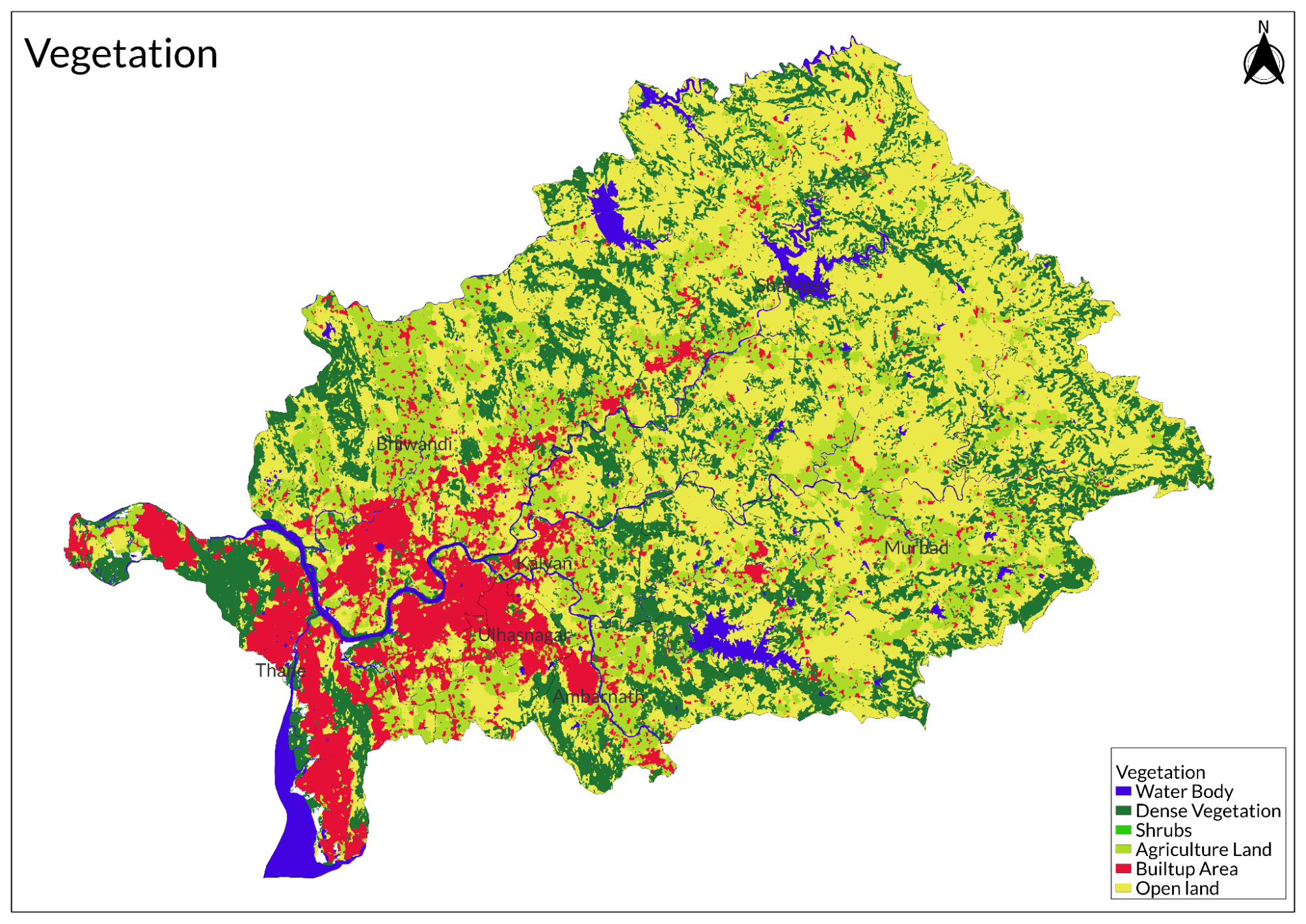
Land Use
Environmental Concerns
Deforestation
Deforestation in Thane district has become a pressing environmental concern, driven largely by rampant urbanization and the significant reduction of green cover. This transformation is having a notable impact on local climate conditions, contributing to rising temperatures that exceed those of nearby Mumbai.
The rapid urban development in Thane has led to the widespread clearing of trees and mangroves, which were once integral to the region's ecological balance. Environmentalists highlight that the area is increasingly losing its greenery, with concrete structures replacing what were previously lush landscapes. V Walavalkar, a city-based environmentalist, emphasizes that Thane is "no longer a green city," as development projects have prioritized construction over environmental preservation.
The consequences of this deforestation are evident in the rising temperatures recorded in Thane. Recent heat waves have seen temperature increases of over six degrees Celsius compared to historical averages. Residents have expressed disappointment, noting that they chose Thane for its greener environment, which they believed would provide a more pleasant climate. However, the degradation of the natural landscape has led to poorer air quality and increased heat retention in urban areas. Meteorological experts suggest that while geographical factors play a role in temperature variations between Thane and Mumbai, the loss of vegetation significantly exacerbates these differences. The natural cooling effects provided by trees and green spaces have diminished, leading to higher heat levels in Thane.
Air Pollution
Air pollution in Thane has reached critical levels, particularly at several major junctions where the Air Quality Index (AQI) readings range from 201 to 240, indicating a polluted status. Key areas affected include Teen Hath Naka, Shilphata, Retibunder, Castle Mill, Balkum, and Mumbra Fire Centre. According to the annual pollution report for 2020-21 by the Thane Municipal Corporation (TMC), air quality initially improved during the lockdown but has since deteriorated due to a surge in vehicular traffic and ongoing construction projects. The number of registered vehicles in Thane has increased by around 100,000 since 2019-20, significantly contributing to this decline in air quality.
The impact of construction activities is particularly concerning, as ongoing infrastructure projects such as road widening and Metro line development generate dust and increase vehicular emissions. Environmentalists have pointed out that the presence of high-rise buildings near highways worsens pollution retention, hindering effective air circulation. Seasonal variations also play a role; for instance, during festive periods like Diwali, levels of Repairable Suspended Particulate Matter (RSPM) spiked by 57% compared to previous years. These findings highlight the urgent need for comprehensive measures to address air quality issues in Thane.
Water Pollution
The seawater quality in Mumbai and Thane districts has significantly declined, as reported by the Maharashtra Pollution Control Board (MPCB). The findings indicate that the Water Quality Index (WQI) for seawater samples from these areas has dropped from bad to very bad. According to the report titled "Water Quality Status of Maharashtra" for 2018-19, seawater at Mumbai's beaches falls within a medium to bad range, primarily due to the impact of human settlements and industrial activities near the coast.
The report highlights that untreated and semi-treated sewage from industrial zones and human waste are contaminating the seawater, leading to a drastic decrease in water quality. The WQI is assessed using 43 parameters, including pH level, dissolved oxygen, biochemical oxygen demand (BOD) and faecal coliform levels. A WQI above 63 indicates good to excellent water quality, while a score of 38 or lower signifies bad to very bad conditions, rendering the water non-drinkable.
Monitoring conducted at ten saline water stations revealed that levels of faecal coliform and biochemical oxygen demand have surged to nine times above safety thresholds. The Mithi River near the Mahim bridge has recorded the lowest WQI average of 30, indicating it is unsuitable for drinking. Similarly, seawater near the Gateway of India averages a WQI of 49, categorizing it as very bad.
Wetland Destruction
Wetlands in Thane district, India, have faced significant destruction due to development projects, illegal dumping, and various other activities. Over the past five years, Thane has lost more than 60% of its wetlands, including crucial mangroves, marshes, and salt pans. This loss has led to severe consequences such as flooding, pollution, and habitat loss for numerous plant and animal species.
Specific examples of wetland degradation include the Ulhas River, where illegal dumping has compromised nearby wetlands and mangroves, threatening the river's width and increasing the risk of flooding. In Bhiwandi, wetlands have been converted into dumping sites, resulting in substantial environmental degradation. Additionally, in Nerul, wetlands, lakes, and mangroves in Sector 60 have been destroyed, contributing further to the ecological crisis.
The consequences of this destruction are dire. The loss of wetlands exacerbates flooding during the rainy season as these areas typically absorb excess water. Furthermore, illegal dumping of construction debris pollutes local waterways and devastates vital ecosystems. The destruction of these habitats also leads to a decline in biodiversity, threatening the survival of various species that rely on wetland environments.
Conservation Efforts/Protests
Water Conservation Initiatives
The Shivjal Surajya Abhiyan, launched on December 10, 2024, aims to tackle water scarcity in the Shahapur and Murbad talukas. This initiative focuses on improving water supply and enhancing groundwater recharge through various measures, including constructing and repairing dams, upgrading percolation ponds, and cleaning drinking water wells. Additionally, the program encourages villages to adopt rooftop rainwater harvesting systems to optimize water conservation efforts.
Lake Conservation Efforts
In Thane city, a specialized lake conservation program leverages bioremediation technology to restore local lakes. This initiative is designed to preserve the ecological integrity and economic value of these water bodies, highlighting their role in supporting biodiversity and providing vital ecosystem services.
Forest Regeneration Projects
The Green Thane Project is a significant undertaking aimed at regenerating degraded forest areas within urban limits. The project involves planting native tree species, distributing free saplings to residents, and promoting awareness about the critical role of forests in maintaining ecological balance and mitigating climate change.
Environmental NGOs
Thane has many nonprofit organizations that work on several dimensions of environment preservation and awareness. Earth5R is an NGO focused on environmental awareness and action. They have conducted numerous clean-up drives, such as the one held at Vivekananda Balashram Lane in Yeoor Hills, where volunteers collected litter to promote a cleaner environment.
Then there is Paryavaran Dakshata Mandal, that conducts various environmental education programs, workshops, and clean-up drives throughout Thane district. Their efforts aim to raise awareness about environmental issues and engage the community in various initiatives.
The Save Thane Creek initiative is dedicated to conserving the Thane Creek Flamingo Sanctuary, a critical habitat for migratory birds. This project emphasizes the importance of protecting this unique ecosystem, which supports a diverse range of wildlife and contributes to the region's biodiversity.
Thane Nature Club works to foster awareness about biodiversity and promotes eco-friendly practices among residents. Through various activities and campaigns, the club encourages sustainable living and helps residents understand the importance of preserving local ecosystems.
The district also has the Thane Society for the Prevention of Cruelty to Animals is dedicated to ensuring the welfare of animals in Thane. The organization provides shelter, medical care, and advocacy for animal rights. Their efforts include educating the public about animal cruelty and promoting responsible pet ownership.
There's another notable organization, namely, the Wildlife Welfare Association, which operates with a mission to rescue and rehabilitate animals. They focus on protecting biodiversity by rescuing reptiles and other wildlife from harmful situations. The WWA also engages in awareness campaigns about the importance of wildlife conservation and the need for habitat protection.
Graphs
Water
Climate & Atmosphere
Forests & Ecology
Human Footprint
Sources
Botanical Survey of India (BSI).Official Website of BSI.Ministry of Environment, Forest and Climate Change, Government of India.https://bsi.gov.in/
Central Ground Water Board (CGWB).Official Website of CGWB.Ministry of Jal Shakti, Government of India.http://cgwb.gov.in/
Geological Survey of India (GSI).Official Website of GSI.Ministry of Mines, Government of India.https://www.gsi.gov.in/
Hindustan Times. 2022.Air at 6 Junctions in Thane City Polluted with AQI 201-240.Hindustan Times.https://www.hindustantimes.com/cities/mumbai…
Hindustan Times. 2023.Air Pollution Worsens in Navi Mumbai, Thane, Badlapur, and Ulhasnagar.Hindustan Times.https://www.hindustantimes.com/cities/mumbai…
India Meteorological Department (IMD).Mausam - Official Website of IMD.Ministry of Earth Sciences, Government of India.https://mausam.imd.gov.in/
Maharashtra Forest Department.Official Website of Maharashtra Forest Department.Government of Maharashtra.https://forest.maharashtra.gov.in/
Maharashtra Remote Sensing Application Centre (MRSAC).Official Website of MRSAC.Government of Maharashtra.https://mrsac.gov.in/
Maharashtra State Biodiversity Board.Official Website of Maharashtra Biodiversity Board.Government of Maharashtra.http://www.maharashtrabiodiversityboard.gov.…
Maharashtra State Gazetteers Department.Cultural Archives of Maharashtra Gazetteers.Government of Maharashtra.https://cultural.maharashtra.gov.in/english/…
Maharashtra State Gazetteers Department.Hills and Geography of Thane District.Government of Maharashtra.https://gazetteers.maharashtra.gov.in/cultur…
NDTV. 2020.Seawater Quality in Mumbai and Thane Districts Goes from Bad to Very Bad: Report.NDTV News.https://www.ndtv.com/mumbai-news/seawater-qu…
Sanjay Gandhi National Park (SGNP).Official Website of SGNP.Government of Maharashtra.https://sgnp.maharashtra.gov.in/
Times of India. 2019.In Thane, Rampant Urbanization Decreasing Green Cover, Leading to More Heat Than Mumbai.Times of India.https://timesofindia.indiatimes.com/city/tha…
Zoological Survey of India (ZSI).Official Website of ZSI.Ministry of Environment, Forest and Climate Change, Government of India.https://zsi.gov.in/
Last updated on 6 November 2025. Help us improve the information on this page by clicking on suggest edits or writing to us.